Mount Mueller (Victoria) facts for kids
Quick facts for kids Mount Mueller |
|
|---|---|
| Highest point | |
| Elevation | 1,460 metres (4,790 ft) AHD |
| Parent peak | Mount Baw Baw |
| Geography | |
| Location | Victorian Alps, Victoria |
| Parent range | Baw Baw Plateau, Great Dividing Range |
Mount Mueller is a mountain in Victoria, Australia. It's part of the huge Great Dividing Range. This mountain stands tall at about 1,460 meters (that's about 4,790 feet) above sea level.
Contents
Where is Mount Mueller Located?
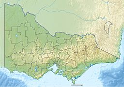
Mount Mueller is found about 120 kilometers (75 miles) east of Melbourne. It's also about 50 kilometers (31 miles) north of a place called the Latrobe Valley.
This mountain is one of several peaks on the Baw Baw Plateau. A plateau is a large, flat area of land that is higher than the land around it. The Baw Baw Plateau stretches out towards the north-east.
Other Peaks on the Baw Baw Plateau
Besides Mount Mueller, other mountains on this plateau include:
- Mount Baw Baw
- Mount Whitelaw
- Mount St Phillack (which is the highest point on the plateau)
- Mount Tyers
- Mount Kernot
- Mount St Gwinear
The Baw Baw Plateau is separated from other high areas of Victoria. This separation is due to several rivers. These include the Thomson and Aberfeldy rivers. There are also smaller rivers like the Tanjil and Tyers rivers to the south.
What is Mount Mueller Made Of? (Geology)
The Baw Baw area, called a massif (a compact group of mountains), is made from a type of rock called granodiorite. This rock formed a very long time ago, during the late Devonian period.
The plateau itself doesn't have huge changes in height. The highest point, Mount St. Phillack, reaches 1,567 meters (5,141 feet).
Plants and Animals (Biology)
The lower parts of the Baw Baw Plateau are covered in different types of forests. You can find montane eucalypt forests and tall forests there. In the valleys near creeks, there are cool temperate rainforests. These rainforests have trees like myrtle beech (Nothofagus cunninghamii).
Higher up, above 1,200 meters (about 3,900 feet), you'll see snow gum woodlands. These trees are specially adapted to colder weather. There isn't a clear line where trees stop growing. Instead, subalpine grasslands and shrublands grow in flat valley bottoms. This happens because cold air sinks and collects in these areas.
Much of this subalpine zone is protected. It's part of the Baw Baw National Park, which covers about 133 square kilometers (51 square miles).
Climate of the Plateau
The climate on the plateau is subalpine. This means it's cold, similar to mountain regions. On average, it gets about 1,900 millimeters (75 inches) of rain each year. Snow usually covers the plateau from June to September, making it a winter wonderland.
 | Chris Smalls |
 | Fred Hampton |
 | Ralph Abernathy |


