Mount Nagishlamina facts for kids
Quick facts for kids Mount Nagishlamina |
|
|---|---|

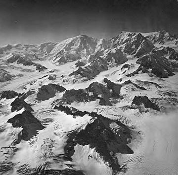
Mt. Nagishlamina centered in distance
{Mt. Torbert in upper right) |
|
| Highest point | |
| Elevation | 11,068 ft (3,374 m) |
| Prominence | 1,368 ft (417 m) |
| Isolation | 1.95 mi (3.14 km) |
| Parent peak | Mount Torbert (11,413 ft) |
| Geography | |
| Location | Kenai Peninsula Borough Alaska, United States |
| Parent range | Tordrillo Mountains Alaska Range |
| Topo map | USGS Tyonek B-7 |
| Climbing | |
| First ascent | 1989, Dave Johnston |
Mount Nagishlamina is a tall mountain in Alaska, standing 11,068 feet (3,374 meters) high. It is covered in large sheets of ice and snow, called glaciers. This mountain is part of the Tordrillo Mountains, which are a smaller group within the larger Alaska Range.
You can find Mount Nagishlamina about 90 miles (145 km) west of Anchorage. It is also close to other big peaks, being 7.4 miles (12 km) northwest of Mount Spurr and 1.9 miles (3 km) southeast of Mount Torbert. Mount Torbert is actually the closest and taller mountain nearby. Mount Nagishlamina is the fifth-highest peak in the Tordrillo Mountains.
The mountain gets its name from the Nagishlamina River, which flows down its western side. This name comes from the Denaʼina language, spoken by local Native Alaskan people. Mountaineers (people who climb mountains) started using the name Mount Nagishlamina in the 1970s. The name was officially recognized in 1999 by the United States Board on Geographic Names, a group that names places in the U.S.
In 1989, a climber named Dave Johnston made the first ascent of Mount Nagishlamina. At that time, it was probably the highest mountain in the United States that no one had ever climbed before.
Contents
Understanding Mount Nagishlamina's Climate
Mount Nagishlamina has a subarctic climate. This means it has very long, cold, and snowy winters. The summers are usually cool.
Temperatures and Weather Conditions
During winter, temperatures on the mountain can drop very low. They often go below -20 °C (-4 °F). When the wind blows, it can feel even colder, sometimes as low as -30 °C (-22 °F).
Glaciers and Water Flow
This cold climate is perfect for the large ice sheets around the mountain. The Harpoon Glacier and Capps Glacier are two of these. Water from melting snow and ice on the mountain, along with water from its glaciers, flows into Cook Inlet.
Best Time to Visit
If you want to see or climb Mount Nagishlamina, the best time to go is usually during May and June. The weather is most favorable then.
 | Emma Amos |
 | Edward Mitchell Bannister |
 | Larry D. Alexander |
 | Ernie Barnes |


