
Mount Pelion West facts for kids
Quick facts for kids Mount Pelion West |
|
|---|---|

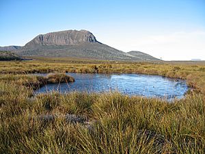
Pelion West from near Pelion Hut on Pelion Plains
|
|
| Highest point | |
| Elevation | 1,560 m (5,120 ft) |
| Prominence | 469 m (1,539 ft) |
| Isolation | 6.35 km (3.95 mi) |
| Geography | |

Mount Pelion West
Location in Tasmania
|
|
| Location | Central Highlands, Tasmania, Australia |
| Parent range | Pelion Range |
| Topo map | Achilles (4036) |
| Geology | |
| Age of rock | Jurassic |
| Mountain type | Dolerite |
| Climbing | |
| Easiest route | One day return from Pelion Hut, via the Overland Track |
Mount Pelion West is a tall mountain in Tasmania, Australia. It is found in the Central Highlands area. This mountain is part of the Pelion Range, a group of mountains.
Mount Pelion West is inside the famous Cradle Mountain-Lake St Clair National Park. It sits near the edge of the Murchison River area.
This mountain is very high! It is the fourth tallest mountain in Tasmania. It stands at 1,560 meters (about 5,118 feet) above sea level. Only eight mountains in Tasmania are taller than 1,500 meters.
Contents
Where is Mount Pelion West?
Mount Pelion West is surrounded by other interesting places. To its west, there is a large, flat area of moorland. To the north, you can see Cradle Mountain and Barn Bluff.
Not far to the northeast, about 6 kilometers away, is Mount Oakleigh. To the east, you'll find Mount Pelion East. Directly south is Mount Achilles.
Nearby Rivers and Tracks
Below the northern side of Mount Pelion West, there's a stream called Pelion Creek. This creek flows into the start of the Forth River. The Forth River begins east of Pelion West at a spot called Frog Flats. This is the lowest point on the entire Overland Track.
The famous Overland Track passes quite close to Mount Pelion West. At its closest point, the track is only about 2 kilometers from the mountain's top.
Climbing Mount Pelion West
Climbing Mount Pelion West can be a challenging adventure. An early explorer and climber named Keith Ernest Lancaster climbed it on January 30, 1946. He had to crawl through some parts because of the spiky plants called Richea scoparia. These plants often grow in the high mountain areas of Tasmania.
Lancaster called Mount Pelion West one of "The Giants of the Reserve." He also mentioned the "huge boulders" that cover the top of the mountain.
The Climbing Route
There is a walking track to climb Mount Pelion West. It goes along the mountain's northeastern side. This track is not marked, so it can be tricky to find.
The path starts about 250 meters east of where the Overland Track crosses Pelion Creek. Look for two logs that are straight across the Overland Track; the path begins between them.
How Difficult is the Climb?
Climbing Mount Pelion West is harder than climbing Mount Ossa or Mount Pelion East. These two are more common side trips for hikers on the Overland Track.
The main challenge on Pelion West is crossing over 500 meters of huge dolerite boulders. Dolerite is a type of hard rock. After crossing these boulders, you reach the final summit, which is a slanted, obelisk-shaped boulder.

Images for kids
-
Pelion West as seen from Pine Forest Moor
-
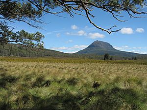
Pelion West from Pelion Plains
-
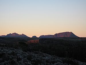
From Waterfall Valley, right to left: Pelion West, Thetis, Paddys Nut, Ossa
-
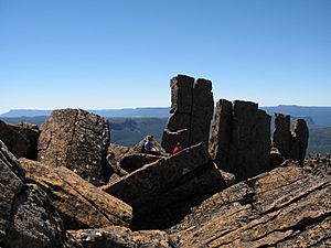
Rugged top of Pelion West
-
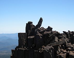
Pelion West's angled obelisk summit boulder
-

Pelion Plains, Lake Ayr and Mount Pillinger from Pelion West
-
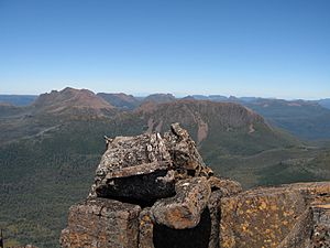
Cradle Mountain and Barn Bluff from Pelion West
-
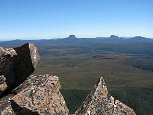
Mount Ossa, Tasmania's highest mountain from Pelion West on the right and Pelion East, the spire-like mountain on the left
-
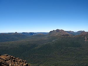
Mount Ossa, Paddys Nut, Mount Thetis and many other spectacular mountains as viewed from Mount Pelion West
-
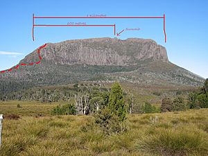
Track location and distance to summit


See also
 In Spanish: Monte Pelion Oeste para niños
