Mount Rohr facts for kids
Quick facts for kids Mount Rohr |
|
|---|---|

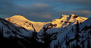
Mount Rohr from the northwest
|
|
| Highest point | |
| Elevation | 2,423 m (7,949 ft) |
| Prominence | 353 m (1,158 ft) |
| Parent peak | Mount Marriott (2735 m) |
| Geography | |
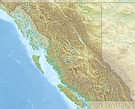
| Location | British Columbia, Canada |
| Parent range | Cayoosh Range Lillooet Ranges Coast Mountains |
| Topo map | NTS 92J8 |
| Climbing | |
| Easiest route | Scrambling |
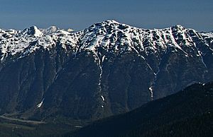
Mount Rohr is a tall mountain in British Columbia, Canada. It stands about 2,423 meters (7,950 feet) high. This makes it a significant peak in the Cayoosh Range, which is part of the larger Coast Mountains.
The mountain is located about 29 kilometers (18 miles) east of Pemberton. It's also near other famous peaks like Cayoosh Mountain and Joffre Peak. Highway 99 runs along the southern base of Mount Rohr. This highway connects Cayoosh Pass with the western end of Duffy Lake.
Mount Rohr is special because it marks the western edge of Duffey Lake Provincial Park. It is also the highest point within this park.
Naming Mount Rohr
The mountain is named after a special person, Reverend Victor Sebastian Rohr. He was born in 1873 and passed away in 1965. Reverend Rohr spent 40 years living and working in British Columbia. He was a missionary who worked with First Nations people in the region.
A mountaineer named Reverend Damasus Payne suggested the name for the mountain. The official name was approved on April 21, 1966. This was done by the Geographical Names Board of Canada, which is in charge of naming places in Canada.
Climbing and Exploring Mount Rohr
Mount Rohr is a popular spot for outdoor adventures. There are two main ways to climb the mountain. One route is called the West Ridge. The other route goes via Rohr Lake.
In the winter, these routes are also popular for skiing. Water from the mountain flows into nearby creeks. Some water goes north into Haylmore Creek, and some goes south into Cayoosh Creek.
Mountain Weather
Mount Rohr is located in a subarctic climate zone. This means it has long, cold winters and short, cool summers. The weather here is greatly affected by the Pacific Ocean.
Most weather systems, like storms, come from the Pacific Ocean. They travel east towards the Coast Mountains. When these weather systems hit the mountains, they are forced to rise. This process is called Orographic lift. As the air rises, it cools down and drops its moisture.
This means the Coast Mountains get a lot of rain and snow. Winter months, especially, see heavy snowfall. Temperatures can get very cold, sometimes dropping below -20 degrees Celsius. With the wind, it can feel even colder, below -30 degrees Celsius. The best time to climb Mount Rohr is usually from July to September. During these months, the weather is often more stable and pleasant.
 | Chris Smalls |
 | Fred Hampton |
 | Ralph Abernathy |


