Mount Steller (Chugach Mountains) facts for kids
Quick facts for kids Mount Steller |
|
|---|---|

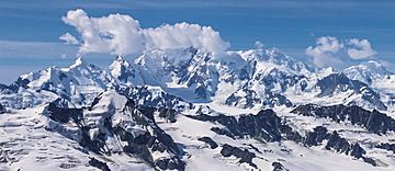
Aerial view from northeast
|
|
| Highest point | |
| Elevation | 10,715 ft (3,266 m) |
| Prominence | 5,515 ft (1,681 m) |
| Listing |
|
| Geography | |
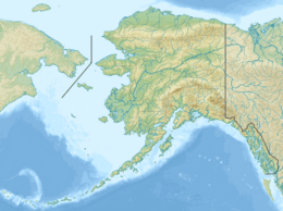
| Location | Yakutat City and Borough Alaska U.S. |
| Parent range | Chugach Mountains |
| Topo map | USGS Bering Glacier C-6 |
| Climbing | |
| First ascent | 1992 by B Jacobs, G Anderson, M Bowling, R Wesson |
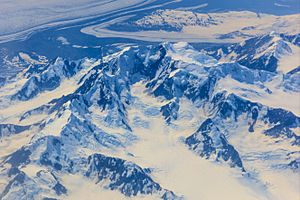
Mount Steller is a tall mountain peak located in the eastern part of the Chugach Mountains in Alaska, United States. It stands out because it's in a very remote area, surrounded by huge fields of ice. It also rises very high above the land around it. For example, it climbs 8,000 feet (2,440 meters) from the Bering Glacier in just about 4 miles (6.4 km).
Mount Steller is the highest point on Waxell Ridge. This ridge runs from east to west on the south side of the Bagley Icefield. The Bagley Icefield is one of the biggest icefields in North America. The large Bering Glacier flows along the east and south sides of the ridge. On the west side, the Steller Glacier flows from the mountain.
The mountain was named after a famous scientist named Georg Wilhelm Steller.
Because Mount Steller is in such a remote spot and often has bad weather, people didn't climb it until recently. The first time anyone successfully climbed to the top was in 1992.
What is the Climate Like?
Mount Steller has a subarctic climate. This means it has very long, cold, and snowy winters. The summers are usually mild. Weather systems from the Gulf of Alaska hit the Chugach Mountains. This forces the air upwards, causing a lot of rain and snow to fall. This effect is called orographic lift.
Temperatures on Mount Steller can drop below -20 °C (-4 °F). With the wind chill, it can feel even colder, below -30 °C (-22 °F). The best time to visit or try to climb the mountain is usually from May through June. This is when the weather is most favorable.
 | Madam C. J. Walker |
 | Janet Emerson Bashen |
 | Annie Turnbo Malone |
 | Maggie L. Walker |


