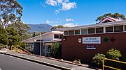
Mount Nelson, Tasmania facts for kids
Quick facts for kids Mount NelsonHobart, Tasmania |
|||||||||||||||
|---|---|---|---|---|---|---|---|---|---|---|---|---|---|---|---|
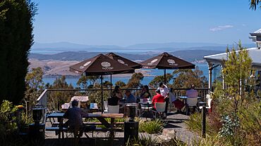
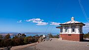
Mount Nelson Signal Station Cafe
|
|||||||||||||||
| Population | 2,749 (2021 census) | ||||||||||||||
| Postcode(s) | 7007 | ||||||||||||||
| LGA(s) | City of Hobart, Kingborough Council | ||||||||||||||
| State electorate(s) | Clark | ||||||||||||||
| Federal Division(s) | Clark | ||||||||||||||
|
|||||||||||||||
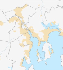
Mount Nelson is a mountain suburb located just south of Hobart, Tasmania, Australia. It sits to the south of Hobart's main city area. Mount Nelson is quite high, with its top reaching 351 meters (about 1,152 feet) above sea level. From here, you can see amazing views of the Derwent River and the areas around it.
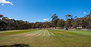
Many people visit Mount Nelson, including tourists who come to see the old Mount Nelson Signal Station. The Truganini Conservation Area is also a popular spot for nature lovers. Students attend schools like Hobart College and the Sustainability Learning Centre. The area also has sports fields, including the University Soccer Club and Mount Nelson Oval.
Contents
History of Mount Nelson
Not much is known about the Nuenonne people, who lived in the Mount Nelson area long ago. Their lives changed a lot when the British started to settle in Tasmania in 1803. This led to a big decrease in the number of Aboriginal people living there.
In 1830-31, a colonial official named George Augustus Robinson went on an expedition. He learned about the local languages from an Aboriginal guide named Wurati. Wurati shared many names for places, including "kriwalayti" from the Bruny Island language. This was the name for Mount Nelson, which you can see from Bruny Island. The word "kriwalayti" means 'hill' or 'mountain'. Today, the Palawa people use "kriwalayti" in their language, palawa kani.
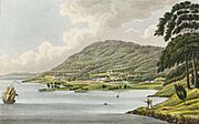
Mount Nelson was named by Governor Macquarie in 1811. It was named after the ship HMS Lady Nelson. This ship brought the first settlers to Hobart in 1803. Governor Macquarie himself arrived on the same ship in 1811. Many people think it was named after the famous British admiral, Lord Horatio Nelson, but this is not true.
Modern Changes in Mount Nelson
After World War II (around 1945), Mount Nelson started to grow a lot. The government helped immigrants, who were looking for a new home after the war, to settle here. This turned Mount Nelson into a busy place to live. Also, an old firing range (a place for shooting practice) was changed into farmland for the University of Tasmania.
A post office called Rialannah opened in 1948 and was renamed Mount Nelson in 1956. It closed in 1971. In 1967, many houses in Mount Nelson were destroyed by the terrible Black Tuesday Bushfires.
Mount Nelson Signal Station
In 1811, Governor Lachlan Macquarie visited Van Diemen's Land (which is now Tasmania). He decided to set up a signal post on top of Mount Nelson. This post was used to announce when ships were arriving in the river. At first, they used flags to send messages. Later, in 1838, they upgraded to a tall, six-armed semaphore. This machine could send over 900,000 different signals!
This signal network helped send messages quickly between the penal colony at Port Arthur and Hobart. Signalmen, often with their families, worked long hours, from 6 AM to 9 PM, in all kinds of weather.
In 1880, Tasmania's first telephone line was installed. It connected the Mount Nelson signal station to the Hobart telegraph office. This meant they no longer needed the semaphore. Even with new technology, the station remained important. In 1958, it became a base for ship-to-shore radio communication. The station stopped its operations in 1969, ending 158 years of communication history.
Since 1979, the Parks and Wildlife Service has looked after the Mount Nelson site. Today, the station still honors its past. It flies the Tasmanian State flag every day. It also uses International maritime signal flags to welcome ships and celebrate special events.
Geography of Mount Nelson
Mount Nelson is located next to Sandy Bay on its northern side. It extends through the University of Tasmania area. The eastern border follows Lambert Rivulet and goes through the Skyline and Mount Nelson Signal Station Reserve. The southern border touches the Kingborough Council area.
Inside, Mount Nelson is surrounded by areas like Fern Tree, Dynnyrne, Ridgeway, and Tolmans Hill. It's also near the Southern Outlet highway. This location gives people living there a mix of city convenience and beautiful nature.
Mount Nelson covers about 5.9 square kilometers (about 2.3 square miles). Nearly 16.3% of the area is made up of 14 parklands. The main road in Mount Nelson is Nelson Road. It was built in 1908 to make it easier to reach the signal station. This road goes up the mountain from the Wrest Point Hotel Casino into the Sandy Bay suburb.
Truganini Conservation Area
This area is named after Truganini, a Nuenonne woman. The Truganini Conservation Area protects the native bushland on the southeast side of Mount Nelson. You can take a 90-minute bushwalk (4.2 km or 2.6 miles) from the Signal Station to Sandy Bay. On this walk, you can see different plants, a memorial to Truganini, and wildflowers. You might also spot native birds, like the endangered swift parrot.
Wildlife in Mount Nelson
Mount Nelson is a very important place for the endangered swift parrot. About 1,000 breeding pairs of these parrots live here. There are ongoing efforts to protect their homes and help them survive.
Mount Nelson Population
As of 2022, about 2,766 people live in Mount Nelson. This means there are about 421.7 people per square kilometer. In 2021, the most common age group in Mount Nelson was 40 years old. On average, there are 2.5 residents in each household.
Facilities in Mount Nelson
Mount Nelson has a medical center, a general store, a dental clinic, and a pharmacy. The Mount Nelson Fire Station is located at 40 Olinda Grove.
Educational Facilities
Mount Nelson has several schools. Hobart College is one of the city's four public high schools. Interestingly, Queen Mary of Denmark, who is married to Frederik X, used to be a student at Hobart College. Mount Nelson is also home to Mount Nelson Primary School. This school has about 200 students from kindergarten to Grade 6. Students from Mount Nelson and Tolmans Hill often go on to Taroona High School.
Getting to Mount Nelson
You can get to Mount Nelson by taking Proctors Road off the Southern Outlet highway. You can also use Nelson Road, which starts in Sandy Bay. Metro Tasmania buses also serve the suburb. Routes 457, 458, X58, and school routes 412, 413, 415, and 417 go directly to Hobart College.


