Clay Township, Michigan facts for kids
Quick facts for kids
Clay Township, Michigan
|
|
|---|---|

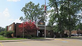
Clay Township Municipal Offices
|
|

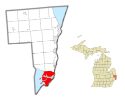
Location within St. Clair County (red) and the administered CDP of Pearl Beach (pink)
|
|
| Country | United States |
| State | Michigan |
| County | St. Clair |
| Settled | 1805 |
| Established | 1826 (Plainfield Township) 1828 (Clay Township) |
| Area | |
| • Total | 82.47 sq mi (213.60 km2) |
| • Land | 35.32 sq mi (91.48 km2) |
| • Water | 47.15 sq mi (122.12 km2) |
| Elevation | 577 ft (176 m) |
| Population
(2020)
|
|
| • Total | 8,446 |
| • Density | 102.4/sq mi (39.5/km2) |
| Time zone | UTC-5 (Eastern (EST)) |
| • Summer (DST) | UTC-4 (EDT) |
| ZIP code(s) | |
| Area code(s) | 810 |
| FIPS code | 26-16180 |
| GNIS feature ID | 1626090 |
Clay Township is a special area in St. Clair County, Michigan. It's located right where the St. Clair River flows into Lake St. Clair. This area is unique because it has many islands, and Harsens Island is the largest one!
The township is mostly around the city of Algonac. Even though they are close, Clay Township and Algonac are managed separately. A big part of Algonac State Park is also found within Clay Township. In 2020, about 8,446 people called Clay Township home.
Contents
Communities in Clay Township
Clay Township is made up of several smaller communities. Some of these are on the mainland, and others are on the islands.
Island Communities
- Bedore is a small community on the southern coast of Harsens Island.
- Clays Landing is at the very end of M-154 on Harsens Island.
- Forster is located just west of Bedore.
- Grand Pointe is an older community in the northeast of Harsens Island. It was settled around 1888.
- Harsens Island is also the name of the main post office for the island. The island was first settled in 1779 by James Harsen. He bought the whole island from the Native American people by 1783.
- Maple Leaf is on Harsens Island, southwest of Sans Souci.
- Miller is near the southern tip of Harsens Island.
- Muirs is another community along M-154 on Harsens Island.
- Riverside is in the southern part of Harsens Island.
- Sans Souci is a community on Harsens Island.
Mainland Communities
- Pearl Beach is a community located on the southern part of the mainland.
- Perch Point is in the northwestern part of the township along M-29.
- Pointe aux Tremble is also along M-29, within the Pearl Beach area. It was settled in 1904.
- Roberts Landing is along M-29, near Algonac State Park. It was named after its first settler in 1830 and was a popular spot for fishing and hunting.
History of Clay Township
The first settler in this area was John Martin in 1805. The place was first called Pointe du Chene, which means "Oak Point."
How Clay Township Got Its Name
In 1826, the area was organized as Plainfield Township. This name came from early settler John K. Smith's hometown in Vermont. But in 1828, the township was reorganized and renamed after Henry Clay. He was a famous American lawyer and statesman.
Algonac started as a village within Clay Township in 1867. It became its own city in 1967, separate from the township.
Historic Places to See
Clay Township has several interesting historic sites:
- Colony Tower Complex
- Harsen House
- LeRoy Smith House
- North Channel Shooting Club
- St. Clair River Informational Designation
- Stewart Farm / Memoir of Aura Stewart
- St. Clair Flats Front and Rear Range Light
Geography and Nature
Clay Township covers about 82.47 square miles (213.60 square kilometers). A large part of this area, about 57%, is water! This includes parts of the St. Clair River and Lake St. Clair. The river delta has many channels and canals.
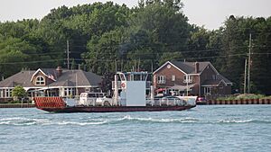
Across the river from Clay Township is the Walpole Island First Nation in Ontario, Canada. You can get there by taking the Walpole–Algonac Ferry from downtown Algonac.
The township is also home to important natural areas. These include the St. Clair Flats State Wildlife Area and most of the St. John's Marsh State Wildlife Area. Most of Algonac State Park is also here.
Islands of Clay Township
Clay Township is known for its many islands. Here are some of them:
- Bruckner Island
- Club Island
- Dickinson Island
- Green Island
- Gull Island
- Harsens Island (the largest)
- McDonald Island
- Middle Island
- Muscamoot Ridge
- North Island
- Russell Island
- Sand Island
- Strawberry Island
Getting Around Clay Township

Airport
 Harsens Island Airport (FAA: Z92) is a small public airport on Harsens Island. It opened in 1994 and has a grass runway.
Ferries
Ferries are important for getting to the islands!
- Champion's Auto Ferry takes cars and people from the mainland to Harsens Island.
- Russell Island Ferry takes only people to Russell Island, as cars are not allowed there. The ferry boat, called the Pride of Lake Huron, was built in 1948.
Main Roads
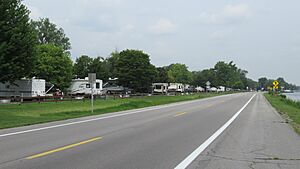
- M-29 is a state highway that goes through the township along the river.
- M-154 is a state highway found only on Harsens Island. You need to take a ferry to reach it.
 U.S. Bicycle Route 20 also passes through parts of the township. It sometimes shares its path with the Bridge to Bay Trail, which is great for biking!
People of Clay Township
In 2000, about 9,822 people lived in Clay Township. There were 3,934 households. About 22.6% of the people were under 18 years old. The average age was 41 years. For every 100 females, there were about 103 males.
The average income for a household in the township was around $55,059.
See also
 In Spanish: Municipio de Clay (Míchigan) para niños


