Mulberry River (Arkansas) facts for kids
Quick facts for kids Mulberry River |
|
|---|---|

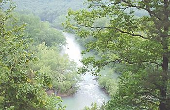
The Mulberry River flows through the Ozark Mountains.
|
|
| Country | United States |
| State | Arkansas |
| Physical characteristics | |
| Main source | Newton County, Arkansas 2,100 ft (640 m) |
| River mouth | Arkansas River |
| Length | 70 mi (110 km) |
| Basin features | |
| Basin size | 373 sq mi (970 km2) |
| Type: | Scenic, Recreational |
| Designated: | April 22, 1992 |
The Mulberry River is a river in northwestern Arkansas, United States. It is about 70-mile-long (110 km). A river like the Mulberry is called a tributary because it flows into a larger river, in this case, the Arkansas River.
The water from the Mulberry River eventually joins the Mississippi River. This means the Mulberry River is part of the huge area of land that drains into the Mississippi River, known as its watershed. The Mulberry River's own watershed covers about 373 square miles (970 km2). On average, about 557 cubic feet of water flow from the river every second near its end.
In 1992, the United States government gave the Mulberry River a special title: a National Wild and Scenic River. This means parts of the river are protected to keep them wild and beautiful for everyone to enjoy.
Contents
Where Does the Mulberry River Flow?
The Mulberry River starts in southwestern Newton County, Arkansas. For most of its journey, it flows through the Ozark National Forest in the Ozark Mountains.
The river first flows west through Johnson and Franklin counties. In Franklin County, it turns south. It then flows past the town of Mulberry. Finally, it joins the Arkansas River about 3 miles (5 km) south of Mulberry. This meeting point is on the border of Franklin and Crawford counties.
Fun Things to Do on the Mulberry River
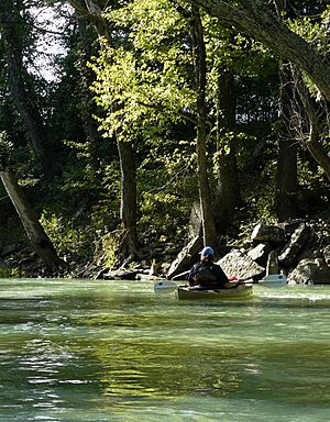
The Mulberry River is a very popular spot for outdoor activities. Many people love to go kayaking or canoeing here because of its beautiful scenery.
Boating and Water Levels
The amount of water in the river changes a lot depending on the season and how much rain has fallen. Usually, there's enough water for paddling from mid-October to mid-June. The water in the river is very clean.
You can float about 45 miles of the river. This stretch starts at the Wolf Pen Access and Recreation Area in the Ozark National Forest. It continues almost all the way to where the river meets the Arkansas River.
Rapids and Safety
The Mulberry River has different types of rapids, from easy (Class I) to more challenging (Class III). If the water level is high, paddling can be tricky and even dangerous. But when the water is low, the river is calm and flows very slowly.
Camping and Fishing
There are several places along the river where you can stop. Some of these spots offer camping and supplies. Fishing is also a popular activity here. People often try to catch Smallmouth Bass and Green Sunfish.
Protected Status
The upper 56 miles of the Mulberry River were officially protected in 1992. This protection is part of the National Wild and Scenic Rivers System. It helps keep the river's natural beauty and recreational value safe for future generations.
 | Janet Taylor Pickett |
 | Synthia Saint James |
 | Howardena Pindell |
 | Faith Ringgold |


