
Mungallala facts for kids
Quick facts for kids MungallalaQueensland |
|||||||||||||||
|---|---|---|---|---|---|---|---|---|---|---|---|---|---|---|---|

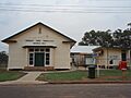
Mungallala Memorial Hall
|
|||||||||||||||

Mungallala
Location in Queensland
|
|||||||||||||||
| Population | 85 (2021 census) | ||||||||||||||
| • Density | 0.1883/km2 (0.488/sq mi) | ||||||||||||||
| Postcode(s) | 4467 | ||||||||||||||
| Area | 451.3 km2 (174.2 sq mi) | ||||||||||||||
| Time zone | AEST (UTC+10:00) | ||||||||||||||
| Location |
|
||||||||||||||
| LGA(s) | Maranoa Region | ||||||||||||||
| County | Mungallala County | ||||||||||||||
| State electorate(s) | Warrego | ||||||||||||||
| Federal Division(s) | Maranoa | ||||||||||||||
|
|||||||||||||||
Mungallala is a small country town and area in the Maranoa Region of Queensland, Australia. It's known for its quiet, rural lifestyle. In 2021 census, about 85 people lived in Mungallala.
Contents
Where is Mungallala?
Mungallala is in South West Queensland. It is about 608 kilometres (378 miles) west of Brisbane, which is the capital city of Queensland. It's also about 133 kilometres (83 miles) west of Roma, a bigger regional town.
The main road, called the Warrego Highway, goes right through Mungallala. This highway connects the town from the east (coming from Womalilla) to the west (going towards Morven). A railway line, the Western railway line, also runs through the area, close to the highway. Mungallala has its own railway station, which is just a short distance south-west of the town centre.
The town itself is quite small, with only a few streets.

A Look at Mungallala's Past
The name Mungallala comes from an old Aboriginal language, Kunggari language. It means something like "bird shout," possibly referring to the sound of running emus. Another nearby place, Dulbydilla, also has an Aboriginal name meaning "black waterhole," because of the dark water from eucalypt leaves.
Long ago, Mungallala was a stop on the Cobb & Co stagecoach route. These coaches carried mail and people between Roma and Charleville. The journey was long, and Mungallala might have been a place where they changed horses. This stagecoach service ended in 1888 when the Western railway line reached Charleville, making train travel faster.
- A school, Mungallala Provisional School, first opened in 1904. It became Mungallala State School in 1909.
- The Mungallala Post Office has been open since at least 1911.
- Several churches were built in Mungallala over the years, including St John's Anglican Church in 1914 and Sacred Heart Catholic Church in 1923. Some of these churches have since closed or been moved.
Learning in Mungallala
Mungallala State School is a government primary school for students from Prep (the first year of school) to Year 6. It's located on Redford Street. In recent years, the school has had a small number of students, making it a very close-knit learning environment.
For older students, there isn't a high school in Mungallala. The closest secondary school for Years 7-10 is Mitchell State School in Mitchell. For students wanting to complete Years 11 and 12, the nearest high schools are in Roma and Charleville.
What's in Mungallala Today?
Even though it's a small town, Mungallala has some useful facilities for its residents and visitors:
- Public Library: The Maranoa Regional Council runs a public library on Redford Street.
- Caravan Parks: There are two free caravan parks, which are great for travellers.
- Recreation Centre: This centre hosts events for local people and visitors.
- Sports: You can find two tennis courts and a small 4-hole golf course. Sometimes, eastern grey kangaroos help keep the grass short!
- Pub and Cafe: The town has a pub and a cafe. The cafe also helps care for local wildlife.
- Emergency Services: Mungallala has its own Police Station and Fire Station.
- Cemetery: There is also a local cemetery.

Images for kids
-
Mungallala Memorial Hall
