Municipal Borough of Dagenham facts for kids
| Dagenham | |
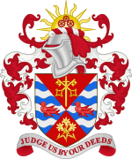
| Motto: Judge us by our deeds | |
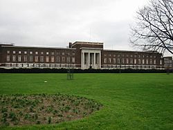
 Dagenham Civic Centre |
|
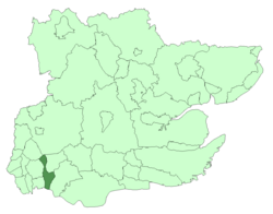
 Dagenham within Essex in 1961 |
|
| Geography | |
| Status | Civil parish Urban district (until 1938) Municipal borough (after 1938) |
| 1931/1951 area | 6,554 acres (26.52 km2) |
| 1961 area | 6,565 acres (26.57 km2) |
| HQ | Valence House (until 1937) Becontree Heath (after 1937) |
| History | |
| Origin | Dagenham parish |
| Created | 1926 |
| Abolished | 1965 |
| Succeeded by | London Borough of Barking London Borough of Redbridge |
Quick facts for kids Demography |
|
|---|---|
| 1931 population - 1931 density |
89,362 14/acre |
| 1951 population - 1951 density |
114,568 17/acre |
| 1961 population - 1961 density |
108,368 16/acre |
| Politics | |
| Governance | Dagenham Urban District Council Dagenham Borough Council |
 Coat of arms of Dagenham Borough Council |
|
Dagenham was a special area in south west Essex, England. It had its own local government from 1926 to 1965. This area covered the parish of Dagenham.
It started as an 'urban district' and later became a 'municipal borough' in 1938. This change happened because many people moved to Dagenham. The area changed from mostly farms to a busy urban place. This was due to the London County Council building the large Becontree housing estate. Many people from central London moved there.
Dagenham was close to London. It was part of the Metropolitan Police District and the London Traffic Area. Today, Dagenham is part of two larger areas in Greater London. These are the London Borough of Barking and Dagenham and the London Borough of Redbridge.
Contents
How Dagenham Became a District
Dagenham parish was part of the Romford Rural District starting in 1894. By 1920, the population of Dagenham grew a lot. This was because the land changed from farming to large housing developments. The Becontree estate was a big part of this change.
People suggested that Dagenham should leave the rural district. They thought it should be split between Ilford Urban District and Barking Town Urban District. Instead, Dagenham became its own urban district in 1926.
From District to Borough
In 1929, there was an idea to combine Dagenham with Barking and Ilford. These three areas all had parts of the Becontree estate. Another idea was for Dagenham to gain some land from Barking. But these plans did not happen.
Dagenham became part of the London Passenger Transport Area in 1933. This meant its transport was linked with London's. Dagenham officially became a municipal borough in 1938. This gave it more power to manage its own affairs.
The urban district council first worked from Valence House. They bought this building in 1928. To have a better place, the council built a new Civic Centre. This building had an 'art deco' design. It opened in 1937. Today, the local government for Barking and Dagenham uses this building.
The Civic Centre is located at Becontree Heath. This was an old meeting place for the Becontree area. The first stone for the building was placed in 1936. This was done by Lord Snell, who was the Chairman of the London County Council.
The Dagenham parish and district stretched northwards. It included areas like Chadwell Heath, Marks Gate, Hog Hill, and part of Hainault Forest. It also shared a border with Chigwell. The council also managed local education. This was under a law called the Education Act 1944.
When Dagenham Changed Again
Dagenham was seen as part of the Greater London Conurbation. This means it was part of the large built-up area around London. A special group called the Royal Commission on Local Government in Greater London looked at Dagenham. They decided it should become part of Greater London.
In 1965, Dagenham's local government was ended by a new law, the London Government Act 1963. Its area became part of Greater London instead of Essex. It was combined with parts of other districts, including Barking. Together, they formed the London Borough of Barking. This area is now known as the London Borough of Barking and Dagenham.
A small northern part of Dagenham, near Chigwell, became part of the London Borough of Redbridge. This also included the south-eastern part of Chigwell Urban District.
Population Growth in Dagenham
The number of people living in Dagenham grew a lot. This happened after the Becontree estate was built starting in 1921. The population reached its highest point in 1951. New industries, like the Ford Motor Company factory, also brought more people to the area.
| Year | 1861 | 1871 | 1881 | 1891 | 1901 | 1911 | 1921 | 1931 | 1951 | 1961 |
|---|---|---|---|---|---|---|---|---|---|---|
| Population | 2,708 | 2,879 | 3,411 | 4,324 | 6,091 | 7,930 | 9,127 | 89,362 | 114,568 | 108,368 |
 | William L. Dawson |
 | W. E. B. Du Bois |
 | Harry Belafonte |


