Munsungan-Chase Lake Thoroughfare Archeological District facts for kids
Quick facts for kids |
|
|
Munsungan-Chase Lake Thoroughfare Archeological District
|
|
| Nearest city | Millinocket Lake, Maine |
|---|---|
| Area | 45 acres (18 ha) |
| NRHP reference No. | 79000163 |
| Added to NRHP | September 6, 1979 |
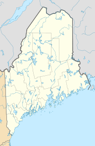
The Munsungan-Chase Lake Thoroughfare Archeological District is a special place in northern Maine, United States. It's a remote area where scientists have found many important archaeological sites. These sites show us that people lived here a very long time ago. They arrived not long after the huge glaciers melted away from the last Ice Age.
The area is famous for its workshops where ancient people made stone tools. They used a type of rock called red chert, which was easy to find there. Tools made from this region's chert have been discovered all over New England. This important district was added to the National Register of Historic Places in 1979.
Exploring the Ancient Sites
Munsungan Lake and Chase Lake are located far north in Piscataquis County, Maine. Water from these lakes flows into Munsungan Stream and then into the Aroostook River. Finally, it reaches the Saint John River. The two lakes are connected by a short waterway known as The Thoroughfare.
Around these lakes, there are many rock outcrops. These rocks contain different kinds of chert. Early humans discovered that this chert was perfect for making strong stone tools. Even though the lakes might have been higher back then, the dry land next to The Thoroughfare was a good place for people to live.
Discovering Human History
Archaeologists have explored this large region and found over 100 interesting sites. The Thoroughfare area itself has seven spots where people lived. Evidence shows human activity from the time when people first arrived (the Paleoindian period) up to the time when they started making pottery (the Ceramic period).
One of the biggest sites is called the Fluted Point Site. It covers a huge area, more than 3,000 square meters. This was a large place where people lived and made tools. Another site, the Windy Point Site, was a smaller workshop. Scientists dug up and studied both of these sites in the early 1980s.
About Munsungan Lake
| Munsungan Lake | |
|---|---|
| Location | Piscataquis County, Maine |
| Coordinates | 46°22′N 68°59′W / 46.367°N 68.983°W |
| Primary inflows | Chase Lake |
| Primary outflows | Munsungan Stream |
| Basin countries | United States |
| Max. length | 5 mi (8.0 km) |
| Max. width | 1 mi (1.6 km) |
| Surface area | 1,600 acres (650 ha) |
| Max. depth | 123 feet (37 m) |
| Water volume | 69,087 acre⋅ft (85,218,000 m3) |
| Surface elevation | 810 ft (250 m) |
Munsungan Lake is a deep lake with very cold water. It's home to native fish like togue and land-locked Atlantic salmon. These large fish hunt smaller fish such as rainbow smelt and squaretail.
The smaller fish lay their eggs in the streams that flow into the lake. These streams include Atkins Brook, Bluffer Brook, Cedar Brook, Chase Brook, Currier Brook, Munsungan Brook, Norway Brook, and Reed Brook.
 | Jackie Robinson |
 | Jack Johnson |
 | Althea Gibson |
 | Arthur Ashe |
 | Muhammad Ali |


