Mynydd Marchywel facts for kids
Quick facts for kids Mynydd Marchywel |
|
|---|---|

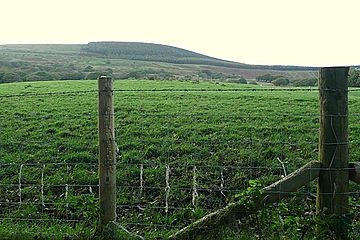
View of Mynydd Marchywel
|
|
| Highest point | |
| Elevation | 418 m (1,371 ft) |
| Prominence | 263 m (863 ft) |
| Parent peak | Fan Gyhirych |
| Listing | Marilyn |
| Naming | |
| Language of name | Welsh |
| Geography | |
| Location | Neath Port Talbot, Wales |
| OS grid | SN 768037 |
| Topo map | OS Landranger 170 / Explorer 165 |
Mynydd Marchywel is a hill in South Wales. It stands about 418 meters (1,371 feet) tall. You can find it in the Neath Port Talbot area.
At its top, you'll find a pile of stones called a cairn and a special marker called a trig point. Much of the hill is covered by forests. Many small streams flow from Mynydd Marchywel. Some go west to the River Tawe, others east to the River Dulais, and some south to the River Clydach. The Dulais and Clydach rivers eventually join the River Neath.
Contents
What is Mynydd Marchywel Made Of?
This hill is made up of many layers of rock. These layers include a type of sandstone called Pennant Sandstone. There are also layers of mudstone and sometimes coal seams. All these layers are tilted towards the south and southwest. This tilt is part of a large bowl-shaped rock structure called the South Wales Coalfield syncline.
Some parts of the hill's slopes are covered by glacial till. This is a mix of rock and soil left behind by glaciers long ago. People have dug for coal in these layers for a very long time. One of the last places to mine coal here was Gleision Colliery, located under the northwestern side of Mynydd Marchywel.
Ancient Sites on the Hill
Mynydd Marchywel is home to some interesting historical sites. These are protected as "Scheduled Monuments" because they are important parts of history.
Summit Cairn
The pile of stones at the very top of Mynydd Marchywel is a Round cairn. This means it's an ancient burial mound from the Bronze Age. It is about 10 meters (11 yards) north of the trig point. The stones are slowly spreading out, but you can still see traces of larger stones that once formed a border around the mound.
Tirlan Medieval House Sites
On the southeastern side of Mynydd Marchywel, near a place called Tyrlan, you can find the remains of two old medieval houses. These houses were built on flat areas, or "platforms," on the hillside. They are about 120 meters (131 yards) apart. You can also see old cultivation ridges nearby. These are marks in the ground from where people used to farm many centuries ago.
How to Explore Mynydd Marchywel
You can explore Mynydd Marchywel by following the Saint Illtyd's Walk. This walking path crosses the northern slopes of the hill. It runs from Ynysmeudwy to Crynant. This path is one of the few official public rights of way on the hill.
However, there are many forest tracks you can use. Also, most of the western parts of the hill, including the summit, are open for you to explore freely. This is because they are designated as open access land under the Countryside and Rights of Way Act 2000. This law allows people to walk freely on certain types of land.
 | William L. Dawson |
 | W. E. B. Du Bois |
 | Harry Belafonte |

