Māhukona facts for kids
Quick facts for kids Māhukona |
|
|---|---|
| Highest point | |
| Elevation | −3,770 feet (−1,149 m) |
| Geography | |
| Location | Hawaii, US |
| Parent range | Hawaiian Islands |
| Topo map | USGS Kamuela |
| Geology | |
| Mountain type | Shield volcano, Hotspot volcano |
| Volcanic arc/belt | Hawaiian-Emperor seamount chain |
| Last eruption | About 470,000 BP |
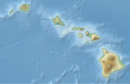
Māhukona is a huge, hidden volcano located underwater near the Island of Hawaiʻi. It's a type of volcano called a shield volcano, known for its wide, gentle slopes, like a warrior's shield. Māhukona is found on the northwest side of the big island.
Scientists know this volcano was once above the ocean surface. They found old shorelines deep underwater. One old shoreline is about 3,770 feet (1,150 meters) below sea level. Another major slope change is about 4,400 feet (1,340 meters) deep. These features show where the ocean used to be.
What is Māhukona?
Māhukona is a shield volcano. This means it was built up over time by many flows of runny lava. Its top has a roughly round caldera. A caldera is a large, bowl-shaped hollow that forms when the ground above a volcano's magma chamber collapses.
A clear rift zone stretches out to the west from the volcano's center. A rift zone is a crack or series of cracks where lava can erupt. Scientists think another rift zone once went to the east. However, newer volcanoes have covered it up over time.
A Volcano's History
The main period when Māhukona was actively erupting and building its shield shape ended a very long time ago. This was about 470,000 years ago. At one point, the very top of Māhukona was actually above the sea. It stood about 800 feet (250 meters) tall above the water.
But then, the volcano started to sink. This sinking is called subsidence. It slowly dropped below sea level between 435,000 and 365,000 years ago. Māhukona is the oldest volcano that helped form the island of Hawaiʻi. It is even older than the famous Kohala and Mauna Kea volcanoes.
Exploring the Deep
In 2001, a group of scientists explored the area around Māhukona. The Monterey Bay Aquarium Research Institute used a special remotely controlled submarine for their investigation. This submarine helped them study the underwater volcano up close.
The name Māhukona comes from a place on the nearby shore. This area is known as Māhukona and is located to the northeast of the volcano.
 | Jackie Robinson |
 | Jack Johnson |
 | Althea Gibson |
 | Arthur Ashe |
 | Muhammad Ali |


