Napier-Hastings Urban Area facts for kids
Quick facts for kids
Napier-Hastings Urban Area
|
|
|---|---|
|
Urban area
|
|
| Country | New Zealand |
| Region | Hawke's Bay |
| Area | |
| • Territorial | 5,335 km2 (2,060 sq mi) |
| Elevation | 9 m (30 ft) |
| Population
(June 2018)
|
|
| • Territorial | 139,600 |
| • Density | 26.167/km2 (67.772/sq mi) |
| • Urban | 134,500 |
| Postcodes |
4120, 4122
|
The Napier-Hastings Urban Area used to be a special way Statistics New Zealand (Stats NZ) grouped the cities of Napier and Hastings. It was seen as one big urban area in the Hawke's Bay Region. This grouping was part of an older system called the New Zealand Standard Areas Classification 1992 (NZSAC92).
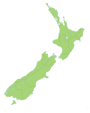
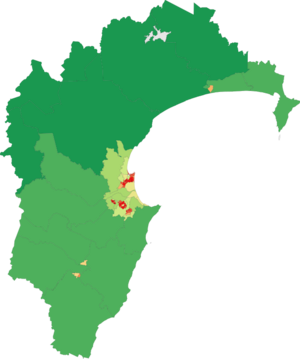
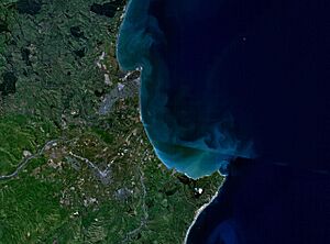
This urban area was mostly on the Heretaunga Plains, with some parts on the hills around it. It included Napier, Hastings, the town of Havelock North, and other smaller places. Under the old system, it was the sixth-largest urban area in New Zealand. It had about 134,500 people. This was fewer than Tauranga and more than Dunedin.
Even though Napier and Hastings are about 9 km apart, Stats NZ treated them as one area. This is because their economies and social lives are very connected. About three-quarters of all the people in Hawke's Bay live in this area.
Later, Stats NZ changed how they group areas. The Napier-Hastings Urban Area was split into smaller parts. Now, Napier and Hastings are separate "large urban areas." Havelock North is a "medium urban area." Other places like Clive are "small urban areas." Even smaller places like Haumoana and Te Awanga are "rural settlements." Some very small places that were once included are now left out.
Contents
Understanding the Urban Zones
The Napier-Hastings Urban Area was divided into two main parts. These were called urban zones.
Hastings Urban Zone
The Hastings Urban Zone was located within the Hastings District. It included the city of Hastings and the town of Havelock North. It also covered areas from Omahu and Pakowhai in the north. In the west, it reached Pakipaki. Along the coast, it went from Clive to Te Awanga.
This zone had about 68,000 people. Hastings is home to the main hospital for the region. It also has sports parks and a water park called Splash Planet. If Hastings were a single urban area, it would be the 8th largest in New Zealand.
Napier Urban Zone
The Napier Urban Zone included the city of Napier. It also had two parts of Hastings District next to it. These were the Eskdale–Whirinaki area to the north and the Waiohiki area to the south.
Napier has the region's port, which is important for exports. It also has the airport and a polytechnic college. The main offices for the regional council are also in Napier. If Napier were a single urban area, it would be the 10th largest in New Zealand.
Joining the Cities: Amalgamation
The idea of joining Napier and Hastings into one city has been discussed for a long time. This is called amalgamation. Both cities have already grown by taking in smaller towns. For example, Napier absorbed Taradale, and Hastings absorbed Havelock North in 1989.
In 1999, people in both cities voted on whether to join. Most Napier residents (75%) said no. Most Hastings residents (64%) said yes. Many people thought the vote happened too soon. Some Napier residents were still upset about their hospital closing in 1998. Hastings Hospital became the only public hospital in the region.
In 2015, there was another idea to create a "super regional council." This new council would include Napier, Hastings, and also the Wairoa and Central Hawkes Bay areas. This would create a council for about 150,000 people. However, in a vote in September 2015, most people (about 66%) voted against this plan. They preferred to keep things as they were.
Some people think the combined area should have a new name. This would show that it's New Zealand's sixth-largest population center. Some names that have been suggested include:
- Heretaunga (the name of the plains where both cities are located)
- Hawkes Bay City (to show its location and "city" status)
- Hawke (another name linked to the region)
- The Bay City (a common nickname, but perhaps not a serious official name)
- Napier-Hastings (the current name, but it doesn't solve the issue of being seen as one place)
Earthquakes in Hawke's Bay
The Hawke's Bay region experiences many earthquakes. The Napier-Hastings area has had many strong earthquakes. Since Europeans settled here in the 1800s, more than 50 damaging earthquakes have happened. Some of the most important ones are listed below.
| Date | Location | Magnitude (ML) | Depth | Fatalities | More information |
|---|---|---|---|---|---|
| 8 July 1843 | 25 km west of Tikokino | 7.6 | 12 km | 2 | |
| 22 February 1863 | Waipukurau | 7.5 | 25 km | 1863 Hawke's Bay earthquake | |
| 3 February 1931 | 20 km north of Napier | 7.8 | 20 km | 256 killed, thousands injured | 1931 Hawke's Bay earthquake |
| 8 February 1931 | Wairoa | 6.4 | 60 km | ||
| 13 February 1931 | 50 km east of Napier | 7.3 | 30 km | ||
| 16 September 1932 | Wairoa | 6.9 | 12 km |
Education and Learning
The Eastern Institute of Technology (EIT) is a major college in the region. It is based in Taradale. EIT offers many courses for students after high school. It serves both the Hawke's Bay and Gisborne regions. It has campuses in Taradale, Auckland, and Gisborne.
There are also many secondary schools (high schools) in the Napier-Hastings area. Here is a list of some of them:
| Name | Gender | Area | Decile | Roll | Website | MOE |
|---|---|---|---|---|---|---|
| Flaxmere College | Coed | Flaxmere | 1 | 329 | [1] | 134 |
| Hastings Boys' High School | Boys | Hastings | 2 | 821 | [2] | 227 |
| Hastings Christian School | Coed | Hastings | 7 | 314 | [3] | 443 |
| Hastings Girls' High School | Girls | Hastings | 2 | 573 | [4] | 228 |
| Havelock North High School | Coed | Havelock North | 8 | 1,100 | [5] | [6] |
| Iona College | Girls | Havelock North | 9 | 330 | [7] | 224 |
| Karamu High School | Coed | Hastings | 4 | 912 | [8] | 229 |
| Lindisfarne College | Boys | Hastings | 10 | 431 | [9] | 230 |
| Napier Boys' High School | Boys | Napier | 6 | 1,321 | [10] | 216 |
| Napier Girls' High School | Girls | Napier | 7 | 1,058 | [11] | 217 |
| Sacred Heart College | Girls | Napier | 5 | 275 | [12] | 219 |
| St John's College | Boys | Hastings | 4 | 427 | [13] | 226 |
| St Joseph's Māori Girls' College | Girls | Taradale | 3 | 112 | [14] | 222 |
| Taikura Rudolf Steiner School | Coed | Hastings | 6 | 293 | [15] | 231 |
| Tamatea High School | Coed | Napier | 3 | 374 | [16] | 218 |
| Taradale High School | Coed | Taradale | 8 | 1,035 | [17] | 215 |
| William Colenso College | Coed | Napier | 2 | 314 | [18] | 220 |
| Woodford House | Girls | Havelock North | 9 | 384 | [19] | 225 |
 | Delilah Pierce |
 | Gordon Parks |
 | Augusta Savage |
 | Charles Ethan Porter |


