National Register of Historic Places listings in Barnes County, North Dakota facts for kids
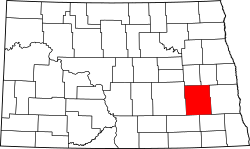
This is a list of the National Register of Historic Places listings in Barnes County, North Dakota.
This is intended to be a complete list of the properties and districts on the National Register of Historic Places in Barnes County, North Dakota, United States. The locations of National Register properties and districts for which the latitude and longitude coordinates are included below, may be seen in a map.
There are 13 properties and districts listed on the National Register in the county. Another property was once listed but has been removed.
| Adams | Barnes | Benson | Billings | Bottineau | Bowman | Burke | Burleigh | Cass | Cavalier | Dickey | Divide | Dunn | Eddy | Emmons | Foster | Golden Valley | Grand Forks | Grant | Griggs | Hettinger | Kidder | La Moure | Logan | McHenry | McIntosh | McKenzie | McLean | Mercer | Morton | Mountrail | Nelson | Oliver | Pembina | Pierce | Ramsey | Ransom | Renville | Richland | Rolette | Sargent | Sheridan | Sioux | Slope | Stark | Steele | Stutsman | Towner | Traill | Walsh | Ward | Wells | Williams |
Current listings
| Name on the Register | Image | Date listed | Location | City or town | Description | |
|---|---|---|---|---|---|---|
| 1 | Alderman School District #78 |
(#13000452) |
11 miles (18 km) north of Valley City on County Route 21 47°05′15″N 98°00′11″W / 47.08763°N 98.00313°W |
Valley City | ||
| 2 | All Saints' Episcopal Church |
(#92001605) |
516 N. Central Ave. 46°55′42″N 98°00′05″W / 46.928333°N 98.001389°W |
Valley City | ||
| 3 | Amphitheater and Fieldstone WPA Features at Valley City Pioneer Park |
(#10001195) |
Southwest of the intersection of 5th St. and 8th Ave. NW 46°55′39″N 98°00′51″W / 46.9275°N 98.014167°W |
Valley City | Federal Relief Construction in North Dakota, 1931-1943, MPS; the features were built by the Works Progress Administration (WPA) in 1937 and include four fieldstone cairns at the entrance to Pioneer Park and "PIONEER" spelled out with stones | |
| 4 | Barnes County Courthouse |
(#85002978) |
491 Second Ave., NW. 46°55′38″N 98°00′18″W / 46.927222°N 98.005°W |
Valley City | ||
| 5 | Green Consolidated School |
(#11000768) |
39 R St. SE. 46°50′57″N 98°07′19″W / 46.849167°N 98.121944°W |
Valley City | ||
| 6 | Ladbury Church |
(#05001140) |
6 miles east of Dazey on ND 26, north 3 miles then west 0.25 miles 47°13′32″N 98°04′29″W / 47.225556°N 98.074722°W |
Dazey | ||
| 7 | Midland Continental Railroad Depot |
(#03000870) |
401 Railway St. 47°10′14″N 98°27′33″W / 47.170556°N 98.459167°W |
Wimbledon | ||
| 8 | Rudolf Hotel |
(#83001926) |
Central Ave. and 2nd St. 46°55′21″N 98°00′09″W / 46.9225°N 98.0025°W |
Valley City | ||
| 9 | State Normal School at Valley City Historic District |
(#95000049) |
Roughly bounded by College St., SE., 2nd Ave.,SE., Viking Dr., and 2nd Ave., SW. 46°55′06″N 98°00′09″W / 46.918333°N 98.0025°W |
Valley City | ||
| 10 | US Post Office-Valley City |
(#89001758) |
149 NE. 3rd St. 46°55′32″N 98°00′05″W / 46.925556°N 98.001389°W |
Valley City | ||
| 11 | Valley City Carnegie Library |
(#79003724) |
413 Central Ave. 46°55′35″N 98°00′11″W / 46.926389°N 98.003056°W |
Valley City | ||
| 12 | Valley City Municipal Auditorium |
(#07001341) |
320 Central Ave., S. 46°55′15″N 98°00′11″W / 46.920833°N 98.003056°W |
Valley City | ||
| 13 | West Park Bridge |
(#97000169) |
4th St., SW., across the Sheyenne River 46°55′14″N 98°00′30″W / 46.920556°N 98.008333°W |
Valley City |
Former listing
| Name on the Register | Image | Date listed | Date removed | Location | City or town | Summary | |
|---|---|---|---|---|---|---|---|
| 1 | Rainbow Arch Bridge |
(#97000170) |
|
Main St., E, across the Sheyenne River |
Valley City | Demolished in 2004. |

All content from Kiddle encyclopedia articles (including the article images and facts) can be freely used under Attribution-ShareAlike license, unless stated otherwise. Cite this article:
National Register of Historic Places listings in Barnes County, North Dakota Facts for Kids. Kiddle Encyclopedia.


