
National Register of Historic Places listings in Cascade County, Montana facts for kids

This article is about special places in Cascade County, Montana that are listed on the National Register of Historic Places. This list includes buildings, areas, and sites that are important to history or culture in the United States. When a place is on this list, it means it's recognized for its value and efforts are made to protect it.
Cascade County has 47 places on this list. Three of these are even more special and are called National Historic Landmarks. These landmarks are extra important because they represent a significant part of American history.
Contents
- What is the National Register of Historic Places?
- National Historic Landmarks in Cascade County
- Other Notable Historic Places
- J. C. Adams Stone Barn
- Cascade County Courthouse
- Chicago, Milwaukee and St. Paul Passenger Depot
- Timothy Edwards Collins Mansion
- First United Methodist Church Parsonage
- Hardy Bridge
- Masonic Temple
- Mullan Road
- Roberts Building
- Tenth Street Bridge
- Tower Rock State Park
- Ulm Pishkun
- Union Bethel African Methodist Episcopal Church
- Ursuline Academy
- US Post Office and Courthouse-Great Falls
- O.S. Warden Bridge
- Historic Districts
- Images for kids
What is the National Register of Historic Places?
The National Register of Historic Places is like a special club for old buildings, sites, and areas. It's the official list of places in the United States that are worth saving. These places could be important because of their history, amazing design, or what they mean to a community.
Why are places listed?
Places get listed for many reasons. They might be where important events happened, or they might be great examples of a certain type of architecture. Sometimes, they are important because of the people who lived or worked there. Being on the list helps protect these places for future generations.
National Historic Landmarks in Cascade County
Cascade County is home to three very special places. These are called National Historic Landmarks. They are considered some of the most important historic sites in the entire country.
First Peoples Buffalo Jump

The First Peoples Buffalo Jump State Park is near Ulm, Montana. It is one of the largest and most used buffalo jumps in North America. For thousands of years, Native American tribes used these cliffs to hunt buffalo. They would guide herds of buffalo over the cliffs. This provided them with food, hides, and tools.
This site shows how early people lived and hunted. It is a powerful reminder of the deep connection between Native Americans and the land. It became a National Historic Landmark in 2015.
Great Falls Portage

The Great Falls Portage is a historic trail near Great Falls, Montana. It is famous because Lewis and Clark used it in 1805. They had to carry their boats and supplies around the series of waterfalls on the Missouri River. This was a very difficult and long journey.
The portage was about 18 miles (29 km) long. It took the expedition nearly a month to complete. This site is a key part of American exploration history. It became a National Historic Landmark in 1966.
Charles M. Russell House and Studio

The C. M. Russell Museum Complex in Great Falls, Montana includes the home and art studio of Charles M. Russell. He was a famous American artist. Russell is known for his paintings and sculptures of the American West. He showed the lives of cowboys, Native Americans, and wildlife.
His home and studio give us a look into his life and work. They help us understand the art and history of the American frontier. This site became a National Historic Landmark in 1966.
Other Notable Historic Places
Many other places in Cascade County are listed on the National Register. They include old buildings, schools, bridges, and even entire neighborhoods.
J. C. Adams Stone Barn

The J. C. Adams Stone Barn is located northeast of Sun River, Montana. It is an old barn built from stone. Stone barns are unique and show the building styles of early settlers. This barn was listed in 1979.
Cascade County Courthouse

The Cascade County Courthouse is in Great Falls, Montana. It is the main building for the county government. Courthouses often have interesting architecture and are important centers for a community. This building was listed in 1980.
Chicago, Milwaukee and St. Paul Passenger Depot
_2002-05.jpg)
This old train station is in Great Falls, Montana. It was once a busy place where people traveled by train. Train depots are important reminders of how people used to travel and how cities grew around railroads. It was listed in 1988.
Timothy Edwards Collins Mansion

The Timothy Edwards Collins Mansion is a large, historic home in Great Falls, Montana. Mansions like this often show the wealth and building styles of the past. This beautiful house was listed in 1980.
First United Methodist Church Parsonage
_-_Cascade_County,_Montana.png)
This parsonage, or minister's home, is in Great Falls, Montana. It is part of the history of the First United Methodist Church. It was listed in 2003.
Hardy Bridge

The Hardy Bridge is an old bridge near Cascade, Montana. It crosses the Missouri River. Historic bridges are important examples of engineering from the past. This bridge was listed in 2010.
Masonic Temple

The Masonic Temple in Great Falls, Montana is a grand building. It was built by the Masons, a fraternal organization. Many Masonic Temples have unique designs and play a role in local history. This one was listed in 2000.
Mullan Road

The Mullan Road is a historic military road. It was built in the 1860s to connect military posts. A part of this road is north of Great Falls, Montana. It was an important route for travel and trade in early Montana. It was listed in 1975.
Roberts Building
_-_Cascade_County,_Montana.png)
The Roberts Building is a historic commercial building in Great Falls, Montana. Old commercial buildings show how businesses operated and how downtown areas developed. This building was listed in 1985.
Tenth Street Bridge
.jpg)
The Tenth Street Bridge crosses the Missouri River in Great Falls, Montana. It is another example of important bridge engineering. It was listed in 1996.
Tower Rock State Park
_-_Cascade_County,_Montana.png)
Tower Rock State Park is a unique rock formation south of Cascade, Montana. It was an important landmark for Native Americans and early explorers, including Lewis and Clark. It was listed in 2002.
Ulm Pishkun

The Ulm Pishkun is another buffalo jump site near Ulm, Montana. Like First Peoples Buffalo Jump, it was used by Native Americans for hunting. These sites are very important for understanding ancient hunting practices. It was listed in 1974.
Union Bethel African Methodist Episcopal Church
_-_Cascade_County,_Montana.png)
The Union Bethel African Methodist Episcopal Church in Great Falls, Montana is a historic church. It represents the history of the African American community in the area. It was listed in 2003.
Ursuline Academy
_-_Cascade_County,_Montana.png)
The Ursuline Academy in Great Falls, Montana was once a school run by the Ursuline sisters. Many old schools are listed for their architectural beauty and their role in education. It was listed in 1991.
US Post Office and Courthouse-Great Falls
_-_Cascade_County,_Montana.png)
This building in Great Falls, Montana served as both a post office and a courthouse. Federal buildings often have grand designs and are important parts of a city's history. It was listed in 1986.
O.S. Warden Bridge

The O.S. Warden Bridge crosses the Missouri River in Great Falls, Montana. It is another example of a historic bridge in the county. It was listed in 2012.
Historic Districts
Some listings are not just single buildings but entire areas called "historic districts." These districts have many buildings that together tell a story about a community's past.
Belt Commercial Historic District
This district includes the main business street in Belt, Montana. It shows what a small town's commercial area looked like in the past. It was listed in 2004.
Great Falls Central Business Historic District
This large district covers the main downtown area of Great Falls, Montana. It includes many historic buildings that were once shops, offices, and banks. It shows the growth of Great Falls as a city. It was listed in 2004.
Great Falls Northside Residential Historic District
This district in Great Falls, Montana includes many historic homes. It shows how neighborhoods developed and the different styles of houses built over time. It was listed in 1991.
Great Falls Railroad Historic District
This district in Great Falls, Montana is near the old train tracks. It includes buildings related to the railroad, which was very important for the city's growth. It was listed in 1993.
Montana ExpoPark
The Montana ExpoPark in Great Falls, Montana is a historic fairground. Fairgrounds often have unique buildings and have been places for community gatherings for many years. It was listed in 1989.
Images for kids
-
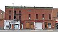
The Arvon Block in Great Falls.
-
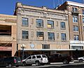
The Margaret Block in Great Falls.
-
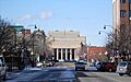
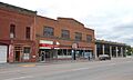
Central Avenue in the Great Falls Central Business Historic District.
-
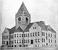
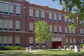
The old Great Falls Central High School building.
-
Great Falls High School Historic District.
-
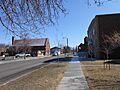
A street in the Great Falls Northside Residential Historic District.
-
A street in the Great Falls Railroad Historic District.
-
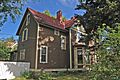
The Harry E. Randall House in Great Falls.


_-_Cascade_County,_Montana.png)


