National Register of Historic Places listings in Hardeman County, Tennessee facts for kids
Have you ever wondered about old buildings or places that are super important to history? In the United States, there's a special list called the National Register of Historic Places. It helps protect and celebrate buildings, sites, and objects that have a big story to tell about our country's past.
This page is a list of all the amazing places in Hardeman County, Tennessee that are on this important list. There are 12 places here, and one of them is even a National Historic Landmark! That means it's extra special and important to the whole country.
Historic Places in Hardeman County
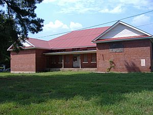
Allen-White School
The Allen-White School is located in Whiteville, Tennessee. It was added to the National Register in 2005. This school building is a part of the community's history.
James Monroe Avent House
You can find the James Monroe Avent House in Hickory Valley, Tennessee. This historic house was recognized in 2001. It's a great example of old homes in the area.
Bills-McNeal Historic District
The Bills-McNeal Historic District is a special area in Bolivar, Tennessee. It includes many streets like Lafayette, McNeal, and Union. This district was added to the list in 1980. It helps preserve the historic feel of this part of Bolivar.
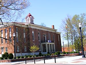
Bolivar Court Square Historic District
Also in Bolivar, Tennessee, the Bolivar Court Square Historic District is found around U.S. Route 64 and State Route 125. This area, listed in 1980, is the heart of the town. It includes the old courthouse and other important buildings.
Bolivar-Somerville Stage Road
The Bolivar-Somerville Stage Road is an old road that goes through Hardeman County. It's located southwest of Whiteville, Tennessee. This historic road, added in 2005, even extends into Fayette County. It reminds us of how people traveled long ago.
Davis Bridge Battlefield
The Davis Bridge Battlefield is near Pocahontas, Tennessee. This battlefield, listed in 1998, marks a place where an important battle happened. It also extends into McNairy County.
Hatchie River Ferry
The Hatchie River Ferry is located near the end of Big Bend Lane, south of State Route 15 in Bolivar, Tennessee. This site, added in 2005, shows where a ferry once crossed the Hatchie River. Ferries were important for crossing rivers before bridges were common.
North Main Street Historic District
Another historic district in Bolivar, Tennessee is the North Main Street Historic District. It includes North Main, Sycamore, and Jefferson Streets. This area was listed in 1980 and helps keep the historic look of these streets.
Pocahontas School
The Pocahontas School is located on State Route 57 in Pocahontas, Tennessee. This school building was added to the National Register in 2007. It's an important part of the town's educational history.
Robertson Family Farm
The Robertson Family Farm is found on Newsom Road in Whiteville, Tennessee. This farm was recognized in 2007. It represents the history of farming and family life in the area.
Siege and Battle of Corinth Sites
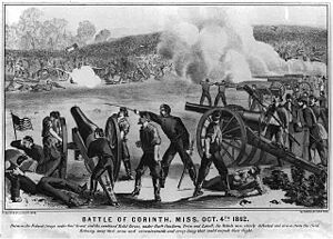
The Siege and Battle of Corinth Sites are mostly in Alcorn County, Mississippi, but a small part is in Hardeman County, near Pocahontas, Tennessee. This site is a National Historic Landmark, meaning it's super important to the history of the entire United States. It includes a small part of the Davis Bridge Battlefield. This area saw major events during the American Civil War.
United Sons and Daughters of Charity Lodge Hall
The United Sons and Daughters of Charity Lodge Hall is on West McNeal Street in Bolivar, Tennessee. This building was added to the National Register in 2005. It was once a meeting place for a charitable group.
Western State Hospital Historic District
The Western State Hospital Historic District is located on U.S. Route 64 in Bolivar, Tennessee. This district was listed in 1987. It includes buildings that were part of an important hospital.
Former Listing
Sometimes, a place might be removed from the National Register. This usually happens if the building is changed too much or no longer exists.
Campbell House
The Campbell House in Bolivar, Tennessee was once on the National Register. It was listed in 1975 but was removed in 1986.


