
National Register of Historic Places listings in Rutland County, Vermont facts for kids

Welcome to Rutland County, Vermont! This page is all about special places here that are listed on the National Register of Historic Places. Think of it like a Hall of Fame for buildings, areas, and sites that are super important to America's history.
These places are chosen because they tell amazing stories about the past. They could be old houses, schools, bridges, or even whole neighborhoods! In Rutland County, there are 76 of these cool historic spots. One of them is even extra special and is called a National Historic Landmark!
Want to see where these places are? Many of them have special map coordinates so you can find them easily. Let's explore some of these amazing historic sites!
| Addison - Bennington - Caledonia - Chittenden - Essex - Franklin - Grand Isle - Lamoille - Orange - Orleans - Rutland - Washington - Windham - Windsor |
What is the National Register of Historic Places?
The National Register of Historic Places is like an official list kept by the United States government. It helps protect and celebrate buildings, structures, objects, sites, and districts that are important in American history, architecture, archaeology, engineering, or culture. When a place is on this list, it means it's recognized as a valuable part of our shared heritage.
Historic Places in Rutland County
Rutland County is full of history, and many of its treasures are on the National Register. These places include everything from old homes and libraries to covered bridges and even entire villages!
Cool Old Buildings and Homes
Many historic homes and public buildings in Rutland County have been preserved. These places often show us how people lived and worked long ago.
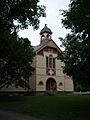
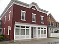
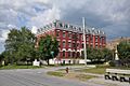
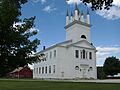
- The H. H. Baxter Memorial Library in Rutland is one such place. It was built a long time ago and is now the Rutland Jewish Community Center.
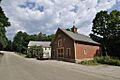
- The Castleton Medical College Building in Castleton is another historic spot. Imagine learning medicine in a building from so long ago!
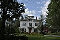
- The Chaffee-Moloney Houses in Rutland are also on the list. These houses give us a peek into the past architecture of the area.
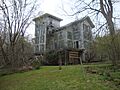
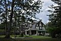
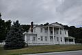
- In Rutland, you can also find Clementwood, a historic estate, and Linden Terrace, another grand old building.
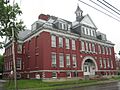
- The Longfellow School in Rutland is a historic school building. Can you imagine going to school there?
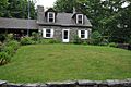
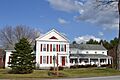
- The Proctor-Clement House in Rutland is now a bed and breakfast. It's a great example of a historic home that's still being used today.
- The St. Stanislaus Kostka School and Convent House in West Rutland also made the list. These buildings show the history of education and community in the area.
- The Watkins School in Rutland is another historic school building. It's cool to see how school buildings have changed over time.
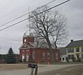
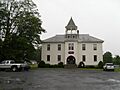
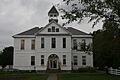
- The West Rutland Town Hall is a historic building in West Rutland. Town halls are often central to a community's history.
Historic Villages and Districts
Sometimes, it's not just one building that's historic, but a whole group of them! These are called "historic districts." They help us see what towns looked like in the past.
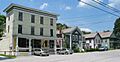
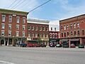
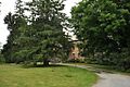
- Benson Village is a historic district in Benson. Walking through it is like stepping back in time.
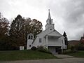
- The Brandon Village Historic District in Brandon is another example. It shows off the historic heart of the town.
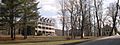
- The Castleton Village Historic District includes many old buildings in Castleton. It's a beautiful area with lots of history.
- The Danby Village Historic District in Danby and the East Poultney Historic District in East Poultney also preserve the historic feel of their communities.
- The Fair Haven Green Historic District in Fair Haven is centered around a historic town green.
- The Middletown Springs Historic District and the Tinmouth Historic District are other village areas recognized for their historical importance.
- The Pittsford Green Historic District and the Poultney Main Street Historic District highlight the historic centers of those towns.
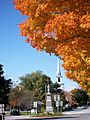
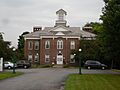
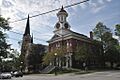
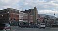
- In Rutland, you'll find the Rutland Courthouse Historic District and the Rutland Downtown Historic District. These areas show the city's important past.
- The Wallingford Main Street Historic District in Wallingford preserves the historic main street of the town.
Amazing Bridges
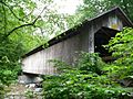
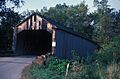
Vermont is famous for its covered bridges, and Rutland County has several historic ones! These bridges are not just old; they are also examples of clever engineering from the past.
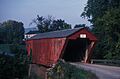
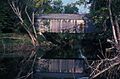
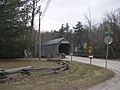
- The Brown Covered Bridge in Shrewsbury is a National Historic Landmark. It was built in 1880 and is a great example of a "Town lattice truss" bridge design.
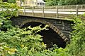
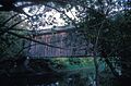
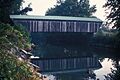
- The Colburn Bridge in Pittsford crosses Sugar Hollow Brook.
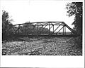
- The Cold River Bridge in Clarendon was also historic, but it was taken down in 2006. Even though it's gone, its history is still remembered.
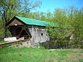
- The Cooley Covered Bridge and Depot Covered Bridge in Pittsford are other charming covered bridges.
- The Dean Covered Bridge and Sanderson Covered Bridge in Brandon cross the Otter Creek.
- The Gorham Covered Bridge in Proctor and the Hammond Covered Bridge in Pittsford are more examples of these beautiful old structures.
- The Kingsley Covered Bridge in East Clarendon is another one to see.
- The Marble Bridge in Proctor is a unique bridge made of marble, crossing Otter Creek.
Other Interesting Historic Sites
Rutland County also has other unique historic places that tell different stories.
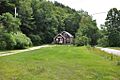
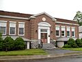
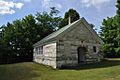
- The Braintree School in Pawlet is a historic school building.
- The Brandon State School in Brandon has a long history.
- The Crowley Cheese Factory in Healdville is a historic place where cheese was made. Imagine how different cheese-making was back then!
- The East Clarendon Railroad Station is a historic train station. Train travel was a huge part of life in the past.
- The Forest Dale Iron Furnace in Brandon was a place where iron was made. This was very important for building things long ago.
- The Fort Vengeance Monument Site in Pittsford marks a historic fort.
- Gifford Woods State Park in Killington is a historic park area.
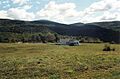
- Hubbardton Battlefield in Hubbardton is a very important site where a battle took place during the American Revolutionary War.
- Hyde's Hotel in Sudbury is a historic hotel.
- The Hydeville School in Castleton is another historic school.
- The Kazon Building in West Rutland is a historic commercial building.
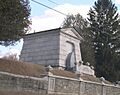
- The Laurel Glen Mausoleum-Laurel Hall in Shrewsbury is a unique historic site.
- The Mission of the Church of Our Savior in Killington includes several historic buildings.
- The Pawlet Town Hall is a historic town hall building.
- The Poultney Central School in Poultney is another historic school.
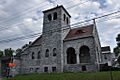
- The St. Peter's Church and Mount St. Joseph Convent Complex in Rutland is a large historic religious complex.
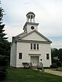
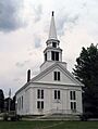
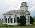
- The Sudbury Congregational Church and Sudbury School No. 3 are historic buildings in Sudbury.
- The Wells Village School in Wells is another historic school building.
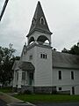
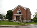
- The West Haven Baptist Church in West Haven is a historic church.
These are just some of the many amazing historic places you can find in Rutland County, Vermont! Each one helps us understand the rich history of this beautiful area.
Images for kids
-
H. H. Baxter Memorial Library
-
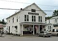
Benson Village
-
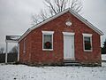
Braintree School
-
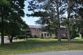
Brandon State School
-
Brandon Village Historic District
-
Brown Covered Bridge
-
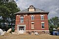
Castleton Medical College Building
-
Castleton Village Historic District
-
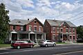
Chaffee-Moloney Houses
-
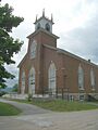
Clarendon Congregational Church
-
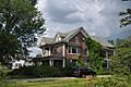
Clarendon House
-
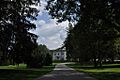
Clementwood
-
Colburn Bridge
-
Cold River Bridge
-
Cooley Covered Bridge
-
Crowley Cheese Factory
-
Danby Village Historic District
-
Dean Covered Bridge
-
Depot Covered Bridge
-
East Clarendon Railroad Station
-
East Poultney Historic District
-
Fair Haven Green Historic District
-
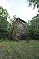
Forest Dale Iron Furnace
-
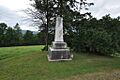
Fort Vengeance Monument Site
-
Gifford Woods State Park
-
Gorham Covered Bridge
-
Hammond Covered Bridge
-
Hubbardton Battlefield
-
Hyde's Hotel
-
Hydeville School
-
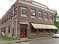
Kazon Building
-
Asahel Kidder House
-
Kingsley Covered Bridge
-
Kingsley Grist Mill Historic District
-
Laurel Glen Mausoleum-Laurel Hall
-
Linden Terrace
-
Longfellow School
-

Marble Bridge
-
Marble Street Historic District
-
Middletown Springs Historic District
-
Mission of the Church of Our Savior
-
Mountain View Stock Farm
-
Thomas H. Palmer House
-
Arthur Perkins House
-
Pittsford Green Historic District
-
Poultney Central School
-
Poultney Main Street Historic District
-
Proctor-Clement House
-
Rutland Courthouse Historic District
-
Rutland Downtown Historic District
-
St. Stanislaus Kostka School and Convent House
-
Sanderson Covered Bridge
-
St. Peter's Church and Mount St. Joseph Convent Complex
-
Sudbury Congregational Church
-
Sudbury School No. 3
-
Tinmouth Historic District
-
Wallingford Main Street Historic District
-
Watkins School
-
Wells Village School
-
West Haven Baptist Church
-
West Rutland Town Hall


.jpg)


