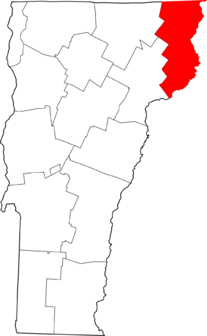
National Register of Historic Places listings in Essex County, Vermont facts for kids
Welcome to Essex County, Vermont! This page lists special places in the county that are part of the National Register of Historic Places. This is like a national list of important buildings, bridges, and areas that have a lot of history. These places are protected because they tell us about the past.
In Essex County, there are 11 different places on this important list. You can even see where many of them are on a map using their special location coordinates!
| Addison - Bennington - Caledonia - Chittenden - Essex - Franklin - Grand Isle - Lamoille - Orange - Orleans - Rutland - Washington - Windham - Windsor |
Historic Places in Essex County
The National Register of Historic Places helps us remember and protect important parts of our history. Here are some of the cool places in Essex County that are on this list:
| Name on the Register | Image | Date listed | Location | City or town | Description | |
|---|---|---|---|---|---|---|
| 1 | Bloomfield-Nulhegan River Route 102 Bridge |
(#91001605) |
VT 102 over the Nulhegan River 44°45′05″N 71°38′01″W / 44.751477°N 71.633501°W |
Bloomfield | This bridge helps people cross the Nulhegan River. It was added to the list in 1991. | |
| 2 | Columbia Covered Bridge |
(#76000123) |
Across the Connecticut River between U.S. Route 3 and VT 102 44°51′12″N 71°33′05″W / 44.853333°N 71.551389°W |
Lemington | This old covered bridge crosses the Connecticut River. It connects Vermont with New Hampshire. | |
| 3 | Guildhall Village Historic District |
(#80000331) |
VT 102 44°33′56″N 71°33′46″W / 44.565556°N 71.562778°W |
Guildhall | This is a whole area in Guildhall that is important for its history. It was listed in 1980. | |
| 4 | Judge David Hibbard Homestead |
(#95000294) |
Woodland Rd. 44°27′06″N 71°53′30″W / 44.451667°N 71.891667°W |
Concord | This old home belonged to Judge David Hibbard. It was added to the list in 1995. | |
| 5 | Island Pond Historic District |
(#79000275) |
Junction of VT 105 and VT 114 44°48′54″N 71°52′52″W / 44.815097°N 71.881036°W |
Island Pond | This historic area is in Island Pond. It's where two main roads meet. | |
| 6 | Jacobs Stand |
(#80000332) |
27 Park St. 44°59′45″N 71°32′23″W / 44.995833°N 71.539722°W |
Canaan | This building is now the Alice M. Ward Library. It became historic in 1980. | |
| 7 | Maidstone State Park |
(#01001285) |
4858 and 4876 Maidstone Rd. 44°38′11″N 71°39′07″W / 44.636389°N 71.651944°W |
Maidstone | Maidstone State Park is a beautiful natural area. It was recognized for its history in 2001. | |
| 8 | Mount Orne Covered Bridge |
(#76000124) |
East of Lunenburg off Town Hwy 1 44°27′38″N 71°39′12″W / 44.460556°N 71.653333°W |
Lunenburg | This is another historic covered bridge. It connects Vermont with New Hampshire. | |
| 9 | U.S. Inspection Station-Canaan, Vermont |
(#14000601) |
387 VT 141 45°00′43″N 71°33′36″W / 45.0119°N 71.56°W |
Canaan | This building was used for border inspections. It became historic in 2014. | |
| 10 | U.S. Inspection Station-Beecher Falls, Vermont |
(#14000602) |
1429 VT 253 45°00′46″N 71°30′22″W / 45.0128°N 71.5061°W |
Canaan | Another important border inspection station. It's located in Beecher Falls. | |
| 11 | U.S. Inspection Station-Norton, Vermont |
(#14000603) |
115 VT 147N 45°00′37″N 71°47′39″W / 45.0104°N 71.7941°W |
Norton | This inspection station is in Norton. It was also added to the list in 2014. |

All content from Kiddle encyclopedia articles (including the article images and facts) can be freely used under Attribution-ShareAlike license, unless stated otherwise. Cite this article:
National Register of Historic Places listings in Essex County, Vermont Facts for Kids. Kiddle Encyclopedia.


