Norton, Vermont facts for kids
Quick facts for kids
Norton, Vermont
|
|
|---|---|
|
Town
|
|

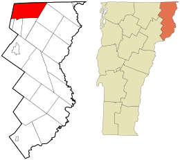
Location in Essex County and the state of Vermont.
|
|

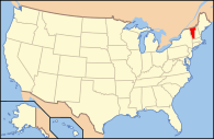
Location of Vermont in the United States
|
|
| Country | United States |
| State | Vermont |
| County | Essex |
| Communities | Norton Averill Lake |
| Area | |
| • Total | 39.6 sq mi (102.6 km2) |
| • Land | 39.2 sq mi (101.5 km2) |
| • Water | 0.4 sq mi (1.1 km2) |
| Elevation | 1,319 ft (402 m) |
| Population
(2020)
|
|
| • Total | 153 |
| • Density | 4/sq mi (1.5/km2) |
| Time zone | UTC-5 (EST) |
| • Summer (DST) | UTC-4 (EDT) |
| ZIP code |
05907
|
| Area code(s) | 802 |
| FIPS code | 50-52750 |
| GNIS feature ID | 1462165 |
Norton is a small town in Essex County, Vermont, United States. It's located right on the border between Canada and the United States. Specifically, it sits just south of Stanhope, Quebec. In 2020, about 153 people lived there.
Contents
History of Norton
From 1970 to 1994, Norton was home to a special place called Earth Peoples Park. This was a large piece of land, about 592 acres, where anyone could live for free. It was seen as a "liberated" area.
However, in 1994, the state of Vermont took over the land. Today, it is known as the Black Turn Brook State Forest. This forest is now a protected area for nature.
Geography of Norton
Norton is located in the very northeast corner of Vermont. To its west is Orleans County, Vermont, and to its north is the Canadian province of Quebec.
Roads and Rivers
Vermont Route 114 is a main road that goes through the middle of town. It starts near Norton Pond in the south and heads north to the village of Norton. This village is right next to the Canada–US border. From there, the highway turns east towards Averill and Canaan, Vermont.
The northern part of the highway follows the Coaticook River. This river flows from Norton Pond north into Quebec. Its water eventually reaches the Saint Lawrence River through other rivers like the Massawippi and Saint-François rivers.
Land and Water
The town of Norton covers a total area of about 102.6 square kilometers (39.6 square miles). Most of this area, about 101.5 square kilometers (39.2 square miles), is land. The remaining 1.1 square kilometers (0.4 square miles) is water.
The highest point in Norton is Brousseau Mountain. It stands about 2,723 feet (830 meters) tall and is located near the eastern border of the town.
Population of Norton
| Historical population | |||
|---|---|---|---|
| Census | Pop. | %± | |
| 1860 | 32 | — | |
| 1870 | 303 | 846.9% | |
| 1880 | 239 | −21.1% | |
| 1890 | 960 | 301.7% | |
| 1900 | 692 | −27.9% | |
| 1910 | 479 | −30.8% | |
| 1920 | 336 | −29.9% | |
| 1930 | 339 | 0.9% | |
| 1940 | 314 | −7.4% | |
| 1950 | 279 | −11.1% | |
| 1960 | 241 | −13.6% | |
| 1970 | 207 | −14.1% | |
| 1980 | 184 | −11.1% | |
| 1990 | 169 | −8.2% | |
| 2000 | 214 | 26.6% | |
| 2010 | 169 | −21.0% | |
| 2020 | 153 | −9.5% | |
| U.S. Decennial Census | |||
In 2000, there were 214 people living in Norton. These people lived in 91 households, and 51 of these were families. The population density was about 5.5 people per square mile (2.1 people per square kilometer).
Many homes in Norton, about 26.9%, speak French. This shows how close the town is to the Canadian province of Quebec, where French is widely spoken.
The average household in Norton had about 2.35 people. The average family had about 3.15 people.
Age Distribution
The population of Norton includes people of all ages. In 2000, about 24.3% of the residents were under 18 years old. About 18.2% were 65 years old or older. The average age in the town was 43 years.
See also
 In Spanish: Norton (Vermont) para niños
 | William M. Jackson |
 | Juan E. Gilbert |
 | Neil deGrasse Tyson |

