National Register of Historic Places listings in Stearns County, Minnesota facts for kids
Have you ever wondered about old buildings and places that are super important to history? In Stearns County, Minnesota, there are many special spots that are officially recognized for their historical value! These places are listed on the National Register of Historic Places. It's like a special list kept by the United States government to protect and celebrate buildings, sites, and objects that tell important stories about our past.
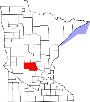
Stearns County has 36 places on this list. One of them is even more special: it's a National Historic Landmark. This means it's one of the most important historical places in the entire country! There were also three other places that used to be on the list but were removed for different reasons, like being moved or torn down. Let's explore some of these amazing historical treasures!
Contents
- Historic Places in Stearns County
- Homes with History
- Important Churches and Religious Sites
- Buildings for Business and Government
- Historic Districts and Other Sites
- Clark and McCormack Quarry and House
- Fair Haven Flour Mill
- Freeport Roller Mill and Miller's House
- Anton Gogala Farmstead
- Cold Spring Brewing Company Houses
- Model School (St. Cloud)
- Original Main Street Historic District (Sauk Centre)
- Palmer House Hotel
- St. Cloud Commercial Historic District
- St. Cloud Veterans Administration Hospital Historic District
- National Historic Landmark
- Former Listings
- Images for kids
Historic Places in Stearns County
Homes with History
Many old houses in Stearns County are on the National Register because of their unique architecture or the important people who lived there.
Francis Arnold House
The Francis Arnold House was built way back in 1884. It belonged to the owner of a flour mill nearby. This house helps us remember the old days when water power was used to grind grain into flour for everyone to use. It's located near St. Cloud.
John N. Bensen House
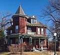
In St. Cloud, you can find the John N. Bensen House, built in 1904. This house is a great example of Queen Anne style architecture. This style is known for its fancy details, towers, and decorative porches. John N. Bensen was a successful businessman from Germany, and his home shows how well he did. Today, it's a bed and breakfast!
Nehemiah P. Clarke House
Another beautiful Queen Anne home in St. Cloud is the Nehemiah P. Clarke House, built in 1893. Nehemiah P. Clarke was a pioneer merchant and lumberman. His house shows the wealth and style of important people from that time.
Foley-Brower-Bohmer House
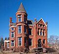
The Foley-Brower-Bohmer House in St. Cloud is a grand home built in 1889. It's a fantastic example of Richardsonian Romanesque architecture, which uses heavy stone, round arches, and deep windows. This house was owned by important industrialist brothers, Timothy and Thomas Foley, and later by a politician named Ripley B. Brower.
Michael Majerus House
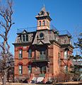
Also in St. Cloud, the Michael Majerus House from 1891 is considered the best example of Second Empire architecture in the city. This style often features a special type of roof called a mansard roof. This house is also now a bed and breakfast.
Important Churches and Religious Sites
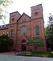
Many churches in Stearns County are on the list because they were central to the lives of early immigrant communities.
Church of St. Boniface (Melrose)
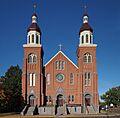
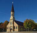
The Church of St. Boniface in Melrose was built in 1899, with its rectory (the priest's home) added in 1907. This church shows how important ethnic parishes were for German American communities in rural Minnesota. It's now known as the Church of St. Mary.
Rural Catholic Churches
Several other Catholic churches in Stearns County are recognized for their role in anchoring German, Polish, or Slovene immigrant settlements. These include:
- Church of St. Joseph-Catholic in St. Joseph
- Church of St. Mary Help of Christians-Catholic in St. Augusta
- Church of St. Stephen-Catholic in St. Stephen
- Church of the Immaculate Conception-Catholic in Avon
These churches were not just places of worship; they were community centers for new arrivals to Minnesota.
Church of the Sacred Heart (Freeport)
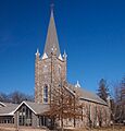
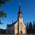
The Church of the Sacred Heart in Freeport was built in 1905. It was a key part of the Catholic German American community that settled there in 1876.
St. Benedict's Convent and College Historic District
In St. Joseph, the St. Benedict's Convent and College Historic District is a large campus. It includes the convent and a boarding school for girls. This site shows the huge impact and growth of the Sisters of the Order of Saint Benedict, which is the largest community of Benedictine sisters in the world. The buildings here were built between 1868 and 1959.
St. John's Abbey and University Historic District
The St. John's Abbey and University Historic District in Collegeville is another very important religious and educational campus. It belongs to the Order of Saint Benedict and has 17 buildings constructed between 1868 and 1959. This district is important for both its history and its architecture.
Buildings for Business and Government
Carter Block
The Carter Block in St. Cloud is a commercial building from 1902. It was a very important place for retail stores, storage, and meeting spaces as St. Cloud grew.
Fifth Avenue Commercial Buildings
A block of six commercial buildings on Fifth Avenue in St. Cloud (built between 1883 and 1914) also made the list. They represent the history and architecture of St. Cloud's main business area.
First National Bank (St. Cloud)
The First National Bank building in St. Cloud was built in 1889. It was home to a very powerful bank and is known as St. Cloud's "finest designed and best preserved commercial building."
First State Bank (St. Joseph)
In St. Joseph, the First State Bank building from 1918 is special because of its fancy terracotta (a type of baked clay) front. It's a rare example in Minnesota of Egyptian Revival architecture, a style inspired by ancient Egyptian designs.
Kimball Prairie Village Hall
The Kimball Prairie Village Hall in Kimball was built in 1908. This municipal hall was designed to hold several government and public services all in one place.
Pan Motor Company Office and Sheet Metal Works
The Pan Motor Company Office and Sheet Metal Works in St. Cloud are the remaining parts of St. Cloud's first big industrial complex. This company, which operated from 1917 to 1922, was Minnesota's main (though short-lived) car manufacturer.
Stearns County Courthouse and Jail
The Stearns County Courthouse and Jail in St. Cloud are important symbols of the county government. The courthouse, built in 1921, is in the Beaux-Arts architecture style, known for its grand and formal look. The jail, built in 1922, is in the Prairie School style, which emphasizes horizontal lines and natural materials.
Historic Districts and Other Sites
Clark and McCormack Quarry and House
Near Rockville, you'll find the Clark and McCormack Quarry and House. This granite quarry, started in 1907, was a major source of "Rockville Pink" stone used in buildings. The owner's house from 1924 is also part of this site, showing a big industry in the area.
Fair Haven Flour Mill
The Fair Haven Flour Mill in Fair Haven Township is Minnesota's third-oldest surviving water-powered flour mill, built in 1867. It's now kept safe in a county park.
Freeport Roller Mill and Miller's House
The Freeport Roller Mill and Miller's House in Freeport was a steam-powered milling complex that started in 1898. Sadly, the mill building burned down in 2011.
Anton Gogala Farmstead
The Anton Gogala Farmstead near St. Anthony is a well-preserved example of an old small farm. It has several log buildings that date back to 1875! This farm is also linked to an immigrant family who helped start the Slovene American community in St. Anthony.
Cold Spring Brewing Company Houses
In Cold Spring, three houses are listed together: the Eugene Hermanutz House, the John Oster House, and the Ferdinand Peters House. These homes were built between 1907 and 1912 by the co-owners of the Cold Spring Brewing Company. They are important for their architecture and their connection to the area's main industry.
Model School (St. Cloud)
The Model School in St. Cloud is Minnesota's oldest surviving laboratory school building. It was built in 1913 for a normal school (a school that trained teachers) that started in 1869. Today, it's called Riverview Hall at St. Cloud State University.
Original Main Street Historic District (Sauk Centre)
The Original Main Street Historic District in Sauk Centre is a 10-block area that many believe inspired the famous author Sinclair Lewis's 1920 novel Main Street. This district helped create the idea of "Main Street" as a symbol of small American towns. It includes 74 important buildings.
Palmer House Hotel
The Palmer House Hotel in Sauk Centre was built in 1901 and expanded in 1916. It's a great example of a hotel that used to be common, specifically serving traveling salespeople. It's also part of the Original Main Street Historic District.
St. Cloud Commercial Historic District
The St. Cloud Commercial Historic District covers the central business area of St. Cloud, mainly along W. St. Germain Street. It includes 41 important buildings built mostly between 1870 and 1947, showing the growth of the city's downtown.
St. Cloud Veterans Administration Hospital Historic District
The St. Cloud Veterans Administration Hospital Historic District is important for a few reasons. It shows how local people worked hard to get the hospital built, its impact on health care for Minnesota veterans, and its Colonial and Classical Revival architecture. This district has 34 buildings constructed between 1923 and 1950.
National Historic Landmark
Sinclair Lewis Boyhood Home
The Sinclair Lewis Boyhood Home in Sauk Centre is a very special place. It was the childhood home of Sinclair Lewis from 1885 to 1902. Sinclair Lewis became one of the most famous American novelists of the 1920s and was the first American to win the Nobel Prize in Literature. This home is now a museum where you can learn about his early life. It's one of the most important historical sites in the entire country!
Minnesota Home School for Girls Historic District
The Minnesota Home School for Girls Historic District in Sauk Centre was Minnesota's first all-female youth detention center. It was started in 1911 and designed using the Cottage Plan, where girls lived in smaller, home-like buildings instead of one large institution. Today, it's called Eagle's Healing Nest, a center for veterans.
Former Listings
Some places were once on the National Register but are no longer listed. This can happen if a building is moved, changed too much, or torn down.
- The Catholic Church of the Sacred Heart near Holdingford was listed in 1982 but removed in 1993 because it was moved in 1989.
- The St. Cloud Post Office/City Hall was listed in 1976 but removed in 1987. This 1902 building was torn down to make space for a convention center.
- The St. Cloud Public Library from 1939 was listed in 1982 but removed in 1984 because it was demolished in 1981.
Images for kids


