Nether Denton facts for kids
Quick facts for kids Nether Denton |
|
|---|---|
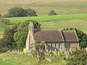
 St Cuthbert's Church, Nether Denton |
|
| Population | 415 (2011 (including Upper Denton)) |
| OS grid reference | NY602631 |
| Civil parish |
|
| District | |
| Shire county | |
| Region | |
| Country | England |
| Sovereign state | United Kingdom |
| Post town | BRAMPTON |
| Postcode district | CA8 |
| Dialling code | 016977 |
| Police | Cumbria |
| Fire | Cumbria |
| Ambulance | North West |
| EU Parliament | North West England |
| UK Parliament |
|
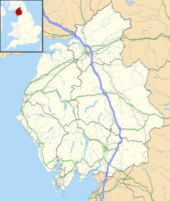
Nether Denton is a small, spread-out community in the countryside of Cumbria, England. It's located about 12 miles (19 km) north-east of Carlisle, right by the A69 road. In 2011, about 415 people lived in the area.
Nether Denton is just a couple of miles south-west of another village called Upper Denton. The area also includes a small village known as Low Row.
Contents
Discovering Nether Denton
Nether Denton is a quiet place with a rich past. It's known for its historical buildings and its connection to ancient Roman times.
A Glimpse into History
The area around Nether Denton has been important for a very long time. You can find clues about its past in its old buildings.
Roman Connections
St Cuthbert's Church in Nether Denton is built on a very old site. It stands where a Roman fort used to be. This fort was about 0.5 miles (0.8 km) south of Hadrian's Wall. It was also on the Stanegate road, which was an important Roman road.
The church building you see today was built between 1868 and 1870. However, there has been a church on this spot since the 12th century. Imagine how many stories these old stones could tell!
Denton Hall and Pele Towers
Denton Hall is another interesting historical building. It's now used as a farmhouse. Part of it is a pele tower, which is a type of small castle. These towers were built in the 14th century to protect people from raids.
The pele tower at Denton Hall has been changed over time. It has gables (pointy roof sections) and is not as tall as it once was. It connects to a house that was built in 1829. The walls of the tower are very thick, about 2 meters (6.6 feet) wide! This made them very strong and safe.
 | Roy Wilkins |
 | John Lewis |
 | Linda Carol Brown |


