New Eddystone Rock facts for kids
 |
|
| Geography | |
|---|---|
| Location | Behm Canal |
| Coordinates | 55°30′13″N 130°56′09″W / 55.50361°N 130.93583°W |
| Highest elevation | 237 ft (72.2 m) |
| Administration | |
|
United States
|
|
| State | Alaska |
| Borough | Ketchikan Gateway |
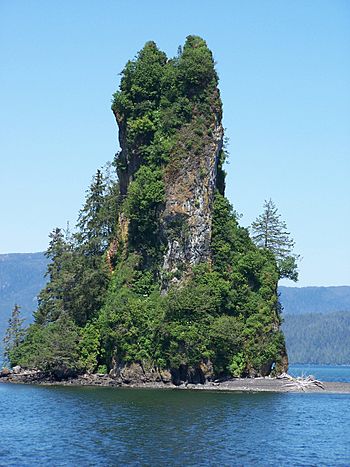
New Eddystone Rock is a cool island in Alaska. It's located in a place called Behm Canal, about 40 miles (64 km) east of Ketchikan. This island is actually a tall, strong pillar made of a type of rock called basalt.
Contents
Geology
How New Eddystone Rock Formed
Long, long ago, during the last ice age, a huge sheet of ice covered Southeast Alaska. This ice was super heavy! It pushed down on the Earth's crust (the outer layer of our planet) in places like Behm Canal.
When the ice started to melt, the heavy weight was lifted. The Earth's crust then slowly began to spring back up, like a giant sponge. This process is called isostatic rebound. As the crust moved, it cracked the rock. This cracking allowed a volcano to erupt about 15,000 to 13,800 years ago, creating New Eddystone Rock!
This volcano starts way down at the bottom of Behm Canal, about 850 feet (259 meters) below the sea. The part of the island you can see sticks up 237 feet (72 meters) above the water. So, the whole volcano is actually over 1,000 feet (305 meters) tall! The part underwater is shaped a bit like a cone. But over thousands of years, ocean waves have worn away most of the rock above the water. What's left is a very hard, spire-shaped "volcanic plug." This is the tough core that resisted the waves.
Other Underwater Volcanoes
Scientists have studied the bottom of Behm Canal. They found that New Eddystone wasn't the only volcano that formed when the crust bounced back. They've found four other spots where volcanoes erupted. Two of these look like domes. This suggests they erupted when they were still under the thick glacier ice, and the ice smoothed them out. The other two, along with New Eddystone Rock, are more pointed. This means they were never covered by the moving ice. Out of all five volcanoes found in Behm Canal, only New Eddystone Rock rises above the water!
The water level in Behm Canal changes a lot with the tides, sometimes by more than 20 feet (6 meters). Since much of New Eddystone Rock is a low-lying beach, the size of the island you see above the water changes quite a bit depending on whether it's high tide or low tide.
History
We don't know how the native Tlingit people discovered this island. We also don't know their name for it or what role it played in their lives before Europeans arrived.
European Discovery
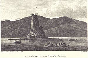
The first European to see New Eddystone Rock was Captain George Vancouver. He was sent by the British Admiralty in 1791 to explore the northwest coast of North America. In July 1793, Vancouver's long journey brought him to what is now Observatory Inlet, British Columbia. He anchored his big ships there. Then, he took two smaller boats to survey the coast to the north. He led one boat, and Lieutenant Peter Puget led the other.
As they explored north through Behm Canal, Vancouver and his team reached New Eddystone Rock on Friday, August 9, 1793. They landed their boats there. In his report to King George III, he wrote:
- We stopped to breakfast and whilst we were thus engaged, three small canoes, with about a dozen of the natives, landed and approached us unarmed, and with the utmost good humor accepted such presents as were offered to them, making signs in return, that they had brought nothing to dispose of, but inviting us in the most pressing manner to their habitations
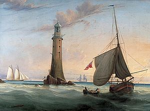
Vancouver decided not to visit their homes. Instead, he kept exploring north. He named the island "New Eddystone Rock" because it reminded him of the Eddystone Lighthouse off Plymouth, England. That lighthouse also stands on a tall, narrow rock that rises from the sea.
Protecting the Island
Over time, much of Southeast Alaska, including New Eddystone Rock, became part of the Tongass National Forest. This happened through actions taken by President Theodore Roosevelt. Later, on December 1, 1978, President Jimmy Carter declared a part of the Tongass National Forest to be the Misty Fjords National Monument. New Eddystone Rock was included in this special area. In 1980, the US Congress passed a law called the Alaska National Interest Lands Conservation Act. This law gave wilderness protection to most of the national monument. Today, the U.S. Forest Service manages the island.
 | Janet Taylor Pickett |
 | Synthia Saint James |
 | Howardena Pindell |
 | Faith Ringgold |


