Ngarkat, South Australia facts for kids
Quick facts for kids NgarkatSouth Australia |
|||||||||||||||
|---|---|---|---|---|---|---|---|---|---|---|---|---|---|---|---|
 |
|||||||||||||||
| Population | 0 (2016 census) | ||||||||||||||
| Established | 1999 | ||||||||||||||
| Postcode(s) | 5302 | ||||||||||||||
| Time zone | ACST (UTC+9:30) | ||||||||||||||
| • Summer (DST) | ACST (UTC+10:30) | ||||||||||||||
| Location |
|
||||||||||||||
| LGA(s) | Coorong District Council Tatiara District Council Southern Mallee District Council |
||||||||||||||
| Region | Limestone Coast Murray Mallee |
||||||||||||||
| County | Buckingham Chandos "outside of counties" |
||||||||||||||
| State electorate(s) | Chaffey MacKillop |
||||||||||||||
| Federal Division(s) | Barker | ||||||||||||||
|
|||||||||||||||
|
|||||||||||||||
| Footnotes | Locations Adjoining localities |
||||||||||||||
Ngarkat is a special place in South Australia. It's located in the southeastern part of the state, right on the border with Victoria. This area is part of two regions: the Murray Mallee and the Limestone Coast. It's about 227 kilometers (141 miles) southeast of Adelaide, the capital city of South Australia.
About Ngarkat
Ngarkat is a "locality," which is like a specific area or district. Its boundaries were set up in a few steps. The first part was created in August 1999. Then, more parts were added in March and August of 2000.
The name Ngarkat comes from the Ngarkat Conservation Park. This park is a very important part of the area.
What's Special About Ngarkat?
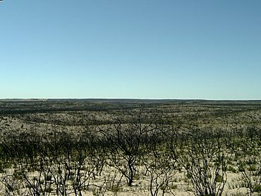
Most of the land in Ngarkat is used for conservation. This means it's protected to keep its natural environment safe. The biggest part of this protected land is the Ngarkat Conservation Park.
There is a small part of Ngarkat that is not inside the park. This area is located between the Ngarkat Highway and the border with Victoria.
Who Lives in Ngarkat?
According to the 2016 Australian census, no people live in Ngarkat. It is mainly a natural, protected area.
How Ngarkat is Governed
Ngarkat is part of several government areas. For national elections, it's in the federal Division of Barker. For state elections, it's in the Chaffey and MacKillop districts.
Locally, Ngarkat is managed by three different councils: the Coorong District Council, the Tatiara District Council, and the Southern Mallee District Council.
 | Anna J. Cooper |
 | Mary McLeod Bethune |
 | Lillie Mae Bradford |


