Nichols Farms Historic District facts for kids
Quick facts for kids |
|
|
Nichols Farms Historic District
|
|
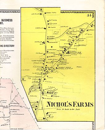
Clark's Map of Nichol's Farms in 1867
|
|
| Location | Center Rd., 1681--1944 Huntington Turnpike, 5--34 Priscilla Pl., and 30--172 Shelton Rd., Trumbull, Connecticut |
|---|---|
| Area | 104 acres (42 ha) |
| Architectural style | Early Colonial, Georgian, Federal, Greek Revival, Victorian |
| NRHP reference No. | 87001392 |
| Added to NRHP | August 20, 1987 |
Nichols Farms is a special historic area located in Trumbull, Connecticut. A part of this area, called the Nichols Farms Historic District, is listed on the National Register of Historic Places. This means it's officially recognized as an important place in history.
Long ago, the Paugusset people lived here. Then, in the 1630s, English settlers arrived during a time called the Great Migration. They came from a nearby coastal town named Stratford. The first English homes were built soon after Stratford was settled in 1639.
For 86 years, Stratford governed the Nichols area. Then, in 1725, Nichols became its own separate village. Because of this, many early records for Nichols Farms are found mixed in with Stratford's old documents. The English settlers named the area "Nichols" after a family who owned a very large farm right in the middle of it. The village was first known as Unity in 1725. Seventy-two years later, in 1797, Unity (which was later called North Stratford) was given the rights to become a full town.
Contents
Nichols Farms: A Historic Place
The Nichols Farms Historic District was added to the National Register of Historic Places on September 20, 1987. It covers about 104 acres (0.42 square kilometers). This district includes 81 important buildings, one historic site, and one historic object.
Historic Buildings in Nichols Farms
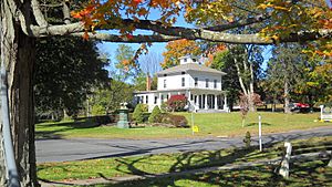
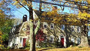
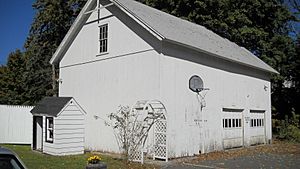
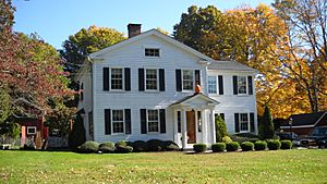
Most of the historic buildings are private homes. They are located near the village green on Center Road, Huntington Turnpike (numbers 1681-1944), Priscilla Place (numbers 5-34), and Shelton Road (numbers 30-172). These 81 buildings show different styles of Connecticut homes from the early 1700s up to today.
Early Land Use and Farming
In 1661, leaders in Stratford allowed people to claim land for farming. This land could not be too close to the town meeting house. Early farmers in Nichols Farms, like Elder Phillip Groves, Captain William Curtiss, and Lt. Joseph Judson, helped plan how the land would be used.
Dividing the Land
Common land in Nichols Farms started to be divided among individuals in 1670. This process was part of the "three-mile" or "woods" division. It continued until about 1800.
First Farms on Mischa Hill
Mischa Hill is in the center of Nichols Farms. It was one of the first areas in Trumbull where English colonists settled and farmed. Many early landowners were among the first settlers in Stratford. Some of these families included Booth, Bostick, Brinsmaid, Curtiss, Fairchild, Groves, Hawley, Judson, Nichols, and Uffoot.
Lt. Joseph Judson, Sgt. Jeremiah Judson, and Joseph Curtiss started their farms on Mischa Hill before 1658. In that year, they were elected as "freemen" by the Connecticut Colony government. To be a freeman, a person had to own land in their own name.
Abraham Nichols and His Farm
Abraham Nichols is thought to have made the first lasting settlement in Trumbull around 1690 or 1700. Other settlers soon followed him into the "wilderness" to build mills, churches, and schools. It was once believed that Abraham Nichols owned about 1,000 acres (4 square kilometers) of land. Much of this land stayed in the Nichols family for over 200 years.
The Woods Estate
The last person in the Nichols family line was Florence Nichols, who married George Woods in 1903. After they passed away in the early 1970s, their property was given to the Nichols Methodist Church. The Town of Trumbull bought it from the church in 1974. This land became known as the "Woods Estate" and is now home to the Trumbull Historical Society.
Newer research shows that Abraham Nichols actually owned about 285 acres (1.15 square kilometers) of land. About 55 acres (0.22 square kilometers) of this land is still open space today.
Abraham's Return to Trumbull
Walter Nicholls, who wrote a history of the Nichols family in 1909, believed Abraham stayed in Trumbull to manage his "plantation" when his father moved to Woodbury in 1673. However, Abraham was only eleven years old then, so it's more likely he went with his family. He probably returned to Trumbull between 1696 and 1700.
Walter Nicholls described Abraham's home:
Around 1700, Abraham Nicholls built a home on his large property. People who saw it in the early 1800s described it as a huge house with a gambrel roof and many rooms. It was on a hill, offering clear views of the land around it and, about four miles south, the sparkling Long Island Sound. For decades, it stood alone, with no other homes nearby. The quiet was rarely broken, except by the sound of cows, the call of a whippoorwill at night, or the howling of wolves. ... It is a great shame that Abraham Nicholls' will or a list of his belongings cannot be found.
Abraham's Land Purchases
According to old Stratford land records, Abraham Nichols bought several old farms and large pieces of land in 1696. He traded his land for 22 acres (0.09 square kilometers) of "Lt. Joseph Judson's old farm," which had a barn. He also bought 54 acres (0.22 square kilometers) from Jeremiah Judson and 19 acres (0.08 square kilometers) from Benjamin Curtiss. These lands were described as being near "Old farm" or "Judson's farm."
In 1699, Lt. Ebenezer Curtiss recorded 15 acres (0.06 square kilometers) of land from the "three-mile division." This land was next to "Lt. Joseph Judson's farm, now belonging to Abraham Nichols." This record confirms that Nichols bought Judson's old farm, which was started in 1658. This means Abraham Nichols was not the first person to settle the area.
In 1704, Nichols bought Reverend Zachariah Walker's entire farm, which was 36 acres (0.15 square kilometers). In 1708, he bought 5 acres (0.02 square kilometers) called "Mischa Hill Meadow" from Joseph Fairchild. In 1715, he added 1 acre (0.004 square kilometers) from Captain John Hawley. When combined with his own land, these purchases totaled about 285 acres (1.15 square kilometers). About 54 acres (0.22 square kilometers) of these old farms are still open space today.
The Farm Highway
The road connecting Nichols Farms to Stratford, about three miles (5 kilometers) south, was first called the Farm Highway. It was completed to the south side of Mischa Hill in December 1696. Today, this road is known as Nichols Avenue or Route 108.
The highway reached the south side of Mischa Hill, near the land of Zachariah Curtiss and "Captain's Farm." Captain's Farm, owned by Captain John Hawley, was the first farm travelers saw when entering the village at Hawley Lane. This part of Route 108 is considered one of the three oldest documented highways in Connecticut.
Merritt Parkway Construction
The Merritt Parkway was built right through the original center of Nichols Farms in the late 1930s. This construction caused the old Nichols Store to be torn down. Trinity Church was also moved to a new location. Only a large stepping stone from the Nichols Store was saved. It was moved to the front of the Ephraim Hawley House.
Nichols Green: A Community Hub
The green in Nichols Farms is known as Nichols Green or N.I.A. Green. It is cared for by a private group called the Nichols Improvement Association, which was started in 1889 to make Nichols Farms more beautiful.
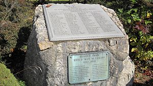
- A memorial honoring residents who fought in World War I and World War II is located at the south end of the green.
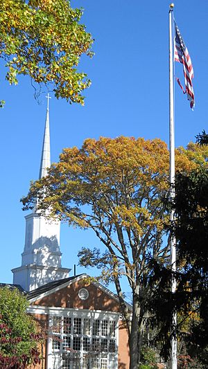
- An 80-foot (24-meter) tall pine flagpole stands on the green. This pole was brought through the Panama Canal from Washington State and put up in 1932. It replaced an even taller 115-foot (35-meter) chestnut flagpole erected on July 4, 1892. That older pole carried a huge 25 by 15-foot (7.6 by 4.6-meter) flag and was thought to be the highest flag flown in the state at the time.
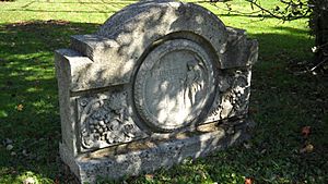
- Another famous landmark near the green is the Bunny Fountain. The Peet family gave this fountain to the people of Nichols in 1895. It was moved in 1931 after a car damaged it. The fountain was moved again and fixed in 1971, and then restored once more in 1992.
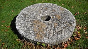
- An old grinding stone from the 1826 Fairchild (Paper) Mill is also at the south end of the green. This mill was located at a spot called the "Falls" of the Pequonnock River, starting in 1674. This area is now the town boundary with Bridgeport and is called "Fairchild Park."
- A piece of the original 1940 Merritt Parkway bridge is on the green. This concrete decoration looks like the official seal of the town of Trumbull. The bridge was taken down in 1979 when the highway interchange was updated.
Properties Not Included (Yet)
When the historic district was first created, 78 buildings were not included. These buildings are on Huntington Turnpike, Nichols Avenue, and Shelton Road. They were part of the original plan for the district in 1976.
Some of these excluded buildings include the Ephraim Hawley House, the Zachariah Curtiss House and barn, the summer home of American folklorist Will Geer, and a home of helicopter inventor Igor Sikorsky. A new survey in 2010 suggested that these properties should be added to the historic district in the future.
 | Mary Eliza Mahoney |
 | Susie King Taylor |
 | Ida Gray |
 | Eliza Ann Grier |


