Pequonnock River facts for kids
Quick facts for kids Pequonnock River |
|
|---|---|
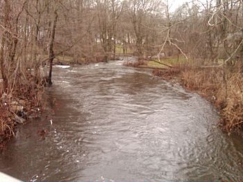
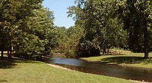
Upriver view from the Daniels Farm Road bridge in Trumbull, CT.
|
|
| Country | United States |
| State | Connecticut |
| Counties | Fairfield |
| Physical characteristics | |
| Main source | Pequonnock River Watershed Lantern Drive & CT Route 25, Monroe, Connecticut, United States |
| River mouth | Bridgeport Harbor Light on Long Island Sound Bridgeport, Fairfield County, Connecticut, United States 0 ft (0 m) 41°09′24″N 73°10′48″W / 41.15667°N 73.18000°W |
| Length | 16.7 mi (26.9 km) |
| Basin features | |
| Basin size | 0.125 sq mi (0.32 km2) |
The Pequonnock River is a 16.7-mile-long (26.9 km) river in eastern Fairfield County, Connecticut. Its water comes from an area called a watershed, which covers parts of five towns. Most of this watershed is in Monroe, Trumbull, and Bridgeport. The river can flood, especially in spring. This happens more often since a special dam in Trumbull was removed in the 1950s.
Historians have different ideas about what the Native American word Pequonnock means. Some think it meant cleared field or open ground. Others believe it meant broken ground. A third group suggests it meant place of destruction.
Contents
River's Path and Features
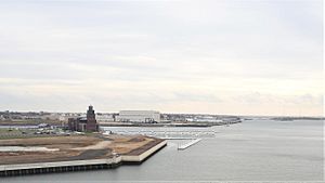
The Pequonnock River has two main branches. The eastern branch starts in Monroe and flows south through Trumbull. It passes by the Old Mine Park Archeological Site and continues to Beardsley Park in Bridgeport. Finally, it joins Bridgeport Harbor and then Long Island Sound near the Bridgeport Harbor Light.
In Bridgeport, the river is held back by the Bunnell's Pond Dam. This dam is located near Connecticut's Beardsley Zoo.
The western branch of the river flows southeast in a wide "S" shape. It starts near the border of Monroe and Newtown, Connecticut. These two branches meet in Monroe, east of where Route 25 and Purdy Hill Road cross.
River's Tributaries
Several smaller streams, called tributaries, flow into the Pequonnock River.
- North Farrars Brook joins the river in Trumbull, less than a mile south of where the two main branches meet.
- Hedgehog Creek and Belden Brook also flow into the river in Trumbull.
- Booth Hill Brook is another tributary in Trumbull.
- Island Brook is the last tributary, joining the river in Bridgeport. Island Brook also has a dam called the Forest Lake Dam.
Bridges and River Travel
For a long time, there was only one bridge crossing the river. After the Revolutionary War, a new bridge opened in 1798. This led to the founding of Bridgeport.
In Bridgeport:
- The last mile of the river, closest to Long Island Sound, is deep enough for most boats to travel on.
- The Pequonnock River Railroad Bridge was built in 1902. It is an important crossing in Bridgeport and was added to the National Register of Historic Places in 1987.
- Bridgeport has several bridges that can open to let boats pass, called drawbridges. These include the Stratford Avenue Bridge, the railroad bridge, the Congress Street Bridge, and the East Washington Avenue bridge.
In Trumbull:
- A wooden walking bridge crosses the river at the Old Mine Park Archeological Site.
- The Twin Brooks Bridge, also known as Liz's Bridge, carries Brock Street over the river. It connects Twin Brooks Park to Route 127. This is the only covered bridge on the river.
River's History
Early Settlements and Villages
Before Europeans arrived, the Pequonnock Native Americans lived along the river. They were part of the Paugussett people. One of their villages on the west bank of the Pequonnock River had about 500 to 600 people living in around 150 homes.
The first English settlers came to the west bank of the river's mouth around 1665. They named their settlement Pequonnock. This village was later renamed Newfield before 1777. During the American Revolution, Newfield was a hub for privateering, which involved private ships attacking enemy ships. In 1800, Newfield village became the borough of Bridgeport, which grew into the city of Bridgeport.
Mills Along the River
In 1722, Gideon and Ephraim Hawley decided to build or rebuild mills on the Pequonnock River. These mills were located at a narrow part of the river near White Plain. Later, in the mid-1700s, Daniel Hawley built another mill "at the spring on the Pequonnock River." This mill was along White Plains Road in Trumbull Center.
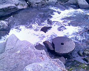
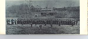
In 1826, Reuben Fairchild and his brothers, Daniel and Eben, built the Fairchild Paper Mill. This mill was at a spot on the river known as the "Falls" since 1674. Andrew Tait, who learned how to make paper in Scotland, helped them. The Fairchild Paper Mill was special because it was the first mill to make white note paper. The company also provided housing for its female workers. The mill was located near what is now the entrance to Fairchild Memorial Park.
The Housatonic Railroad
From 1840 to 1931, a 15-mile (24 km) section of the Housatonic Railroad ran alongside much of the Pequonnock River. There were train stations in Bridgeport, North Bridgeport, Trumbull, Long Hill, Stepney, Pepper, and Botsford. The railroad ended in New Milford, Connecticut. The railroad also operated the Parlor Rock Amusement Park. After 1931, the railroad tracks were removed. Part of the old railroad path became Connecticut Route 8 up to Trumbull. North of Trumbull, it became the Pequonnock River Valley State Park.
Important Events in History
The Pequonnock River has been part of several notable events:
- 1836: Andrew Tait built a paper and strawboard mill in Trumbull.
- July 30, 1905: A big flood caused a lot of damage. Houses were swept away, and a ship hit a bridge, leading to a fire and a large gas line explosion in Bridgeport.
- 1964: The Army Corps of Engineers worked to dredge, or deepen, Bridgeport Harbor.
- December 29, 1989: The 382-acre (1.55 km2) Pequonnock River Valley State Park was created.
Fun Activities on the River
The Pequonnock River and its surrounding areas offer several activities for people to enjoy:
- Biking and Hiking: There are many trails for biking and hiking in the Pequonnock River Valley State Park.
- Fishing: The Connecticut Department of Energy and Environmental Protection (DEP) adds different types of fish to the river before the spring fishing season, making it a good spot for fishing.
- Hunting: Bird hunting is allowed in Pequonnock River Valley State Park during certain times of the year and on specific days.
The River's Watershed
The Pequonnock River watershed is about 80 acres (320,000 m2) in size. It is located at the very beginning of the river in Monroe. This area helps feed the Easton Reservoir.
River Water Quality
Scientists tested the river water for E. coli bacteria many times between May and September 2009. The results showed that the river is considered "class B" from its source through Trumbull and up to Bunnell Pond in Bridgeport. This is a good rating from the Connecticut Department of Environmental Protection. However, areas further south, like near the Washington Street Bridge and into Bridgeport Harbor, have much higher levels of E. coli. This means those parts of the river are more polluted.
Other Uses of the Name Pequonnock
The name Pequonnock is also used for other things in the area:
- Pequonnock Iron Works Inc. - A company in Bridgeport that works with metal.
- Pequonnock National Bank - A bank that existed in Bridgeport in the late 1800s and early 1900s.
- Pequonnock River Railroad Bridge - The historic railroad bridge.
- Pequonnock Road - A road in Trumbull.
- Pequonnock Yacht Club - A club for boat owners.
 | Claudette Colvin |
 | Myrlie Evers-Williams |
 | Alberta Odell Jones |


