North Corbin, Kentucky facts for kids
Quick facts for kids
North Corbin, Kentucky
|
|
|---|---|

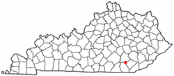
Location of North Corbin, Kentucky
|
|
| Country | United States |
| State | Kentucky |
| Counties | Laurel, Knox |
| Area | |
| • Total | 1.80 sq mi (4.66 km2) |
| • Land | 1.78 sq mi (4.61 km2) |
| • Water | 0.02 sq mi (0.05 km2) |
| Elevation | 1,204 ft (367 m) |
| Population
(2020)
|
|
| • Total | 1,727 |
| • Density | 970.22/sq mi (374.59/km2) |
| Time zone | UTC-5 (Eastern (EST)) |
| • Summer (DST) | UTC-4 (EDT) |
| ZIP Code |
40701 (Corbin)
|
| Area code(s) | 606 |
| FIPS code | 21-56694 |
| GNIS feature ID | 2403345 |
North Corbin is a special kind of place in Kentucky called a census-designated place (CDP). This means it's an area that the government counts as a community for population statistics, even though it's not officially a city or town with its own local government. North Corbin is located in two different counties: Laurel and Knox.
In 2020, about 1,727 people lived in North Corbin. The nearby city of Corbin is just south of North Corbin.
One of the most famous spots in North Corbin is the Harland Sanders Café and Museum. This is where Colonel Sanders first created his secret fried chicken recipe. This recipe later became super famous as Kentucky Fried Chicken!
Contents
Where is North Corbin Located?
North Corbin is mostly in the southern part of Laurel County. A small piece of it also stretches into Knox County to the east. To the south, it shares a border with the city of Corbin, which is in Whitley County.
Major roads run through North Corbin. Interstate 75 is a big highway that forms the western edge of the area. You can get to North Corbin from Exit 29, which connects to U.S. Route 25E. Route 25E forms the northern border of North Corbin.
Inside North Corbin, U.S. Route 25E meets U.S. Route 25W. Together, they form U.S. Route 25. This road goes north from North Corbin about 12 miles to London, which is the main town (county seat) for Laurel County.
If you go southeast from North Corbin on US 25E, you'll reach Barbourville in about 16 miles. Barbourville is the county seat for Knox County. Going south on US 25W will take you into Corbin and then about 22 miles to Williamsburg. If you take I-75 south instead, Williamsburg is a bit closer, about 17 miles away.
Bigger cities are also accessible from North Corbin. Lexington is about 85 miles north on I-75. Knoxville, Tennessee is about the same distance, 85 miles, to the south on I-75.
Land and Water in North Corbin
North Corbin covers a total area of about 4.66 square kilometers (or 1.80 square miles). Most of this area is land, about 4.61 square kilometers (1.78 square miles). A small part, about 0.05 square kilometers (0.02 square miles), is water.
Lynn Camp Creek forms the southern edge of the community. This creek also marks the border with Whitley County. Lynn Camp Creek flows west and eventually joins the Laurel River. The Laurel River is part of the larger Cumberland River system.
People in North Corbin
| Historical population | |||
|---|---|---|---|
| Census | Pop. | %± | |
| 2020 | 1,727 | — | |
| U.S. Decennial Census | |||
In 2000, there were 1,662 people living in North Corbin. These people lived in 689 different homes, and 469 of these were families.
About 29.6% of the homes had children under 18 living there. The average number of people in each home was about 2.41. For families, the average size was about 2.94 people.
The population was spread out by age. About 24.8% of the people were under 18 years old. About 11.7% were 65 years old or older. The average age of people in North Corbin was 36 years.
See also
 In Spanish: North Corbin (Kentucky) para niños
 | James Van Der Zee |
 | Alma Thomas |
 | Ellis Wilson |
 | Margaret Taylor-Burroughs |


