North Dam facts for kids
Quick facts for kids North Dam |
|
|---|---|
 |
|
|
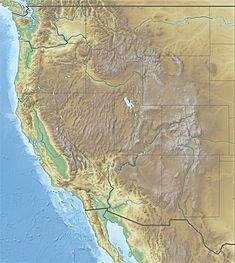
Location of North Dam in the western U.S.
|
|
| Country | United States |
| Location | Grant County, Washington |
| Coordinates | 47°56′27.03″N 119°1′2.66″W / 47.9408417°N 119.0174056°W |
| Construction began | 1946 |
| Opening date | 1951 |
| Operator(s) | United States Bureau of Reclamation |
| Dam and spillways | |
| Type of dam | Embankment, earth-fill |
| Impounds | Grand Coulee |
| Height | 145 ft (44 m) |
| Length | 1,450 ft (442 m) |
| Elevation at crest | 1,580 ft (480 m) |
| Reservoir | |
| Creates | Banks Lake |
| Total capacity | 1,275,000 acre⋅ft (1.573 km3) |
| Active capacity | 715,000 acre⋅ft (0.882 km3) |
| Catchment area | 278.3 sq mi (721 km2) |
| Surface area | 27,000 acres (109 km2) |
| Normal elevation | 1,570 ft (480 m) |
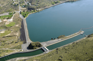
North Dam is a large wall built across the land. It is located near the town of Grand Coulee in Grant County, Washington State, USA. This dam is an earth-fill embankment dam. This means it's made mostly from packed earth and rock, like a big, strong hill.
Construction of North Dam started in 1946. It was finished and ready to use by 1951. North Dam works with another dam called Dry Falls Dam. Together, they create a very important lake called Banks Lake. This lake sits inside an ancient riverbed known as the Grand Coulee.
What Does North Dam Do?
North Dam plays a key role in a huge project called the Columbia Basin Project. This project helps manage water from the Columbia River. It brings water to farms and towns in central Washington. Banks Lake acts like a giant storage tank for this project. It helps keep the water levels steady.
Near North Dam, there's a special entrance to a canal. This canal is like a big water highway. It can either send water to the powerful pump-generating plant at Grand Coulee Dam. Or, it can bring water back to Banks Lake from the same plant. This system helps move water where it's needed most.
How Big is North Dam?
North Dam is quite impressive in size. It stands about 145 feet (44 m) tall. That's roughly as high as a 14-story building! The top of the dam, called the crest, is about 1,400 feet (430 m) long. That's almost half a kilometer.
Both North Dam and Dry Falls Dam have their crests at an elevation of 1,580 feet (480 m). The highest water level allowed in Banks Lake is 1,570 feet (480 m). This means there's about 10 feet (3.0 m) of space above the water. This extra space is called freeboard. It protects the dams from big waves caused by strong winds.
 | Laphonza Butler |
 | Daisy Bates |
 | Elizabeth Piper Ensley |


