North River (Missouri) facts for kids

The North River is a river about 82 miles (132 km) long in northeastern Missouri, United States. It starts in Knox County and flows southeast and east through Shelby and Marion counties. It eventually empties into the mighty Mississippi River between West Quincy and Hannibal.
The area where all the water flows into the North River is about 373 square miles (966 km²). On average, about 231 cubic feet (6.5 m³) of water flows through the river every second. The most water ever recorded flowing through the river was on April 21, 1973, when it reached 57,500 cubic feet (1,628 m³) per second! During very dry times, like droughts, the flow can drop to just 1 cubic foot (28 L) per second or even less.
Contents
What Are the North River's Smaller Streams?
Many smaller streams and branches flow into the North River, adding to its waters. Some of these named streams include Lazy Branch, Sidnor Creek, Lick Creek, Big Branch, Little North River, Hawkins Branch, Merrills Branch, Tiger Fork, Weldons Branch, Looney Creek, Clear Creek, Mesner Branch, Garnett Branch, and Owl Creek.
How Did the North River Get Its Name?
The name of the North River has an interesting history, going back to early American exploration and agreements with Native American tribes.
The "River Jeffreon" Mystery
Many people believe the North River is the "River Jeffreon" that was mentioned in the 1804 Treaty of St. Louis. This treaty was an important agreement led by William Henry Harrison with the Sac and Fox Native American tribes.
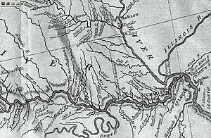
An explorer named Zebulon Pike wrote in his journal in August 1805 that he thought this river was the "Jauflione." He described it as being about 30 yards wide at its mouth. The "River Jeffreon" was important because it marked the northern border of the land that the Sac and Fox tribes agreed to share in Missouri. This land stretched from the Gasconade River on the Missouri River all the way down to the Mississippi. Historical records and documents from that time also suggest that the North River is indeed the "River Jeffreon."
Why is it Called North River?
The river got its current name because of its location compared to the town of Palmyra, Missouri. The North River flows to the north of Palmyra, while another river, the South River, flows to the south of it. Both rivers empty into the Mississippi River very close to each other, sometimes within 1,500 feet (457 m)! On some old maps from the early 1800s, these rivers were even called "North Two Rivers" and "South Two Rivers."
 | Stephanie Wilson |
 | Charles Bolden |
 | Ronald McNair |
 | Frederick D. Gregory |

