North Wales Pilgrims Way facts for kids
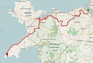
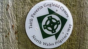
The North Wales Pilgrims Way (Welsh: Taith Pererin Gogledd Cymru) is a long walking path in North Wales. It stretches from near Holywell in the east all the way to Bardsey Island (Welsh: Ynys Enlli) in the west. The first half of the path goes inland. The second half, starting from Abergwyngregyn, follows the beautiful north coast of the Llŷn Peninsula.
The trail is about 133.9 miles (215 km) long. It was officially opened on July 10, 2014, in Aberdaron. The idea for the path began in 2011. Some changes were made to the original plan to fit local needs.
The route uses paths that are already open to the public. These include parts of the Wales Coast Path. Along the way, you will see many small stone churches. Many of these churches are named after important Celtic Saints. They can offer a place to rest and find shelter.
Long ago, pilgrims traveled across North Wales to Bardsey Island. This island is famous as the 'Island of 20,000 Saints'. The North Wales Pilgrims Way is a modern path. It does not always follow the exact old routes.
This trail is part of a project called 'Our Heritage'. This project helps promote Welsh history and culture. It gets some funding from the Welsh Government and the European Regional Development Fund.
Dr. Rowan Williams is a special supporter of the route. He is a Welsh bishop, writer, and poet. He used to be the archbishop of Canterbury.
Every year, a full pilgrimage walk is organized. It takes two weeks in May or June. There is also a 3-day race called the North Wales Pilgrims Way Ultra. Runners compete for a special Brass Shield.
Contents
History of the Pilgrims Way
Since the 600s, pilgrims in North Wales have visited four main places. These are Holywell, Gwytherin, Clynnog Fawr, and Bardsey Island. The first three places are linked to two Welsh Saints: Saint Winifred and Saint Beuno. The North Wales Pilgrims Way connects many spots tied to these saints.
Saint Winifred and Her Well
Saint Winifred (also known as Gwenffrewi) was a Christian woman from Wales in the 600s. Many old stories are told about her. There is a healing spring at the place where she was said to have been healed. This spot is now a special shrine and pilgrimage site. It is called St Winefride's Well in Holywell. People sometimes call it the 'Lourdes of Wales'.
Saint Beuno and Bardsey Island
Saint Beuno was a Welsh abbot and saint in the 600s. He was a very important religious figure.
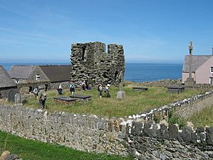
Bardsey Island has been a significant religious place for a long time. Saint Cadfan built a monastery there in 516. In the Middle Ages, it was a major center for pilgrims.
The Walking Route
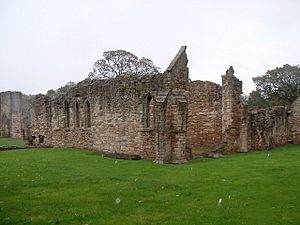
The North Wales Pilgrims Way goes from east to west. It starts at Basingwerk Abbey (Welsh: Abaty Dinas Basing). This is a ruined abbey near Holywell, Flintshire. The trail ends at Aberdaron, on the western tip of the Llŷn Peninsula (Welsh: Penrhyn Llŷn) in Gwynedd.
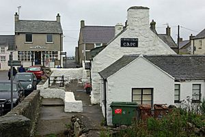
From Aberdaron, you can take an optional boat trip to Bardsey Island. This trip depends on the weather. The boat leaves from Porth Meudwy, which is about 1.2 miles (1.8 km) from Aberdaron by the Coastal Path.
The trail is divided into 25 shorter parts for easier walking. These sections help people plan their journey.
- Basingwerk Abbey to Pantasaph (3 miles / 4.6 km)
- Pantasaph to Maen Achwyfan (Whitford) (3.3 miles / 5.3 km)
- Maen Achwgfan to Llanasa (2.7 miles / 4.3 km)
- Llanasa to Trelawnyd (2.4 miles / 3.8 km)
- Trelawnyd to Tremeirchion (6 miles / 9.6 km)
- St Asaph to Llannefydd (6.3 miles / 10.1 km)
- Llannefydd to Llansannan (4.5 miles / 7.2 km)
- Llansannan to Gwytherin (7.0 miles / 11.3 km)
- Gwytherin to Pandy Tudur (3.4 miles / 5.5 km)
- Pandy Tudur to Llangernyw (2.5 miles / 4 km)
- Llangernyw to Eglwysbach (7.5 miles / 12 km)
- Eglwysbach to Rowen (3.5 miles / 6 km)
- Rowen to Penmaenmawr Stone Circles (4.4 miles / 7.0 km)
- Penmaenmawr Stone Circles to Abergwyngregyn (6.6 miles / 10.6 km)
- Abergwyngregyn to Bangor (12.33 miles / 19.84 km)
- Bangor to Llanberis (10.6 miles / 17.1 km)
- Llanberis to Waunfawr (4.5 miles / 7.3 km)
- Waunfawr to Penygroes (7.1 miles / 11.5 km)
- Penygroes to Clynnog Fawr (6.3 miles / 10.5 km)
- Clynnog Fawr to Trefor (4 miles / 6 km)
- Trefor to Nefyn (6.3 miles / 9.6 km)
- Nefyn to Towyn (Tudweiliog) (6.8 miles / 11 km)
- Towyn (Tudweiliog) to Porth Oer (Whistling Sands) (8 miles / 13 km)
- Porth Oer to Aberdaron (3.3 miles / 5.4 km)
- (Optional boat trip to Bardsey Island)
Pilgrim Passport and Stamps
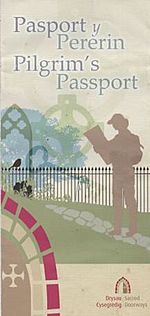
You can get a 'Pilgrim Passport' for the journey. This is a souvenir leaflet. You can pick one up at the Greenfield Valley Heritage Park Visitor Centre. This is located at the start of the route near Basingwerk Abbey. You can also find them at some churches along the way.
There are 23 churches and other spots where you can get a special stamp for your passport. Each stamp is unique. Primary school children from schools along the route designed them. They show old landmarks, sites, and legends from the trail. Artists worked with the children to create these designs.
Sacred Doorways Trail
Alongside the Pilgrims Way, there is a project called 'Sacred Doorways' (Welsh: Drysau Cysegredig). This project highlights interesting churches and chapels in the areas of Conwy, Denbighshire, and Flintshire.
The churches involved in this project are grouped into clusters:
- Conwy cluster: Includes churches like St Michael's in Llanfihangel Glyn Myfyr, St Mary Magdalene's in Cerrigydrudion, and St Grwst's in Llanrwst.
- Denbighshire cluster: Features churches such as Ss Mael & Sulien in Corwen and Corpus Christi in Tremeirchion.
- Flintshire cluster: Has churches like Ss Beuno & Mary in Whitford and St James in Holywell.
In the Conwy Valley, a specific Sacred Doorways Trail connects some of the most interesting churches. These churches also have a Pilgrims Way passport stamp. Even though they are not strictly on the main Pilgrims Way Trail, you can still collect their stamps.
The Pilgrims Passport says: "From saints to sinners, princes to pilgrims, and bards to bandits, the Sacred Doorways church and chapel trails guide you through thousands of years of our fascinating history."
There are four trails in Conwy. You can explore them by walking on public footpaths or by car. They include:
- Sacred Hiraethog: About 17 miles (27 km).
- Sacred Snowdonia: About 16 miles (25 km).
- Sacred Kingdom: About 9 miles (14 km).
- Sacred Landscapes: About 7.5 miles (12 km).
You can link these four trails together by walking an extra 10 miles (16 km).
Maps and Guides
You can find maps of the Pilgrims Way on its main website. There is also a guide book called The Pilgrims Way / Taith Pererin Gogledd Cymru by Mike Stevens. A newer guide, North Wales Pilgrims Way - The Official Guide to the Welsh Camino by Chris Potter, is also available online. Maps for the Sacred Doorways trails can be downloaded too.
Access to Churches
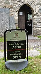
Some churches and chapels on the trail rely on volunteers to open and close them each day. Also, some churches might not be open during the winter months. If a church is closed, you can usually find details near the entrance about where to get the key.
 | Lonnie Johnson |
 | Granville Woods |
 | Lewis Howard Latimer |
 | James West |


