Trefor facts for kids
Quick facts for kids Trefor |
|
|---|---|
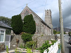 St. George's Church, Trefor |
|
| Population | 814 |
| OS grid reference | SH371467 |
| Community |
|
| Principal area | |
| Country | Wales |
| Sovereign state | United Kingdom |
| Post town | CAERNARFON |
| Postcode district | LL54 |
| Dialling code | 01286 |
| Police | North Wales |
| Fire | North Wales |
| Ambulance | Welsh |
| EU Parliament | Wales |
| UK Parliament |
|
| Welsh Assembly |
|
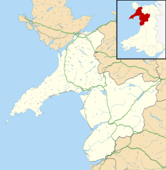
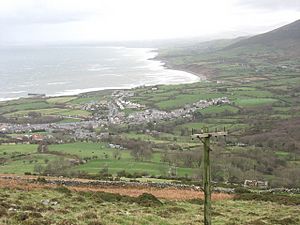
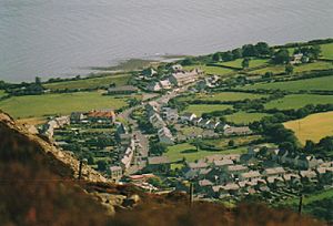
Trefor is a lovely village located on the north coast of the Llŷn Peninsula in Gwynedd, Wales. It's a beautiful spot where the sea meets the mountains. Trefor is part of the Llanaelhaearn community, which also includes the nearby village of Llanaelhaearn.
In 2011, about 814 people lived in Trefor. This makes it the larger of the two villages in the community. Historically, Trefor belongs to the county of Caernarfonshire.
Exploring Trefor: Location and Features
Trefor is located about 9 miles (14 km) north of Pwllheli and 13 miles (21 km) south-west of Caernarfon. It sits right on Caernarfon Bay, offering amazing views of the water. The village is surrounded by both the sea and tall mountains.
You can find Trefor just off the main A499 road. It has a small harbour and a beach with some sandy areas. At the top of the beach, there's a special emergency phone. This phone is there to call for help if anyone needs it during a sea emergency. The land behind the beach is made of a type of clay called boulder clay. This clay was left behind by glaciers during the last glaciation (Ice Age). The sea is slowly wearing away this land over time.
The Mighty Yr Eifl Mountains
Rising steeply behind the village are the impressive Yr Eifl mountains. This range has three main hills that stand out in the skyline above Trefor.
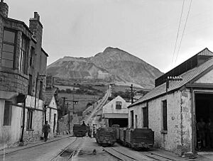
One of these hills, called Garn For, is home to the Trefor Granite Quarry. This quarry, also known as the Yr Eifl Quarry, started operating in 1850. For a while, a special narrow gauge railway called the Trefor Quarry railway carried rock from the quarry to the coast. This railway opened in 1865 but was eventually replaced by trucks on roads. It closed down in 1960. The granite from Trefor is very special; it's even used to make curling stones, which are used in the sport of curling!
The tallest peak in the range is Garn Ganol, standing at 561 meters (1,841 feet) high. The second highest hill is Tre'r Ceiri. On its summit, you can find one of the best examples of a Stone Age or Neolithic settlement in all of Europe! Imagine people living there thousands of years ago!
From the tops of these mountains, on a clear day, you can see incredibly far. You might even spot Ireland, the entire Cardigan Bay, Anglesey, the mountains of Snowdonia, and even some northern mountains in England.
Local Life and Activities
Trefor has a primary school called Ysgol yr Eifl, where the local children learn.
For shopping, there are two places in Trefor. There's a village shop that's open most of the day during the week and for shorter hours on weekends. There's also a post office where you can send mail and do other postal tasks.
If you're looking for fun, there's a children's play area at the north end of the village. From the play area, you can even go on an easy walk that's good for pushchairs. It takes you down to the beach, across the headland, and back into the village.
For those who love water sports, you can go surfing on the other side of the harbour wall at Trefor. It's known for a nice left-hand wave over a stony reef. There's also a small pier next to the harbour, but it's currently closed for safety reasons.
In 2015, a cycling club called Clwb Beicio'r Eifl was started in the village. Its members often go on club rides and take part in cycling events.
Trefor also used to have a football club. It was restarted in the 2000–01 season and won one cup in the 2001–02 season.
 | William M. Jackson |
 | Juan E. Gilbert |
 | Neil deGrasse Tyson |


