Noxubee River facts for kids
Quick facts for kids Noxubee River |
|
|---|---|

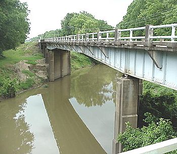
A bridge crossing of the Noxubee River at Macon, Mississippi
|
|
| Country | United States |
| State | Alabama and Mississippi |
| Physical characteristics | |
| Main source | 619 ft (189 m) 33°18′12″N 89°08′51″W / 33.3033333°N 89.1475°W |
| River mouth | 75 ft (23 m) 32°49′42″N 88°10′45″W / 32.8283333°N 88.1791667°W |
| Length | 91 mi (146 km) |
| Basin features | |
| Progression | Noxubee River → Tombigbee River → Mobile River → Gulf of Mexico |
| GNIS ID | 158173 |
The Noxubee River (say it: NAHKS-uh-bee) is a cool river in the southeastern United States. It flows for about 91 miles (146 km) through parts of Mississippi and Alabama. This river is like a smaller stream that feeds into a bigger one called the Tombigbee River. Eventually, its water travels all the way to the Gulf of Mexico!
Where the River Starts and Flows
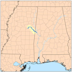
The Noxubee River begins in a pretty spot called Choctaw Lake. This lake is inside the Tombigbee National Forest in Choctaw County, Mississippi. From there, the river flows mostly towards the southeast.
It travels through several counties in Mississippi, like Winston, Oktibbeha, and Noxubee Counties. It also passes through Sumter County in Alabama.
Along its journey, the river goes through the Sam D. Hamilton Noxubee National Wildlife Refuge. This is a special place where animals and nature are protected. The river also flows past the town of Macon, Mississippi. Finally, the Noxubee River joins the Tombigbee River. This meeting point is about 2 miles (3 km) west of Gainesville, Alabama.
What Does "Noxubee" Mean?
The name Noxubee comes from the Choctaw language. It means "to stink." Over time, the river has been known by many other names too.
 | Charles R. Drew |
 | Benjamin Banneker |
 | Jane C. Wright |
 | Roger Arliner Young |


