
Noxubee County, Mississippi facts for kids
Quick facts for kids
Noxubee County
|
|
|---|---|

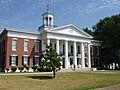
Noxubee County courthouse in Macon
|
|

Location within the U.S. state of Mississippi
|
|
 Mississippi's location within the U.S. |
|
| Country | |
| State | |
| Founded | 1833 |
| Seat | Macon |
| Largest city | Macon |
| Area | |
| • Total | 700 sq mi (2,000 km2) |
| • Land | 695 sq mi (1,800 km2) |
| • Water | 4.8 sq mi (12 km2) 0.7% |
| Population
(2020)
|
|
| • Total | 10,285 |
| • Density | 14.7/sq mi (5.7/km2) |
| Time zone | UTC−6 (Central) |
| • Summer (DST) | UTC−5 (CDT) |
| Congressional district | 3rd |
Noxubee County is a county located in the state of Mississippi. In 2020, about 10,285 people lived there. The main town and county seat is Macon. The name "Noxubee" comes from a Choctaw word that means "to stink."
Contents
Geography of Noxubee County
Noxubee County covers a total area of about 700 square miles. Most of this area, about 695 square miles, is land. The rest, about 4.8 square miles, is water.
Main Roads
 U.S. Highway 45
 Mississippi Highway 14
 Mississippi Highway 21
 Mississippi Highway 39
Neighboring Counties
Noxubee County shares its borders with several other counties:
- Lowndes County (to the north)
- Pickens County, Alabama (to the east)
- Sumter County, Alabama (to the southeast)
- Kemper County (to the south)
- Winston County (to the west)
- Oktibbeha County (to the northwest)
Protected Natural Areas
Part of the Noxubee National Wildlife Refuge is located in Noxubee County. This is a special area set aside to protect wildlife and their natural homes.
People of Noxubee County
| Historical population | |||
|---|---|---|---|
| Census | Pop. | %± | |
| 1840 | 9,975 | — | |
| 1850 | 16,299 | 63.4% | |
| 1860 | 20,667 | 26.8% | |
| 1870 | 20,905 | 1.2% | |
| 1880 | 29,874 | 42.9% | |
| 1890 | 27,338 | −8.5% | |
| 1900 | 30,846 | 12.8% | |
| 1910 | 28,503 | −7.6% | |
| 1920 | 23,710 | −16.8% | |
| 1930 | 25,560 | 7.8% | |
| 1940 | 25,669 | 0.4% | |
| 1950 | 20,022 | −22.0% | |
| 1960 | 16,826 | −16.0% | |
| 1970 | 14,288 | −15.1% | |
| 1980 | 13,212 | −7.5% | |
| 1990 | 12,604 | −4.6% | |
| 2000 | 12,548 | −0.4% | |
| 2010 | 11,545 | −8.0% | |
| 2020 | 10,285 | −10.9% | |
| 2023 (est.) | 9,914 | −14.1% | |
| U.S. Decennial Census 1790-1960 1900-1990 1990-2000 2010-2013 |
|||
Population in 2020
| Race | Number of People | Percentage |
|---|---|---|
| White | 2,639 | 25.66% |
| Black or African American | 7,190 | 69.91% |
| Native American | 13 | 0.13% |
| Asian | 14 | 0.14% |
| Other/Mixed | 257 | 2.5% |
| Hispanic or Latino | 172 | 1.67% |
In 2020, there were 10,285 people living in Noxubee County. These people lived in 3,986 households.
Population in 2010
In 2010, there were 11,545 people in the county. Most of the people, about 71.6%, were Black or African American. About 27.1% were White. Smaller groups included Asian people, Native American people, and people of two or more races. About 0.8% of the population was Hispanic or Latino.
Education in Noxubee County
The Noxubee County School District manages all the public elementary and high schools in the county.
Students can also attend classes at the East Mississippi Community College system. They offer courses at the Macon Extension, which is located at Noxubee County High School in Macon.
Long ago, there were many more schools in the county. In the early 1900s, some of these schools joined together. One old school, the Salem School, is now a historic place. The Noxubee County Agricultural School opened in 1910. It had a large farm and places for students to live.
In the past, there were challenges related to fairness in education. For example, Central Academy in Macon, a private school, closed in 2017.
Communities in Noxubee County
City
- Macon (This is the main town and where the county government is located.)
Towns
Small Communities
These are smaller places that are not officially cities or towns:
- Bigbee Valley
- Gholson
- Mashulaville
- Paulette
- Prairie Point
Images for kids
-
Noxubee County courthouse in Macon
See also
 In Spanish: Condado de Noxubee (Misisipi) para niños
