
Nuevo, Naranjito, Puerto Rico facts for kids
Quick facts for kids
Nuevo
|
|
|---|---|
|
Barrio
|
|

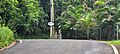
View from Barrio Nuevo
|
|

Location of Nuevo within the municipality of Naranjito shown in red
|
|

Nuevo, Naranjito, Puerto Rico
Location in Caribbean
|
|
| Commonwealth | |
| Municipality | |
| Area | |
| • Total | 3.17 sq mi (8.2 km2) |
| • Land | 3.16 sq mi (8.2 km2) |
| • Water | 0.01 sq mi (0.03 km2) |
| Elevation | 981 ft (299 m) |
| Population
(2010)
|
|
| • Total | 4,004 |
| • Density | 1,267.1/sq mi (489.2/km2) |
| Source: 2010 Census | |
| Time zone | UTC−4 (AST) |
| Zip code |
00719
|
Nuevo is a special neighborhood, or barrio, located in the town of Naranjito, Puerto Rico. In 2010, about 4,004 people lived there. It's a part of Puerto Rico, which is a commonwealth of the United States.
Contents
A Look Back in Time
Nuevo has a long history. It was listed in official Spanish records for many years. After the Spanish–American War in 1898, Spain gave Puerto Rico to the United States. This happened because of a peace agreement called the Treaty of Paris of 1898. Puerto Rico then became a territory of the United States.
In 1899, the United States government counted everyone living in Puerto Rico. This count is called a census. The census found that 1,081 people lived in Nuevo barrio at that time. Over the years, the population of Nuevo has grown quite a bit.
| Historical population | |||
|---|---|---|---|
| Census | Pop. | %± | |
| 1900 | 1,081 | — | |
| 1910 | 1,415 | 30.9% | |
| 1920 | 1,495 | 5.7% | |
| 1930 | 1,589 | 6.3% | |
| 1940 | 1,801 | 13.3% | |
| 1950 | 2,014 | 11.8% | |
| 1960 | 2,154 | 7.0% | |
| 1970 | 2,528 | 17.4% | |
| 1980 | 3,186 | 26.0% | |
| 1990 | 3,715 | 16.6% | |
| 2000 | 3,840 | 3.4% | |
| 2010 | 4,004 | 4.3% | |
| U.S. Decennial Census 1899 (shown as 1900) 1910-1930 1930-1950 1980-2000 2010 |
|||
Neighborhoods in Nuevo
Barrios like Nuevo are often divided into smaller areas. These smaller areas are called sectores (which means sectors in English). Think of them as smaller neighborhoods within the main barrio. The names for these sectores can be different, like urbanización (urbanization) or reparto (development).
Here are some of the sectores you can find in Nuevo barrio:
- Camino Don Manolo
- Camino González Mathews
- Camino Los Matos
- Eusebio Rivera
- Parcelas Hevia
- Sector Aponte
- Sector Bernard
- Sector Bunker Hills
- Sector Cabrera
- Sector Cintrón
- Sector Cuadrado
- Sector Doña Bacha
- Sector Entrada Guadiana
- Sector Febus
- Sector Hevia
- Sector Hogar Crea
- Sector La Tosca
- Sector Loma del Viento
- Sector Martínez
- Sector Matadero
- Sector Mulitas
- Sector Negrón
- Sector Ortega
- Sector Puente Plata
- Sector Santa María (antes Villa Embrolla)
- Sector Siete Curvas
- Sector Sostre
- Urbanización Campo Bello
- Urbanización Valle Verde
- Villa del Plata
Facing the Storm: Hurricane Maria
In 2017, Hurricane Maria hit Puerto Rico very hard. The people living in Nuevo barrio faced many challenges. It took a long time, about 7 to 8 months, for their electricity to come back on.
The hurricane also caused several landslides in the barrio. These landslides affected PR-5, making it unsafe. The good news is that work was completed in October 2021. Funds from FEMA (Federal Emergency Management Agency) helped to fix the highway and make it safe again.
Pictures of Nuevo
-
Puerto Rico Highway 815 in Nuevo
-
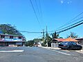
Puerto Rico Highway 8126 in Barrio Nuevo
-
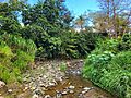
Quebrada Anones in Barrio Nuevo


See also
 In Spanish: Nuevo (Naranjito) para niños
