
Oak Grove, Oregon facts for kids
Quick facts for kids
Oak Grove, Oregon
|
|
|---|---|
|
Census-designated place (CDP)
|
|

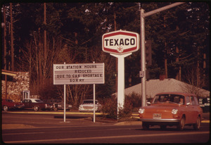
View from main street (Oak Grove Boulevard) in Oak Grove
|
|

Location of Oak Grove, Oregon
|
|
| Country | United States |
| State | Oregon |
| County | Clackamas |
| Area | |
| • Total | 4.17 sq mi (10.80 km2) |
| • Land | 3.90 sq mi (10.11 km2) |
| • Water | 0.27 sq mi (0.69 km2) |
| Elevation | 200 ft (60 m) |
| Population
(2020)
|
|
| • Total | 17,290 |
| • Density | 4,429.93/sq mi (1,710.30/km2) |
| Time zone | UTC-8 (Pacific (PST)) |
| • Summer (DST) | UTC-7 (PDT) |
| ZIP codes |
97222, 97267, 97268
|
| Area code(s) | 503, 971 |
| FIPS code | 41-53900 |
| GNIS feature ID | 2408962 |
Oak Grove is a community located in Clackamas County, Oregon, in the Portland metropolitan area. It is not an official city, but the United States Census Bureau defines it as a census-designated place (CDP). This means it has specific borders for counting its population. In 2020, about 17,290 people lived in Oak Grove.
Contents
History of Oak Grove

How Oak Grove Got Its Name
Oak Grove got its name from Edward W. Cornell. He was part of a team surveying the area in the 1890s. The company developing the land couldn't think of a good name. Cornell suggested "Oak Grove" after his crew ate lunch under a group of oak trees in the area.
Post Office and Railroad Changes
At first, Oak Grove received its mail from the nearby Milwaukie post office. In 1904, a new post office called Creighton was opened. It was named after Susan Creighton, who owned the land where it stood. Postal officials avoided using "Oak Grove" because there was already another Oak Grove post office in Josephine County. The first postmaster was a famous Oregon botanist named Thomas J. Howell.
The Oak Grove railroad station was originally called "Center." Another station, St. Theresa, was actually first named "Oak Grove." To avoid confusion, the Post Office Department changed the post office name to "Oak Grove" in 1907. The "Center" railroad station was then renamed to match. Today, the railroad no longer runs through the community.
Local Landmarks and Services
Concord School is a historic building in Oak Grove. It used to be an elementary school. Oak Grove also has a public library. It is part of the LINCC system, which is run by Clackamas County.
Geography of Oak Grove
Where is Oak Grove Located?
Oak Grove is in the northwestern part of Clackamas County. To its north is the city of Milwaukie. To the east is the community of Oatfield. To the south is Jennings Lodge. To the west is the Willamette River. Across the river are the cities of West Linn and Lake Oswego.
Oregon Route 99E, also known as McLoughlin Boulevard, runs through Oak Grove. This road goes north about 8 miles (13 km) to downtown Portland. It goes south about 4 miles (6 km) to Oregon City.
Land and Water Area
The United States Census Bureau states that the Oak Grove CDP covers a total area of about 4.1 square miles (10.7 square kilometers). Most of this area, about 3.9 square miles (10.1 square kilometers), is land. The remaining 0.27 square miles (0.7 square kilometers), or about 6.35%, is water.
Hog Island is an island in the Willamette River. It is located within the boundaries of Oak Grove.
Population of Oak Grove
| Historical population | |||
|---|---|---|---|
| Census | Pop. | %± | |
| 2020 | 17,290 | — | |
| U.S. Decennial Census | |||
As of the 2020 census, the total population of Oak Grove was 17,290 people.
In 2000, there were 12,808 people living in Oak Grove. There were 5,641 households and 3,249 families. The population density was about 4,380 people per square mile (1,691 people per square kilometer).
The population was spread out by age:
- 21.5% were under 18 years old.
- 7.5% were between 18 and 24 years old.
- 27.5% were between 25 and 44 years old.
- 23.3% were between 45 and 64 years old.
- 20.2% were 65 years or older.
The average age was 40 years old.
See also
 In Spanish: Oak Grove (Oregón) para niños
