Opataouaga Lake facts for kids
Quick facts for kids Opataouaga Lake |
|
|---|---|

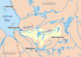
Watershed of Broadback River
|
|
| Location | Eeyou Istchee Baie-James (municipality) (RCM) |
| Coordinates | 50°21′59″N 76°42′01″W / 50.36639°N 76.70028°W |
| Type | Natural |
| Primary inflows | Lake Poncheville and few forested creek |
| Primary outflows | Quénonisca Lake |
| Basin countries | Canada |
| Max. length | 13.0 kilometres (8.1 mi) |
| Max. width | 5.3 kilometres (3.3 mi) |
| Surface area | 27.54 kilometres (17.11 mi) |
| Surface elevation | 269 metres (883 ft) |
Opataouaga Lake is a freshwater lake located in Quebec, Canada. It's part of the Broadback River system, found in the Eeyou Istchee James Bay (municipality) area.
People in this region mainly work in forestry. But many also visit the lake for fun activities like boating and fishing. You can explore the lake and nearby rivers like Lake Poncheville, Quénonisca Lake, and the Broadback River.
To get to Opataouaga Lake, you can use forest road R1023. This road connects to the "James Bay Road," which comes from Matagami. The lake usually freezes over from early November until mid-May, making it a great spot for ice activities in winter.
About Opataouaga Lake
Opataouaga Lake is a long lake, measuring about 13.0 kilometres (8.1 mi) in length and 5.3 kilometres (3.3 mi) in width. It sits at an elevation of 269 metres (883 ft) above sea level and covers an area of 27.54 square kilometres (10.63 sq mi).
The lake has 32 islands, with four main ones. The biggest island is called Sugar Loaf Island, located at the mouth of the lake. It's about 5.0 kilometres (3.1 mi) long and 2.6 kilometres (1.6 mi) wide.
Lake Surroundings
Opataouaga Lake gets its water from Lake Poncheville through a narrow passage called the "Strait of Sables." This strait is about 7.5 kilometres (4.7 mi) long.
Opataouaga Lake is surrounded by other lakes that are also long and run somewhat parallel to each other. These include Ouescapis Lake, Quénonisca Lake, Salamandre Lake, Rocher Lake (which the Nipukatasi River flows through), and Amisquioumisca Lake to the east. To the west, you'll find the larger Evans Lake.
The land around the lake is mostly flat. However, there are a few small mountains nearby. On the east side, two mountains reach about 340 metres (1,120 ft) and 341 metres (1,119 ft) high. On the west side, two other mountain tops are about 347 metres (1,138 ft) and 351 metres (1,152 ft) tall.
How the Water Flows
Water from Opataouaga Lake flows northwards for about 5.9 kilometres (3.7 mi) into a bay of Quénonisca Lake. From there, the water travels another 10.3 kilometres (6.4 mi) northeast to the main part of Quénonisca Lake.
Eventually, the water from Quénonisca Lake joins the Broadback River. The Broadback River then flows westward for about 15.3 kilometres (9.5 mi) into Corbeau Bay, which is part of Evans Lake. After passing through Evans Lake, the water continues west until it reaches Rupert Bay.
Lake Name History
The name Opataouaga comes from the Cree language. It means "the lake with the sandy tip." This name was officially recorded in 1904.
The name Lake Opataouaga was formally recognized on December 5, 1968, by the Commission de toponymie du Québec, which is like a special committee that names places in Quebec.
 | Misty Copeland |
 | Raven Wilkinson |
 | Debra Austin |
 | Aesha Ash |


