Oskélanéo River facts for kids
Quick facts for kids Oskélanéo |
|
|---|---|

Map of Saint-Maurice River watershed
|
|
| Country | Canada |
| Province | Quebec |
| Region | Mauricie |
| Physical characteristics | |
| Main source | Oskélanéo Lake La Tuque (Faucher Township), Mauricie, Quebec 404 m (1,325 ft) 48°10′36″N 74°08′51″W / 48.17667°N 74.14750°W |
| River mouth | Bureau Lake (South Bay) La Tuque (Achintre Township), Mauricie, Quebec 402 m (1,319 ft) 48°15′20″N 75°08′12″W / 48.25556°N 75.13667°W |
| Length | 12.6 km (7.8 mi) |
| Basin features | |
| Tributaries |
|
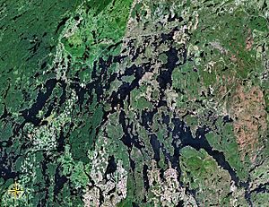
The Oskélanéo River is a river in Quebec, Canada. It flows into the South Bay of Bureau Lake, which is part of the huge Gouin Reservoir. The river is located in the town of La Tuque, in the Mauricie region.
The Oskélanéo River flows through the Faucher and Achintre areas. Logging is the main activity here, but people also enjoy tourism and recreation. Quebec route 404 helps people get to the lower part of the river. This road connects to Quebec route 400, which leads to the Gouin Dam. Other smaller forest roads are used for logging and outdoor fun.
The river usually freezes from mid-November to late April. However, it is generally safe to be on the ice from early December to late March.
Contents
History of the Oskélanéo River
Around 1910, the Transcontinental Railway arrived, helping the village of Oskélanéo grow. The main job in the area was logging. But outdoor activities like hunting and fishing quickly became popular too. This was especially true after the Gouin Reservoir's water level was raised in 1918 and again in 1948.
Today, the village of Oskélanéo offers a direct road to the Gouin Reservoir by going down the Oskélanéo River. In the past, before there were many roads for vehicles, travelers would get off the train at the Oskelaneo River station. They would then use local guides to go on hunting and fishing trips.
Geography of the Oskélanéo River
The Oskélanéo River starts at Oskélanéo Lake. This lake is about 15.8 kilometers (9.8 miles) long and sits at an elevation of 404 meters (1,325 feet). The village of Oskélanéo is located on the west side of this lake.
The river's source is about 8.1 kilometers (5.0 miles) north of Oskélanéo village. It is also about 9.6 kilometers (6.0 miles) south of where the Oskélanéo River meets Bureau Lake.
The Oskélanéo River flows for about 12.6 kilometers (7.8 miles).
- It flows northeast for 3.7 kilometers (2.3 miles) into the Achintre area, through a marshy zone. Here, it meets the Mistatikamekw River.
- Then, it flows northwest for 5.4 kilometers (3.4 miles) through more marshland.
- Finally, it flows northeast for 3.5 kilometers (2.2 miles) through another marshy area until it reaches its mouth.
The Oskélanéo River ends when it flows into the South Bay of Bureau Lake (part of the Gouin Reservoir). This spot is about 17.6 kilometers (10.9 miles) north of the village of Oskélanéo. It is also about 45.8 kilometers (28.5 miles) south of Obedjiwan, Quebec, a village on the north shore of the Gouin Reservoir.
What's in the Oskélanéo River's Area?
The areas around the Oskélanéo River include many other lakes and rivers.
- To the north, you'll find Bureau Lake, Nemio River, Du Mâle Lake, Toussaint Lake, Marmette Lake, and McSeeney Lake.
- To the east are Benjamin Lake, Sulte Lake, Francoeur Lake, Parker Creek, and the De La Galette River.
- To the south, there's Sulte Lake, Bazin River, Douville River, and Gosselin River.
- To the west, you can find Tessier Lake, Saraana Bay, Flapjack River, and Bignell Creek.
The Name Oskélanéo
Before 1918, the Oskélanéo River was seen as one of the rivers that fed the Saint-Maurice River. This was before the La Loutre Central dam was built, which created the first Gouin Reservoir.
The name "Oskélanéo" has been on maps since the mid-1800s. For example, it appeared on Charles Magnus's map in 1857 as "Oskelanaio." Later, in 1914, it was called "Escalana" by Eugène Rouillard. The name "Escalona" was also used on some maps. "Escalana" (or "Escalona") comes from the Algonquin word "oskélanéo," which means "bones."
However, some people believe that "oskélanéo" comes from two other words: "tchiask," meaning "gull," and "sakegane," meaning "lake." If this is true, the name would mean "gull lake" or "gull flight." In the Atikamekw language, the Oskélanéo River is called "Kiackoranan Sipi," which means "river of the gull caught in the net."
There was a Canadian National Railway station named "Oskelaneo River." The word "Oskelaneo" by itself was also the name of a post office from 1921 to 1973, serving what is now a small village. The official name "Oskélanéo River" was made formal on December 5, 1968, by the Commission de toponymie du Québec.
 | Jackie Robinson |
 | Jack Johnson |
 | Althea Gibson |
 | Arthur Ashe |
 | Muhammad Ali |

