Otago Central Rail Trail facts for kids
Quick facts for kids Otago Central Rail Trail |
|
|---|---|
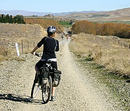
On the Otago Central Rail Trail
|
|
| Length | 150 km |
| Location | Otago region, New Zealand |
| Trailheads | Middlemarch 45°30′11″S 170°07′33″E / 45.50293°S 170.12594°E Clyde 45°11′41″S 169°20′08″E / 45.19476°S 169.33562°E |
| Use | Walking Cycling Horse riding |
| Highest point | 618 m (2,028 ft) |
| Difficulty | Moderate |
| Season | Year round |
| Sights | Otago Central landscape, railway viaducts |
The Otago Central Rail Trail is a 150-kilometre (93-mile) track in the South Island of New Zealand. It's a special path for walking, cycling, and even horse riding. This trail was one of the first of its kind in New Zealand.
It became a big inspiration for the New Zealand Cycle Trail project. In 2012, the Otago Central Rail Trail officially joined this larger network.
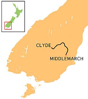
The trail follows the old Otago Central Railway line. It stretches in a big curve between the towns of Middlemarch and Clyde. This trail is very popular, with thousands of people using it every year. It has also helped the local economy in the Maniototo and Alexandra areas.
Contents
History of the Trail
The railway line was finished around 1900. It connected Central Otago with Dunedin. The trains ran until 1990, when the line closed down.
After the railway closed, the New Zealand Department of Conservation saw a great idea. They thought the old railway path could be used for fun activities. So, they bought the land where the tracks used to be. The metal rails and wooden sleepers were removed first.
This new trail quickly became important to the region. Many people wanted to help make it even better. In 2011, about 120 people met to talk about the trail's future. They wanted to find ways to encourage visitors to stay longer.
The success of the Otago Central Rail Trail was a big reason why the New Zealand Cycle Trail project got funding. New Zealand's Prime Minister, John Key, even used it as an example of what the project could achieve.
Exploring the Trail
The trail begins in Middlemarch, on the eastern side. It then curves north through beautiful areas like the Strath Taieri and the Maniototo. The trail finishes in Clyde, which is next to the Clutha River.
You can return to Middlemarch or Dunedin using the historic Old Dunstan Road. This road was once used by gold miners. The trail goes through open countryside. There are not many places to stay or eat between towns. So, it's good to bring your own supplies for the day.
What to Expect on the Trail
Many towns along the trail now have services for visitors. Companies offer help, like moving your luggage between stops. Some people even call it the 'Ale Trail' because of the growing number of pubs along the way!
To really enjoy the scenery and old railway structures, plan enough time. Walking the trail usually takes 5 to 7 days. If you cycle, it takes about 3 to 5 days.
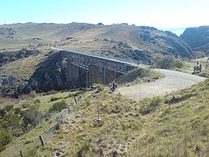
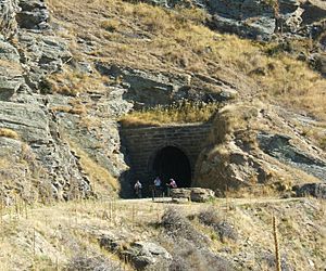
The trail starts at 201 metres (660 feet) above sea level in Middlemarch. Its highest point is 618 metres (2,028 feet) between Ranfurly and Oturehua. Along the way, you will go through three tunnels. These are the two Poolburn Gorge Tunnels and the Prices Creek Tunnel. You will also cross several large bridges called viaducts. Remember to bring a torch (flashlight) for the tunnels!
The trail is well-kept and has clear signs. Toilets are available at different spots. The path is mostly flat or has gentle slopes. This is because it was built for steam trains, which needed easy climbs.
Tips for Your Trip
You can rent mountain bikes in towns like Middlemarch, Ranfurly, Alexandra, and Clyde. Some bike shops also offer transport for you and your bike. They can even move your luggage.
The trail is very popular, especially during holidays. It's a good idea to book your accommodation early.
The area has a special continental climate. This means it can get very hot in summer, sometimes above 28°C (82°F). Winters can be very cold, with temperatures staying below freezing all day. Strong winds can also blow from the mountains. These winds can make cycling harder if you are going in the wrong direction.
The Otago Central Rail Trail Charitable Trust manages the trail. They have a website and a leaflet with helpful information. You can also find visitor information centres in Alexandra, Cromwell, Roxburgh, Ranfurly, and Dunedin. Many books about the trail are available in New Zealand bookshops.
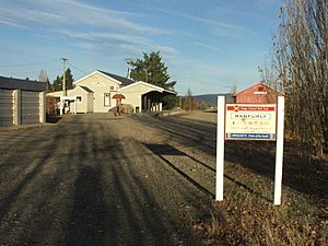
Trail Popularity and Impact
The Otago Central Rail Trail is very well-used. About 10,000 to 12,000 people use the whole trail each year. Another 80,000 local people use parts of it. The Poolburn Gorge section is the most popular, with around 24,000 users annually.
Electronic counters help to count how many people use the trail. These numbers help estimate how popular the entire trail is.
Most users are independent travellers who rent bikes (50%). About 41% are New Zealanders who bring their own bikes. Around 9% are part of guided tours.
The trail has also helped the local economy a lot. It supports about 1,000 full-time and part-time jobs. It has also created around 200 new jobs.
Keeping the trail in good condition costs money. The yearly maintenance and development are estimated to be over $316,000.
 | DeHart Hubbard |
 | Wilma Rudolph |
 | Jesse Owens |
 | Jackie Joyner-Kersee |
 | Major Taylor |


