Otter Kill facts for kids
Quick facts for kids Otter Kill |
|
|---|---|

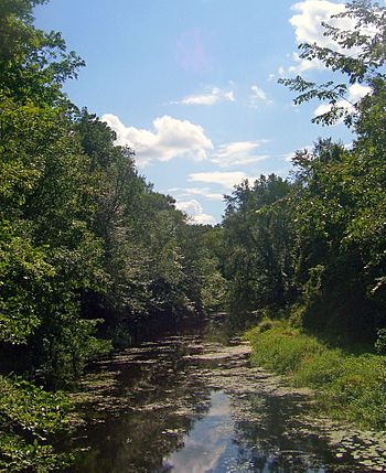
Otter Kill at Otter Road in Hamptonburgh
|
|

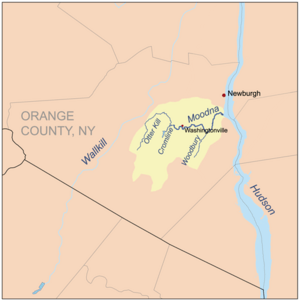
Otter Kill within the Moodna Creek watershed
|
|
| Country | United States |
| State | New York |
| Region | Hudson Valley |
| County | Orange |
| Towns | Goshen, Hamptonburgh, Blooming Grove |
| Physical characteristics | |
| Main source | Goshen Reservoir#2 Town of Goshen 460 ft (140 m) 41°22′07″N 74°18′56″W / 41.36861°N 74.31556°W |
| River mouth | Confluence with Cromline Creek at Moodna Creek N of Washingtonville 300 ft (91 m) 41°25′51″N 74°11′41″W / 41.43083°N 74.19472°W |
| Basin features | |
| River system | Moodna Creek |
| Tributaries |
|
The Otter Kill is a stream about 16 miles (25.7 kilometers) long. It flows through the middle of Orange County, New York, in the United States. The Otter Kill is a tributary, which means it's a smaller stream that flows into a larger one. In this case, it flows into Moodna Creek.
The Otter Kill joins Cromline Creek north of Washingtonville. When these two streams meet, they form the Moodna Creek. Eventually, the water from the Otter Kill reaches the mighty Hudson River.
This stream mostly flows through quiet, undeveloped areas. These areas are in the towns of Goshen, Hamptonburgh, and Blooming Grove. People are building more in these areas. Because of this, the New York State Department of Environmental Conservation says the Otter Kill and its main branch, Black Meadow Creek, are "threatened." This means they need protection to stay healthy.
The Journey of Otter Kill
The Otter Kill takes a curved path through the Moodna valley. It starts at the north end of Goshen's Reservoir #2. From there, it generally flows north, passing under Route 17.
Meeting Black Meadow Creek
About two miles (3.2 kilometers) from where it starts, the Otter Kill flows through swamps. These swamps are east of the village of Goshen. Here, it meets its biggest tributary, Black Meadow Creek. A tributary is a smaller stream that flows into a larger one.
The Otter Kill continues north through more swamps. These areas are surrounded by farms. It then enters the town of Hamptonburgh.
Turning East and South
Just east of the Campbell Hall train station, the stream starts to curve toward the east. It goes under the train tracks. Then it flows under Route 207, just east of the small community of Campbell Hall. This is the largest settlement the Otter Kill flows near.
After this, the stream gets wider. It turns even more sharply to the east, flowing alongside Route 207.
At Brown's Pond, near Rock Tavern, the Otter Kill flows over a small dam. It then crosses under Routes 207 and 208. After this, it turns south, flowing next to Route 208.
It crosses under the Port Jervis Line train tracks again. Soon after flowing under Route 208 one more time, it meets Cromline Creek. When the Otter Kill and Cromline Creek meet, they form the Moodna Creek. The Moodna Creek then flows to the Hudson River near Cornwall.
 | Toni Morrison |
 | Barack Obama |
 | Martin Luther King Jr. |
 | Ralph Bunche |


