Paint Bank, Virginia facts for kids
Quick facts for kids
Paint Bank, Virginia
|
|
|---|---|

Former train station
|
|
| Country | United States |
| State | Virginia |
| County | Craig |
| Elevation | 1,847 ft (563 m) |
| Time zone | UTC-5 (Eastern (EST)) |
| • Summer (DST) | UTC-4 (EDT) |
| ZIP code |
24131
|
| Area code(s) | 540 |
| GNIS feature ID | 1486039 |
| USGS | |
Paint Bank is a small community in northern Craig County, Virginia, United States. It's not a city or town with its own government, but a group of homes and businesses. You can find it where State Route 18 and State Route 311 meet. It sits between Potts Mountain and Peters Mountain, west of New Castle, the county's main town. Paint Bank is one of the communities furthest west in the Roanoke metropolitan area.
Contents
Exploring Paint Bank's History
Paint Bank got its name from the red clay found along Potts Creek. Native Americans, especially the Cherokees, used this clay. They made it into war paint and used it to give their pottery a special red color.
Even though it's a bit remote, the area was easy to reach by following the creeks. Early Native American visitors likely traveled this way. They may have settled here, as an old Native American burial ground was found nearby. Old maps and land records show names like "Paint Banks" and "Indian Paint Bank."
Permanent settlers arrived in the 1700s. In the early 1800s, the same red clay was used to make commercial paint and red bricks for buildings. Many land grants were given around Paint Bank from the 1820s to the 1850s. The Sweet Springs and Price's Mountain Turnpike passed through Paint Bank. It was a popular stop for stagecoaches traveling between Fincastle, Virginia and Sweet Springs, West Virginia.
A few miles from Paint Bank, towards Sweet Springs, was the home of Anne Royall. Born in 1769, she is thought to be America's first professional female journalist.
Paint Bank During the Civil War
During the American Civil War, Paint Bank was known as a "Union hole." This meant it was a place where people supported the Union, even though Virginia was a Southern state. Some people who didn't want to fight in the war found refuge here.
A group called the "Red Strings" (also known as the Order of the Heroes of America) had members in this area. These groups supported the Union. Local citizens called Paint Bank the "Union Hole" because many people there were loyal to the North.
Milling History
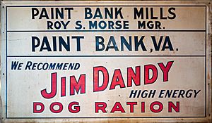
Colonel William Preston, a hero from the Revolutionary War, started a grist mill in Paint Bank. A grist mill grinds corn and wheat into flour. He received the land for his service in 1780.
The mill sits on Potts Creek. Over the years, the mill changed owners many times. It eventually became known as "Tingler's Mill". The current mill building was built in 1873.
Because of changes in county and state borders during the Civil War, the mill has been in two different states and five different counties. But it has never actually been moved! Today, the mill site is being restored and preserved.
Mining for Minerals
In the 1800s and early 1900s, iron ore and manganese were mined in the Paint Bank area. The Virginia Iron, Coal & Coke Company did this mining.
During World War I and World War II, there was more interest in mining these minerals. Manganese was especially important for the war efforts. Geologists studied the area to find more of these valuable minerals.
Forests and Wildlife
In the 1800s, a lot of timber was cut in the area, especially hardwoods like oak. Oak and hemlock bark were used to tan leather, which was a very valuable product.
Today, the George Washington and Jefferson National Forests are nearby. So are the Shawvers Run Wilderness and Barbours Creek Wilderness areas. On Peters Mountain, you can find parts of an Old-growth forest, which means very old trees that have not been cut down.
Shawvers Run Wilderness Area
The Shawvers Run Wilderness Area is in northern Craig County. It's a rugged mountain area with elevations from 2,000 feet to 3,800 feet. You can find hardwood forests mixed with pine and hemlock trees. The streams in this area, like Shawvers Run, have native brook trout. There is also a lot of other wildlife to see.
Railroad Connections
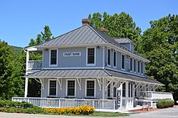
In the early 1900s, a train line called the Potts Valley Branch of the Norfolk & Western Railway reached Paint Bank. The train depot was built in 1909, and the Section Foreman's Cottage in 1910.
Trains ran daily, carrying ore and lumber out of the area. They also brought passengers and goods in. Paint Bank was a busy center for mining and timber around 1900. More than 2,000 people lived near Potts Creek then.
The "Punkin Vine" Railroad
The railroad line was first extended from Ripplemead in 1896. It followed Big Stony Creek to reach the timber in the mountains. In 1909, the tracks were extended 27 miles to Paint Bank. This part of the line was called "The Potts Valley Branch," the "Virginia and Potts Creek Railroad," or even the "Punkin Vine." The tracks were removed during the 1930s due to the Great Depression.
Potts Creek and Fish Hatchery
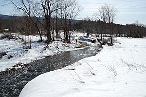
Potts Creek, originally called "Carpenter Creek," flows through Paint Bank. The name "Carpenter Creek" came from a large land grant given to John Carpenter in 1750.
Raising Trout at the Fish Hatchery
The Paint Bank Virginia Fish Hatchery is located in the community. It is run by the Virginia Department of Game and Inland Fisheries. This hatchery raises Brown trout, Brook trout, and Rainbow trout.
The trout are released into local streams when they are about 18 months old. They are used to stock streams in nine different counties. At the hatchery, you can see up to 1.6 million trout in various stages of growth. The creek near the hatchery is also a good place to spot butterflies, birds, and white-tailed deer.
Students from Glenvar High School help raise some of the brook trout hatchlings. These hatchery-raised trout have a much higher survival rate (10%) than those born in the wild (1-3%). They are released into the Roaring Run creek in Botetourt County, Virginia.
 | Stephanie Wilson |
 | Charles Bolden |
 | Ronald McNair |
 | Frederick D. Gregory |


