
Palmetto Mountains facts for kids
Quick facts for kids Palmetto Mountains |
|
|---|---|

Location in Nevada
|
|
| Highest point | |
| Peak | Blue Dick Benchmark |
| Elevation | 2,831 m (9,288 ft) |
| Geography | |
| Country | United States |
| State | Nevada |
| District | Esmeralda County |
| Range coordinates | 37°28′35.752″N 117°34′27.308″W / 37.47659778°N 117.57425222°W |
| Topo map | USGS Magruder Mountain |
The Palmetto Mountains are a cool mountain range located in Esmeralda County, Nevada. Imagine a long line of hills and peaks – that's a mountain range! This area is home to the Lida Mining District and the small town of Lida, Nevada.
Contents
Discovering the Palmetto Mountains
Where in Nevada Are They?
The Palmetto Mountains are found in the western part of the United States. They are located east of the Sylvania Mountains. To their north is the Slate Range and the famous Death Valley. These mountains are also part of a larger group called the Silver Peak Range, which is a bit further to the northwest.
The Tallest Peak
The very highest point in the Palmetto Mountains is called Blue Dick Benchmark. It stands tall at 9,289 feet (or about 2,831 meters) above sea level. That's pretty high up!
A Glimpse into History
Long ago, these mountains were important for mining. People used to dig for valuable minerals here. Getting supplies and ore (rock with minerals in it) in and out of the mountains was a big challenge.
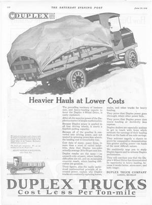
An old advertisement from 1919 tells us a cool story. It talks about a special truck called a Duplex 4-wheel drive motor truck. This truck was used on the steep, sandy, and rough roads leading to the Palmetto Mountains. It was able to replace ten teams of horses that used to carry freight! This helped the Allied Mining and Milling Co. save a lot of money. They cut their handling cost on ore by 40 percent. This shows how important new technology was for mining in tough mountain areas.
