Palu facts for kids
Quick facts for kids
Palu
|
|||
|---|---|---|---|
|
City
|
|||
|
Clockwise from the top:
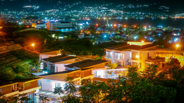
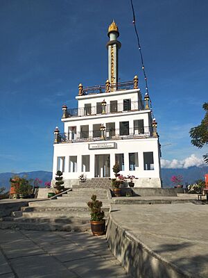
Palu seen at night, Palu Nusantara Gong of Peace, Nosarara Nosabatutu Peace Monument, Palontoan flyover, and Floating Mosque of Palu |
|||
|
|||
| Motto(s):
Maliu Ntuvu
(Uniting all existing elements and potential) |
|||
| Country | |||
| Region | Sulawesi | ||
| Province | |||
| Incorporated | 1 July 1978 | ||
| City Status | 22 July 1994 | ||
| Area | |||
| • Total | 395.06 km2 (152.53 sq mi) | ||
| Elevation | 118 m (387 ft) | ||
| Population
(mid 2023 estimate)
|
|||
| • Total | 387,493 | ||
| • Density | 980.846/km2 (2,540.38/sq mi) | ||
| Time zone | UTC+8 (Indonesia Central Time) | ||
| Area code | (+62) 451 | ||
| HDI (2022) | |||
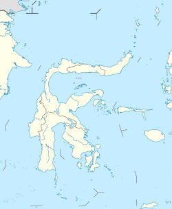
Palu is the capital and largest city of Central Sulawesi Province in Indonesia. It is officially known as the City of Palu (in Indonesian: Kota Palu). Palu is located on the northwestern coast of Sulawesi island. It shares borders with Donggala Regency to the north and west, Parigi Moutong Regency to the east, and Sigi Regency to the south.
The city covers a land area of about 395 square kilometers (152 square miles). In mid-2023, Palu had an estimated population of 387,493 people. This makes it the third-most populated city on Sulawesi island. Palu is a very important city for finance, government, and education in Central Sulawesi. It has the province's main port, its biggest airport, and most of its public universities.
Palu is situated in Palu Bay. It started as a small farming town. In 1953, it was chosen to be the capital of the new Central Sulawesi province. The city is built on the Palu-Koro Fault, which is a crack in the Earth's crust. Because of this, Palu often experiences earthquakes. A very strong earthquake and tsunami hit the city in 2018. This event caused a huge natural disaster called soil liquefaction. Much of the city's buildings were destroyed, and some areas became unsafe to live in. The local government is now planning to move the city to a safer place instead of rebuilding everything in the same spot.
Contents
Exploring Palu's Past
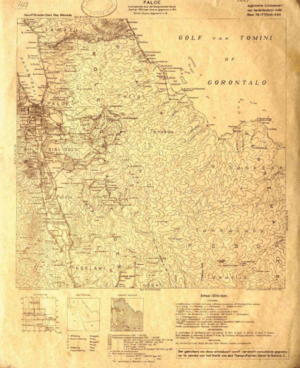
Palu began as a farming town. It was once less important than the nearby town of Donggala. People from villages around Ulayo Mountain started the city. The name "Palu" might come from "topalu'e", meaning "raised land". Another idea is that it comes from "volo", a type of local bamboo.
Early Kingdoms and Leaders
Palu's early history has three main periods: the Tomalanggai Era, the Tomanuru Era, and the Independent Era.
During the Tomalanggai Era, which lasted until the 15th century, most people were hunter-gatherers. They often fought over resources. The leaders were called Tomalanggai. They had absolute power, which led to many wars.
The Tomanuru Era followed, bringing more peace and order. Villages became more organized. Local legends say that during this time, gods' descendants ruled the villages. This period lasted until about the 16th century. An important group of nobles, called the madika, also appeared.
The Independent Era: Trade and New Governments
After the Tomanuru Era, the region entered what historians call the "Independent Era" (zaman Merdeka). During this time, kingdoms in the area started trading with other parts of the world. They also developed early forms of democratic government. Power was shared among different groups, not just one ruler.
Kings were called magau. Nobles who led districts were madika. Village leaders were kapala. Kingdoms had councils with different numbers of officials, like the patanggota (four officials) or walunggota (nine officials). They also had organized military groups. This era continued until the Dutch arrived. Important kingdoms nearby included Bangga, Pakawa, Palu, Tawaeli, Bora, and Sigi.
Palu Under Colonial Rule
Europeans, especially the Portuguese, started visiting Palu in the late 1500s. They came mainly for trade and port access. You can still see Portuguese influence in some local clothing styles. The Dutch arrived in the 1800s, after Portuguese influence had faded.
The Sigi Kingdom was the first to sign agreements with the Dutch in 1863. Other kingdoms soon followed. By the early 1900s, most kingdoms in the region were under Dutch control. There was some local resistance, like the Donggala War in 1902 and the Sigi War (1905-1908). However, these efforts were mostly defeated.
World War II and Indonesian Independence
In 1942, during World War II, a group called the Merah Putih Movement (Red and White Movement) started an uprising. This movement was inspired by Indonesian nationalism. It began when a Dutch police chief was killed, and officials were taken hostage. The movement was connected to a similar one in Gorontalo. They even raised the Indonesian flag in Tolitoli.
However, the Japanese military, who occupied the region, suppressed the movement. After Japan surrendered and Indonesia declared independence, a new group called Laskar Tanjumbulu formed. They took over Japanese military sites and spread news of independence. Some local kings supported the new Indonesian Republic. The Dutch tried to regain control, but eventually, Indonesia became fully independent in 1949.
Palu's Modern Growth
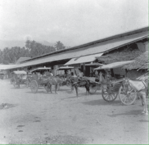
Even though Palu was a Dutch administrative center, it was a small farming town for a long time. Other towns like Poso and Donggala were more important. This changed when the larger Pantoloan Port was built in Palu Bay. An airport, now Mutiara SIS Al-Jufrie Airport, was also built.
Palu's population grew quickly in the 1950s and 60s. In 1964, Palu became the capital of the new Central Sulawesi province. This helped the city grow even more. Palu gained official administrative status in 1978 and became a full city (kotamadya) in 1994.
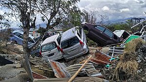
On September 28, 2018, a terrible earthquake and tsunami hit Palu. The city also experienced severe soil liquefaction. This is when the ground turns into a liquid-like state during an earthquake. This caused massive destruction. Many areas are still unsafe to live in. The city government is planning to build a "New Palu City" in a safer location. Rebuilding is still ongoing, and many people live in temporary homes.
Palu's Natural Environment
Palu is located in a basin, near Palu Bay. It sits directly on the Palu-Koro Fault. The ground in the basin is mostly made of soft clay, silt, and sand. These materials were carried and deposited by the Palu River.
The Palu–Koro Fault is a long crack in the Earth, about 300 kilometers (186 miles) long. It runs right through the middle of Palu. The soft ground under the city was a major reason for the huge soil liquefaction and landslides during the 2018 earthquake.
Palu's Climate
Palu has a tropical rainforest climate. This means it's generally hot and humid. However, it's a bit drier than other tropical rainforest areas. This is because the surrounding mountains create a "rain shadow," blocking some of the rain.
| Climate data for Palu | |||||||||||||
|---|---|---|---|---|---|---|---|---|---|---|---|---|---|
| Month | Jan | Feb | Mar | Apr | May | Jun | Jul | Aug | Sep | Oct | Nov | Dec | Year |
| Record high °C (°F) | 38 (100) |
37 (99) |
37 (99) |
37 (99) |
35 (95) |
37 (99) |
37 (99) |
37 (99) |
38 (100) |
37 (99) |
37 (99) |
38 (100) |
38 (100) |
| Mean daily maximum °C (°F) | 30.3 (86.5) |
30.5 (86.9) |
30.7 (87.3) |
30.8 (87.4) |
31.1 (88.0) |
30.2 (86.4) |
29.4 (84.9) |
30.8 (87.4) |
30.9 (87.6) |
32.1 (89.8) |
31.3 (88.3) |
30.8 (87.4) |
30.7 (87.3) |
| Daily mean °C (°F) | 26.6 (79.9) |
26.7 (80.1) |
26.9 (80.4) |
26.9 (80.4) |
27.4 (81.3) |
26.6 (79.9) |
25.7 (78.3) |
26.8 (80.2) |
26.7 (80.1) |
27.7 (81.9) |
27.2 (81.0) |
27.0 (80.6) |
26.9 (80.3) |
| Mean daily minimum °C (°F) | 22.9 (73.2) |
23.0 (73.4) |
23.1 (73.6) |
23.1 (73.6) |
23.8 (74.8) |
23.1 (73.6) |
22.0 (71.6) |
22.8 (73.0) |
22.5 (72.5) |
23.3 (73.9) |
23.1 (73.6) |
23.2 (73.8) |
23.0 (73.4) |
| Record low °C (°F) | 22 (72) |
21 (70) |
18 (64) |
20 (68) |
21 (70) |
21 (70) |
21 (70) |
20 (68) |
20 (68) |
17 (63) |
21 (70) |
21 (70) |
17 (63) |
| Average rainfall mm (inches) | 101 (4.0) |
88 (3.5) |
90 (3.5) |
102 (4.0) |
130 (5.1) |
157 (6.2) |
158 (6.2) |
147 (5.8) |
164 (6.5) |
109 (4.3) |
110 (4.3) |
76 (3.0) |
1,432 (56.4) |
| Average rainy days | 7 | 8 | 9 | 9 | 10 | 12 | 11 | 9 | 8 | 7 | 9 | 7 | 106 |
| Average relative humidity (%) | 75 | 76.5 | 75.5 | 76 | 75.5 | 76.5 | 77 | 74 | 74.5 | 73 | 73 | 74.5 | 75 |
| Source 1: weatherbase | |||||||||||||
| Source 2: climate-data | |||||||||||||
How Palu is Governed
Palu is divided into eight districts (kecamatan). These districts are further split into urban villages (kelurahan). The city's government manages these areas.
Administrative Divisions of Palu
| Kode Wilayah |
Name of District (kecamatan) |
Area in km2 | Pop'n census 2010 |
Pop'n census 2020 |
Pop'n estimate mid 2023 |
No. of kelurahan |
|---|---|---|---|---|---|---|
| 72.71.02 | Palu Barat (West Palu) |
8.28 | 98,739 | 46,435 | 47,118 | 6 |
| 72.71.06 | Tatanga | 14.95 | 52,580 | 55,093 | 6 | |
| 72.71.05 | Ulujadi | 40.25 | 35,055 | 36,796 | 6 | |
| 72.71.03 | Palu Selatan (South Palu) |
27.38 | 122,752 | 72,059 | 74,481 | 5 |
| 72.71.01 | Palu Timur (East Palu) |
7.71 | 75,967 | 43,318 | 44,021 | 5 |
| 72.71.08 | Mantikulore | 206.80 | 76,745 | 81,012 | 8 | |
| 72.71.04 | Palu Utara (North Palu) |
29.94 | 39,074 | 24,458 | 25,431 | 5 |
| 72.71.07 | Tawaeli | 59.75 | 22,568 | 23,521 | 5 | |
| Totals | 395.06 | 336,532 | 373,218 | 387,493 | 46 |
Palu's Economy
Palu's economy was valued at over 24 trillion Rupiah in 2020. Its economic growth slowed down in 2020 due to the COVID-19 pandemic. However, it started growing again in 2021.
The biggest parts of Palu's economy are construction, government activities, and the information and communication sector. Other important areas include trade, education, and manufacturing.
Farming in Palu
Palu was once mainly an agricultural town. In 1947, almost all residents worked in farming. Copra (dried coconut meat) was a major product.
Today, farming is still present but less dominant. It contributes a smaller part to the city's economy. However, the amount of food produced is much higher now. For example, Palu produced 1,492 tons of rice in 2018, compared to only 15 tons in 1947. Other crops include maize, groundnuts, cassava, and various vegetables and fruits. The city also has a large number of chickens and a growing fishing industry.
Manufacturing and Industry
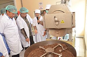
Palu has many manufacturing companies, both large and small. These companies employ thousands of people. The city is home to the Palu Special Economic Zone. This zone focuses on processing farm and mineral products. Raw materials like nickel, asphalt, and cocoa beans come from other parts of the province. Central Sulawesi is one of the biggest cocoa producers in Indonesia.
Hotels and Tourism
As the capital, Palu has many hotels. In 2020, there were 116 registered hotels. However, tourism has decreased since 2018 due to the earthquake and the COVID-19 pandemic. The number of visitors, both local and foreign, dropped significantly. The tourism industry started to recover in late 2021. Palu also has many restaurants, offering various dining options.
Money and Banking
Palu is the main financial center for Central Sulawesi. Bank Sulteng, the province's regional bank, is based here. The city has many cooperatives and banks. These banks provide loans to various businesses, especially in trade. Palu also has insurance companies and a branch of the Indonesia Stock Exchange.
Palu's People
In 2020, Palu had a population of 373,218 people. The population density was about 944 people per square kilometer. The number of males and females is almost equal. Most people in Palu are relatively young, with many between 20 and 30 years old.
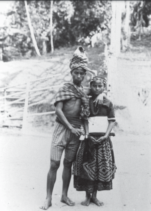
The native Kaili people make up most of Palu's population. There are also many people from other provinces, like the Bugis and Minahasan. These migrants often work as traders or government employees. Smaller groups include Chinese Indonesians, Arab Indonesians, and people from other parts of Indonesia like Batak and Javanese. Palu attracts people looking for jobs and opportunities.
Most people in Palu are Muslims. The region converted to Islam in the 1600s. There are also Christian communities, many of whom are migrants. Some local people also became Christian due to missionary work that started in 1888. Other smaller groups include Buddhists and Hindus. As of 2021, Palu has many mosques, churches, and temples.
Learning and Education in Palu
As of 2020, Palu has many schools at all levels. This includes 171 kindergartens, 190 elementary schools, 73 junior high schools, and 39 senior high schools. There are also 26 vocational high schools.
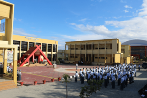
Palu is home to 13 universities and higher education institutions. The most important is Tadulako University, the main public university for Central Sulawesi. It has over 40,000 students. Other universities include Datokarama Islamic State University and Alkhairaat University. The city also has a public library. Palu has a very high literacy rate, meaning almost everyone can read and write.
Health and Hospitals in Palu
As of 2020, Palu has 13 hospitals, including three for maternity care. It also has 17 polyclinics, 39 community health centers (puskesmas), and 35 pharmacies.
Undata Regional Hospital is a major public hospital. It is managed by the provincial government and serves as the main referral hospital for all of Central Sulawesi. Other public hospitals include Anutapura Palu Regional Hospital and Palu Wirabuana Hospital. There are also several private hospitals in the city. Palu also has many smaller healthcare posts and medical clinics.
Culture and Fun in Palu
Important Monuments to See
Palu offers several interesting places to visit. One important site is the Nosarara Nosabatutu Peace Monument. It has a three-story building next to the Nusantara Gong of Peace. The monument's name means "we are siblings, we are united" in the Kaili language.
This monument was built to remember the Poso riots, a conflict between different religious groups in a nearby region. It acts as a museum, sharing messages about peace from various religions. It also shows portraits of people who worked for peace and displays traditional crafts. The area around the monument is popular with locals, with cafes and a park. It also serves as an evacuation spot in case of a tsunami. The Nusantara Gong of Peace is very large, weighing 180 kilograms (397 pounds) and measuring 2 meters (6.6 feet) across. It features symbols of Indonesia's religions and the emblems of its provinces and cities.
Getting Around Palu
Palu has over 851 kilometers (529 miles) of roads, mostly paved. The city's main port is Pantoloan Port. It is the largest and busiest port in Central Sulawesi, used for direct exports. There are also smaller ports like Wani Port.
Palu is served by Mutiara SIS Al-Jufrie Airport. This is the biggest airport in the province and can handle large planes. It served about 1.2 million people in 2019. Pelni operates ship routes from Palu to other parts of Indonesia.
Perum DAMRI, a state-owned bus company, runs bus routes to and from Palu. Many private bus companies also serve the city, especially to Makassar.
Share taxis, known as angkot, were once common public transport. However, online ride-hailing services like Gojek and Grab have become more popular. The number of angkot vehicles has dropped significantly. The city also has rickshaws. The mayor has ordered that manual rickshaws be changed into auto rickshaws by 2024.
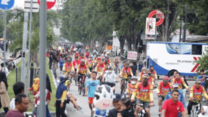
In the city center, around Vatulemo Square and Moh. Yamin Street, "car-free days" are held every weekend. During these times, people can enjoy the streets without cars.
News and Media in Palu
Palu is home to many media companies. In 2021, there were 82 online newspapers in the city. Popular newspapers include SultengRaya and Tribun Palu. The city also has local TV channels like Palu TV, and a provincial TVRI station. Radio stations that are part of Radio Republik Indonesia also operate here.
See also
 In Spanish: Palu (Indonesia) para niños
 | John T. Biggers |
 | Thomas Blackshear |
 | Mark Bradford |
 | Beverly Buchanan |


