Panhandle, Texas facts for kids
Quick facts for kids
Panhandle, Texas
|
|
|---|---|
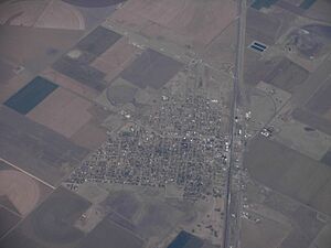
Aerial view of Panhandle
|
|
| Motto(s):
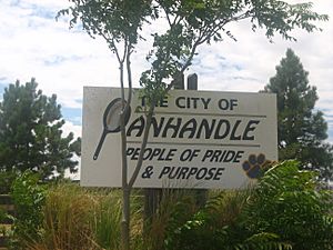
People of Pride & Purpose
|
|
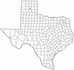
Location of Panhandle, Texas
|
|
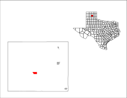 |
|
| Country | United States |
| State | Texas |
| County | Carson |
| Area | |
| • Total | 2.12 sq mi (5.50 km2) |
| • Land | 2.12 sq mi (5.50 km2) |
| • Water | 0.00 sq mi (0.00 km2) |
| Elevation | 3,455 ft (1,053 m) |
| Population
(2020)
|
|
| • Total | 2,378 |
| • Density | 1,121.7/sq mi (432.4/km2) |
| Time zone | UTC−6 (Central (CST)) |
| • Summer (DST) | UTC−5 (CDT) |
| ZIP code |
79068
|
| Area code(s) | 806 |
| FIPS code | 48-54960 |
| GNIS feature ID | 2413105 |
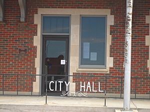
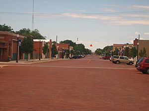
Panhandle is a town in Texas, United States. It is the main town, or "county seat," of Carson County, Texas. In 2020, about 2,378 people lived there. Panhandle is also part of the larger Amarillo city area.
Contents
History of Panhandle, Texas
Panhandle got its name because it is located in the middle of the Texas Panhandle. This is a unique rectangular part of the state. The town was first called "Carson City." Later, its name was changed to "Panhandle City."
Early Days and Growth
In 1887, Panhandle got its own post office. A year later, in 1888, the town was planned as the end point for the Panhandle and Santa Fe Railway. At this time, many large cattle ranches were around the town. Panhandle quickly grew, adding a bank, a general store, a place for wagons, a school, and a newspaper.
In 1888, Carson County was officially set up, and Panhandle became its county seat. Ranchers in the area soon accepted farmers. This was because farmers grew important crops like hay for their cattle. Farmers also brought more families to the area, which was good for the cowboys.
In 1909, the people of Panhandle voted to become an official town with a mayor-council government. This meant they would have a mayor and a council to help run the town.
Panhandle in the 20th Century
The town's population grew a lot in the 1920s. This happened because Panhandle became a center for finding and using natural gas.
A new building for the county courthouse was finished in 1950. By the 1980s, Panhandle was still a busy place. It was a key spot for selling and shipping cattle, wheat, and petroleum products.
The Carson County Square House Museum is in Panhandle. It is the oldest house in town and is listed on the National Register of Historic Places. This means it is an important historical site.
Population and People
| Historical population | |||
|---|---|---|---|
| Census | Pop. | %± | |
| 1910 | 521 | — | |
| 1920 | 638 | 22.5% | |
| 1930 | 2,035 | 219.0% | |
| 1940 | 978 | −51.9% | |
| 1950 | 1,406 | 43.8% | |
| 1960 | 1,958 | 39.3% | |
| 1970 | 2,141 | 9.3% | |
| 1980 | 2,226 | 4.0% | |
| 1990 | 2,353 | 5.7% | |
| 2000 | 2,589 | 10.0% | |
| 2010 | 2,452 | −5.3% | |
| 2020 | 2,378 | −3.0% | |
| U.S. Decennial Census | |||
2020 Census Information
The 2020 United States census counted 2,378 people living in Panhandle. There were 1,058 households and 723 families in the town.
| Race | Number | Percentage |
|---|---|---|
| White (NH) | 1,987 | 83.56% |
| Black or African American (NH) | 13 | 0.55% |
| Native American or Alaska Native (NH) | 17 | 0.71% |
| Asian (NH) | 7 | 0.29% |
| Pacific Islander (NH) | 1 | 0.04% |
| Some Other Race (NH) | 3 | 0.13% |
| Mixed/Multi-Racial (NH) | 109 | 4.58% |
| Hispanic or Latino | 241 | 10.13% |
| Total | 2,378 |
Geography and Climate
Panhandle is located a little south of the center of Carson County. U.S. Route 60 goes through the town. This road leads about 27 miles northeast to Pampa and 27 miles southwest to Amarillo.
Texas State Highway 207 also crosses US 60 in Panhandle. It goes through the middle of the town. This highway leads about 23 miles north to Borger and 9 miles south to Interstate 40 at Conway.
Land Area
The United States Census Bureau says that Panhandle covers a total area of 5.5 square kilometers (about 2.12 square miles). All of this area is land.
Local Climate
Panhandle has a semiarid climate. This means it is generally dry, but not a desert. It gets some rain, but not a lot.
| Climate data for Panhandle, Texas (1981–2010) | |||||||||||||
|---|---|---|---|---|---|---|---|---|---|---|---|---|---|
| Month | Jan | Feb | Mar | Apr | May | Jun | Jul | Aug | Sep | Oct | Nov | Dec | Year |
| Mean daily maximum °F (°C) | 49.9 (9.9) |
53.9 (12.2) |
62.7 (17.1) |
71.9 (22.2) |
80.0 (26.7) |
87.9 (31.1) |
92.8 (33.8) |
91.0 (32.8) |
83.8 (28.8) |
72.7 (22.6) |
60.3 (15.7) |
48.7 (9.3) |
71.3 (21.8) |
| Mean daily minimum °F (°C) | 22.2 (−5.4) |
25.2 (−3.8) |
31.8 (−0.1) |
40.2 (4.6) |
50.4 (10.2) |
59.6 (15.3) |
64.0 (17.8) |
62.9 (17.2) |
55.1 (12.8) |
43.6 (6.4) |
31.8 (−0.1) |
22.6 (−5.2) |
42.4 (5.8) |
| Average precipitation inches (mm) | 0.61 (15) |
0.64 (16) |
1.39 (35) |
1.77 (45) |
2.79 (71) |
3.59 (91) |
2.51 (64) |
2.80 (71) |
2.20 (56) |
1.94 (49) |
0.92 (23) |
0.76 (19) |
21.92 (557) |
| Average snowfall inches (cm) | 3.9 (9.9) |
3.1 (7.9) |
2.0 (5.1) |
0.5 (1.3) |
0.1 (0.25) |
0.0 (0.0) |
0.0 (0.0) |
0.0 (0.0) |
0.0 (0.0) |
0.3 (0.76) |
1.7 (4.3) |
4.1 (10) |
15.8 (40) |
| Source: NOAA | |||||||||||||
Education in Panhandle
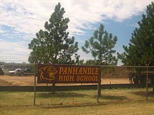
The town of Panhandle is part of the Panhandle Independent School District. This school district serves the students in the area. Panhandle is home to the Panhandle High School Panthers and Pantherettes sports teams.
See also
 In Spanish: Panhandle (Texas) para niños


