Parma, New York facts for kids
Quick facts for kids
Parma
|
|
|---|---|

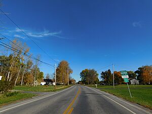
Monroe County Route 185 (Parma Center Road) eastbound entering the town of Parma.
|
|

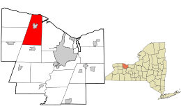
Location in Monroe County and the state of New York.
|
|

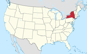
Location of New York in the United States
|
|
| Country | United States |
| State | New York |
| County | Monroe |
| Established | April 8, 1808 |
| Area | |
| • Total | 42.98 sq mi (111.33 km2) |
| • Land | 42.02 sq mi (108.84 km2) |
| • Water | .96 sq mi (2.49 km2) |
| Elevation | 325 ft (99 m) |
| Population
(2020)
|
|
| • Total | 16,217 |
| • Density | 385.94/sq mi (149.00/km2) |
| Time zone | UTC-5 (EST) |
| • Summer (DST) | UTC-4 (EDT) |
| ZIP code |
14468
|
| Area code(s) | 585 |
| FIPS code | 36-055-56561 |
| Website | http://www.parmany.org/ |
Parma is a town located in Monroe County, New York, United States. In 2020, about 16,217 people lived here. The town was named after Parma in Italy. It was officially created in 1808.
Contents
Geography of Parma
Parma covers an area of about 42.9 square miles (111.3 square kilometers). Most of this area, about 42.0 square miles (108.8 square kilometers), is land. The rest, about 1.0 square mile (2.5 square kilometers), is water.
The town is located on the southern shore of Lake Ontario to the north. To the west, it borders the towns of Hamlin, Clarkson, and Sweden. To the south, it is next to the town of Ogden. To the east, it shares a border with the town of Greece.
Population and People in Parma
| Historical population | |||
|---|---|---|---|
| Census | Pop. | %± | |
| 1820 | 1,342 | — | |
| 1830 | 2,639 | 96.6% | |
| 1840 | 2,652 | 0.5% | |
| 1850 | 2,947 | 11.1% | |
| 1860 | 2,904 | −1.5% | |
| 1870 | 2,864 | −1.4% | |
| 1880 | 3,180 | 11.0% | |
| 1890 | 2,912 | −8.4% | |
| 1900 | 2,814 | −3.4% | |
| 1910 | 2,954 | 5.0% | |
| 1920 | 2,923 | −1.0% | |
| 1930 | 3,222 | 10.2% | |
| 1940 | 3,387 | 5.1% | |
| 1950 | 4,049 | 19.5% | |
| 1960 | 6,277 | 55.0% | |
| 1970 | 10,748 | 71.2% | |
| 1980 | 12,585 | 17.1% | |
| 1990 | 13,873 | 10.2% | |
| 2000 | 14,822 | 6.8% | |
| 2010 | 15,633 | 5.5% | |
| 2020 | 16,217 | 3.7% | |
| U.S. Decennial census | |||
In 2000, there were 14,822 people living in Parma. There were 5,283 households, and 4,030 of these were families. The population density was about 353 people per square mile (136 people per square kilometer).
Most people in Parma were white (97.08%). A smaller number were African American (1.29%), Native American (0.18%), or Asian (0.52%). About 1.12% of the population was Hispanic or Latino.
In terms of age, about 28.3% of the people were under 18 years old. About 10.0% were 65 years or older. The average age in the town was 37 years.
History of Parma
The Town of Parma was officially created on April 8, 1808. It was formed from a larger area called Northampton. The town was given its name after the city of Parma in Italy.
Schools in Parma
Most of the town of Parma is part of the Hilton Central School District. Some parts in the south, near Route 104, are in the Spencerport Central School District. A small area in the southwest belongs to the Brockport Central School District. You can find more information about the Hilton school district at hilton.k12.ny.us.
Places in Parma
Here are some of the communities and locations you can find in Parma:
- Hilton - This is a village located in the northern part of the town.
- Parma Center
- Parma Corners
Famous People from Parma
Some notable people have connections to Parma:
- John Baker - He was a U.S. Representative from Indiana and a federal judge.
- George Baldwin Smith - A well-known politician.
- Cathy Turner - An American short track speed skater who won two Olympic Gold Medals.
See also
 In Spanish: Parma (Nueva York) para niños
 | Janet Taylor Pickett |
 | Synthia Saint James |
 | Howardena Pindell |
 | Faith Ringgold |

