Parris Island, South Carolina facts for kids
Quick facts for kids
Parris Island, South Carolina
|
|
|---|---|
|
District
|
|

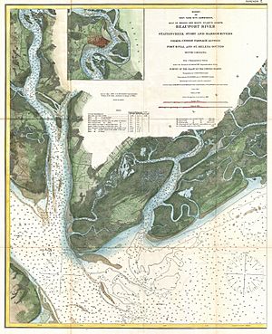
1882 U.S. Coast Survey Map of Beaufort River, showing the island (at left) designated "Paris I."
|
|

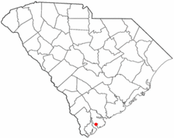
Location of Parris Island, South Carolina
|
|
| Country | United States |
| State | South Carolina |
| County | Beaufort |
| Area | |
| • Total | 19.6 sq mi (51 km2) |
| • Land | 12.2 sq mi (32 km2) |
| • Water | 7.4 sq mi (19 km2) |
| Population
(2000)
|
|
| • Total | 4,841 |
| • Density | 247.0/sq mi (95.36/km2) |
| Time zone | UTC-5 (Eastern (EST)) |
| • Summer (DST) | UTC-4 (EDT) |
| ZIP codes |
29902, 29905
|
| Area code(s) | 843, 854 |
| FIPS code | 45-54850 |
Parris Island is an island in South Carolina, USA. It is part of the city of Port Royal, South Carolina. The island became part of Port Royal in 2002. This happened when the Marine Corps Recruit Depot Parris Island joined the city. Before that, Parris Island was a special area counted by the United States Census Bureau. In 2000, about 4,841 people lived there. Parris Island is also part of the larger Hilton Head Island–Beaufort area.
Contents
History of Parris Island
Early European Settlements
Parris Island was first visited by Europeans in 1562. A French group led by Jean Ribaut settled there for a short time. This was one of the first European settlements in what is now the United States.
Four years later, in 1566, a Spanish explorer named Pedro Menéndez de Avilés founded a town. He named it Santa Elena. This town was the capital of La Florida from 1566 to 1587. From Santa Elena, Spanish explorers traveled to explore areas like the Tennessee Valley. They also went to the Chesapeake Bay and even inland to western North Carolina.
English Control and New Name
Later, the English took control of the island. In 1706, the island was given to Robert Daniell. It was then called Port Royal Island.
After some time, the island came into the hands of Colonel Alexander Parris. He was the Public Treasurer of South Carolina. After he died in 1736, people started calling the island Parris Island. Another island to the north then took the name Port Royal Island.
Parris Island During the Civil War
During the American Civil War, the Union Army captured Parris Island in 1861. It became a place where ships could get coal for fuel. After the war, an important African American Congressman named Robert Smalls helped. He made sure the island continued as a coaling station for the United States Navy. It was then known as the Port Royal Naval Station.
The nearby Port Royal Sound is a very deep natural harbor. It is the deepest on the Atlantic coast of the United States south of New York. The government bought the island completely in 1883. In the early 1890s, a dry dock was built at the naval station. This dry dock was finished in 1895. However, a new naval shipyard was built in Charleston in 1901. This led to the Port Royal Naval Station closing in 1903.
Marine Corps Recruit Depot
In 1915, Parris Island became the Marine Corps Recruit Depot. This is where new Marines go for their basic training. In its early years as a Marine base, people sometimes spelled it "Paris Island."
Two important historical sites on the island are protected. They are the Charlesfort-Santa Elena Site and the Parris Island Drydock and Commanding Generals House. Both are listed on the National Register of Historic Places.
Geography
Parris Island covers about 19.6 square miles (50.8 square kilometers). About 12.2 square miles (31.6 square kilometers) of this is land. The rest, about 7.4 square miles (19.2 square kilometers), is water.
Population Information
In 2000, there were 4,841 people living on Parris Island. Most of the households were families. About 72.3% of households had children under 18 living with them. The average age of people on the island was 20 years old. A large number of people, 72.4%, were between 18 and 24 years old. This is because Parris Island is a training base for young Marines.
See also
 In Spanish: Parris Island para niños
 | Roy Wilkins |
 | John Lewis |
 | Linda Carol Brown |

