Port Royal, South Carolina facts for kids
Quick facts for kids
Port Royal, South Carolina
|
||
|---|---|---|
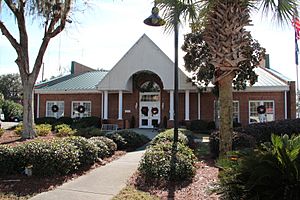
Port Royal Municipal Offices
|
||
|
||
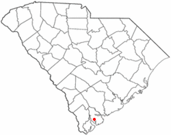
Location of Port Royal, South Carolina
|
||
| Country | United States | |
| State | South Carolina | |
| County | Beaufort | |
| Area | ||
| • Town | 19.55 sq mi (50.64 km2) | |
| • Land | 16.96 sq mi (43.94 km2) | |
| • Water | 2.59 sq mi (6.70 km2) | |
| Elevation | 23 ft (7 m) | |
| Population
(2020)
|
||
| • Town | 14,220 | |
| • Density | 838.20/sq mi (323.63/km2) | |
| • Urban | 52,515 (US: 487th) | |
| • Urban density | 1,200.1/sq mi (463.3/km2) | |
| Time zone | UTC-5 (Eastern (EST)) | |
| • Summer (DST) | UTC-4 (EDT) | |
| ZIP code |
29935
|
|
| Area code(s) | 843, 854 | |
| FIPS code | 45-58030 | |
| GNIS feature ID | 1250223 | |
| Website | www.portroyal.org | |
Port Royal is a town located on Port Royal Island in Beaufort County, South Carolina, United States. In 2020, about 14,220 people lived there. It is part of the larger Hilton Head Island–Bluffton metropolitan area. Port Royal is also home to important military bases like Marine Corps Recruit Depot Parris Island and United States Naval Hospital Beaufort.
Contents
History of Port Royal
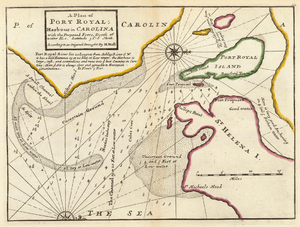
Port Royal gets its name from the nearby Port Royal Sound. A French explorer named Jean Ribault discovered and named it in 1562. Ribault even started a short-lived settlement called Charlesfort on Parris Island. Later, in the 1600s, both Spanish and Scottish groups tried to set up colonies in the area.
Civil War and Growth
During the American Civil War, Port Royal was the site of the Naval Battle of Port Royal. Later in the war, it was part of the Port Royal Experiment. This project helped formerly enslaved people on the Sea Islands learn to live independently. In 1863, the important Emancipation Proclamation was first read aloud in Port Royal. This happened under a special tree at Christmas.
Because of its large, safe natural harbor, Port Royal became a busy port. It helped with phosphate mining after the Civil War. The Port Royal Railroad was built, connecting the town to other areas. This made it easier to trade goods. The town was officially created in 1874.
Challenges and Modern Times
In 1893, a big storm called the Sea Islands Hurricane damaged the phosphate industry. However, the port kept working for many years. The opening of Parris Island as a Marine Corps training base brought new life to the community.
The port's activity began to slow down in the 2000s. The State Ports Authority closed the Port Royal facility in 2004. Since then, there have been efforts to rebuild and develop the area. The town's population grew a lot, especially after Parris Island became part of Port Royal in 2000.
Several historic places in Port Royal are listed on the National Register of Historic Places. These include the Camp Saxton Site and Fort Frederick Heritage Preserve.
Neighborhoods and Areas
The Old Village is the oldest part of Port Royal. Its streets are named after capital cities like Paris, London, and Madrid. Paris Avenue is the main street for shops and businesses.
North of the Old Village is a quiet area called Mossy Creek. Many people in Port Royal live in the Preserve at Port Royal Apartments.
Town Expansion
Port Royal has grown by adding land around its original area. On October 11, 2000, the Marine Corps Recruit Depot Parris Island became part of Port Royal. This instantly doubled the town's population because of all the people living on the base. Port Royal also added areas like Shell Point and Burton.
Some of these annexations, like adding Rose Island, faced legal challenges. In 2006, Port Royal also added land south of the Broad River.
Culture and Events
In Film
A famous scene from the 1994 movie Forrest Gump was filmed in Port Royal. It was the hurricane scene, shot near the town's docks.
Community Events
Port Royal hosts fun events throughout the year. Paris Avenue often has "Street Music" events. There's an annual soft shell crab festival in late April. A community oyster roast takes place in late October. The Beaufort Charities also holds its yearly Oyster Roast in Live Oaks Park in March.
Geography and Location
Port Royal has grown by adding land on the west side of Battery Creek.
The town covers about 57.0 square kilometers (22.0 square miles). Most of this area, about 49.1 square kilometers (19.0 square miles), is land. The rest, about 7.9 square kilometers (3.1 square miles), is water.
Population Changes
| Historical population | |||
|---|---|---|---|
| Census | Pop. | %± | |
| 1880 | 170 | — | |
| 1890 | 524 | 208.2% | |
| 1900 | 601 | 14.7% | |
| 1910 | 363 | −39.6% | |
| 1920 | 383 | 5.5% | |
| 1930 | 353 | −7.8% | |
| 1940 | 342 | −3.1% | |
| 1950 | 793 | 131.9% | |
| 1960 | 686 | −13.5% | |
| 1970 | 2,865 | 317.6% | |
| 1980 | 2,977 | 3.9% | |
| 1990 | 2,985 | 0.3% | |
| 2000 | 3,950 | 32.3% | |
| 2010 | 10,678 | 170.3% | |
| 2020 | 14,220 | 33.2% | |
| 2022 (est.) | 15,632 | 46.4% | |
| U.S. Decennial Census[1] | |||
2020 Census Information
| Race | Num. | Perc. |
|---|---|---|
| White (non-Hispanic) | 8,323 | 58.53% |
| Black or African American (non-Hispanic) | 2,773 | 19.5% |
| Native American | 38 | 0.27% |
| Asian | 327 | 2.3% |
| Pacific Islander | 14 | 0.1% |
| Other/Mixed | 652 | 4.59% |
| Hispanic or Latino | 2,093 | 14.72% |
Based on the 2020 United States census, Port Royal had 14,220 residents. There were 3,868 households and 2,291 families living in the town.
Transportation Routes
Port Royal is connected by several major roads. These include U.S. Highway 21 and South Carolina Highways 128, 170, and 281. The Marine Corps Crossing Bridge (U.S. 21) links the Old Village to Parris Island.
The town was once the end point for the Port Royal Railroad. This old railroad line is now being turned into the Spanish Moss Trail. This trail will be about 14.9 miles long. It will connect Port Royal with Beaufort and other towns to the north.
Notable Person
- General Randolph M. Pate (1898–1961) was a very important person from Port Royal. He served as the Commandant of the Marine Corps from 1956 to 1959.
See also
 In Spanish: Port Royal (Carolina del Sur) para niños
 | Madam C. J. Walker |
 | Janet Emerson Bashen |
 | Annie Turnbo Malone |
 | Maggie L. Walker |


