
Parsa District facts for kids
Quick facts for kids
Parsa District
पर्सा जिल्ला
|
|
|---|---|

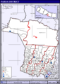
The gate in Birganj on the Indo-Nepal border
|
|
 |
|
| Country | |
| Province | Province No. 2 |
| Admin HQ. | Birganj |
| Government | |
| • Type | Coordination committee |
| • Body | DCC, Parsa |
| Area | |
| • Total | 1,353 km2 (522 sq mi) |
| Population
(2011)
|
|
| • Total | 601,017 |
| • Density | 444.21/km2 (1,150.5/sq mi) |
| Time zone | UTC+05:45 (NPT) |
| Main Language(s) | Bhojpuri (78.1%), Nepali (6.4%), Maithili (5.1%), Tharu (3.8%), Urdu (2.2%), others (4.4%) |
Parsa District is one of the seventy-seven districts in Nepal. It is located in the Terai plain and is part of Province No. 2. The main city and administrative center of Parsa District is Birganj. The district covers an area of about 1,353 square kilometers (522 square miles). In 2011, its population was around 601,017 people. Locals believe the district got its name from the Parsagadhi temple, which is found within the district.
Contents
Land and Weather
Parsa District has two main climate zones. Most of the district (about 74.7%) is in the Lower Tropical zone. This means it is warm and humid, with elevations below 300 meters (1,000 feet). The remaining 25.3% of the district is in the Upper Tropical zone. This area is a bit higher, ranging from 300 to 1,000 meters (1,000 to 3,300 feet).
| Climate Zone | Elevation Range | % of Area |
|---|---|---|
| Lower Tropical | below 300 meters (1,000 ft) | 74.7% |
| Upper Tropical | 300 to 1,000 meters 1,000 to 3,300 ft. |
25.3n% |
People and Languages
In 2011, Parsa District had a population of 601,017 people. Many different languages are spoken here. The most common first language is Bhojpuri, spoken by 78.1% of the people. Other important first languages include Nepali (6.4%), Maithili (5.1%), Tharu (3.8%), and Urdu (2.2%).
Besides their first language, many people also speak a second language. About 30.4% of the population speaks Nepali as a second language. Other common second languages are Bhojpuri (5.4%) and Hindi (4.9%).
How Parsa District is Governed
Parsa District is organized into different types of local governments. This helps manage the district and provide services to its people. The district has one metropolitan city, three urban municipalities, and ten rural municipalities.
Current Municipalities
Here are the main local government areas in Parsa District:
- Birgunj Metropolitan (This is the largest city in the district)
- Bahudarmai Municipality
- Parsagadhi Municipality
- Pokhariya Municipality
- Bindabasini Rural Municipality
- Chhipaharmai Rural Municipality
- Jagarnathpur Rural Municipality
- Jirabhawani Rural Municipality
- Kalikamai Rural Municipality
- Pakaha Mainpur Rural Municipality
- Paterwa Sugauli Rural Municipality
- Sakhuwa Prasauni Rural Municipality
- Thori Rural Municipality
Images for kids
-
Map of the VDCs in Parsa District

 |
Makwanpur (Province No. 3) | |
||
| Chitwan | Bara (Province No. 2) | |||
