
Pennington County, Minnesota facts for kids
Quick facts for kids
Pennington County
|
|
|---|---|

Old Carnegie Library, downtown Thief River Falls, Minnesota.
|
|

Location within the U.S. state of Minnesota
|
|
 Minnesota's location within the U.S. |
|
| Country | |
| State | |
| Founded | November 23, 1910 |
| Named for | Edmund Pennington |
| Seat | Thief River Falls |
| Largest city | Thief River Falls |
| Area | |
| • Total | 618 sq mi (1,600 km2) |
| • Land | 617 sq mi (1,600 km2) |
| • Water | 1.7 sq mi (4 km2) 0.3% |
| Population
(2020)
|
|
| • Total | 13,992 |
| • Estimate
(2023)
|
13,714 |
| • Density | 22.7/sq mi (8.8/km2) |
| Time zone | UTC−6 (Central) |
| • Summer (DST) | UTC−5 (CDT) |
| Congressional district | 7th |
Pennington County is a place in northwestern Minnesota. It's like a district or region within the state. In 2020, about 13,992 people lived there. The main town and government center is called Thief River Falls.
Contents
History of Pennington County
Let's learn about how Pennington County was formed. Long ago, the federal government created the Wisconsin Territory in 1836. Part of this territory later became the state of Wisconsin.
The remaining land became the Minnesota Territory in 1849. The leaders of this new territory created nine counties. One of these was called Pembina.
Over time, parts of Pembina County were used to create new counties. In 1858, Polk County was formed from Pembina. Then, in 1896, Red Lake County was created from Polk County.
Finally, on November 23, 1910, Pennington County was formed. It was made from the northern part of Red Lake County. This made it one of the last counties created in Minnesota.
The county was named after Edmund Pennington. He was a railroad executive in Minnesota. He was the president of the Minneapolis, St. Paul, and Sault Ste. Marie Railway when the county was established. The town of Thief River Falls, which was settled in 1887, became the county seat. This means it's where the county government is located.
Exploring Pennington County's Geography
Pennington County is a fascinating place with interesting land features. The Red Lake River flows into the county from the east. It travels through the middle of the county.
Near Thief River Falls, another river joins it. This is the Thief River, which flows from the north. These two rivers combine and then flow out of Pennington County. They eventually join the Red River further west.
The land in the county has gentle, rolling hills. There are some light woods, and many areas are used for farming. The land slopes downwards towards the west and south. The highest point is about 1,186 feet (361 meters) above sea level.
Pennington County covers about 618 square miles. Most of this is land (617 square miles), with a small amount of water (1.7 square miles). It's one of 17 counties in Minnesota that has more savanna soils than other types. Savanna soils are good for grasslands and scattered trees.
Major Roads in Pennington County
These are the main roads that help people travel through Pennington County:
 U.S. Highway 59
 Minnesota State Highway 1
 Minnesota State Highway 32
 Minnesota State Highway 219
 Pennington County State-Aid Highway 3: This road connects Pennington County to Grand Forks.
 Pennington County State-Aid Highway 17: This road links Thief River Falls to the Airport.
 Pennington County State-Aid Highway 10: This is an important route also known as Pembina Trail.
 Pennington County State-Aid Highway 16: This road helps trucks go around Thief River Falls.
 Pennington County State-Aid Highways 27 & 28: These roads are designed for heavy trucks. They connect to US 2 and other counties.
Airports in the County
- Thief River Falls Regional Airport
Neighboring Counties
Pennington County shares borders with these other counties:
- Marshall County - to the north
- Beltrami County - to the east
- Clearwater County - to the southeast
- Red Lake County - to the south
- Polk County - to the west
Protected Natural Areas
- Higinbotham State Wildlife Management Area
- Pembina State Wildlife Management Area
Population and People of Pennington County
Here's a look at how the population of Pennington County has changed over the years. This information comes from official U.S. Census counts.
| Historical population | |||
|---|---|---|---|
| Census | Pop. | %± | |
| 1910 | 9,376 | — | |
| 1920 | 12,091 | 29.0% | |
| 1930 | 10,487 | −13.3% | |
| 1940 | 12,913 | 23.1% | |
| 1950 | 12,965 | 0.4% | |
| 1960 | 12,468 | −3.8% | |
| 1970 | 13,266 | 6.4% | |
| 1980 | 15,258 | 15.0% | |
| 1990 | 13,306 | −12.8% | |
| 2000 | 13,584 | 2.1% | |
| 2010 | 13,930 | 2.5% | |
| 2020 | 13,992 | 0.4% | |
| 2023 (est.) | 13,714 | −1.6% | |
| U.S. Decennial Census 1790-1960 1900-1990 1990-2000 2010-2020 |
|||
2020 Census Information
The 2020 Census counted 13,992 people living in Pennington County. Here's a breakdown of the different groups of people living there:
| Race | Num. | Perc. |
|---|---|---|
| White (NH) | 12,241 | 87.5% |
| Black or African American (NH) | 177 | 1.3% |
| Native American (NH) | 166 | 1.2% |
| Asian (NH) | 121 | 0.9% |
| Pacific Islander (NH) | 6 | 0.04% |
| Other/Mixed (NH) | 610 | 4.4% |
| Hispanic or Latino | 671 | 4.8% |
Communities in Pennington County
Pennington County has several different types of communities where people live.
Cities in the County
- Goodridge
- St. Hilaire
- Thief River Falls (This is the county seat, where the main government offices are.)
Unincorporated Communities
These are smaller places that don't have their own city government.
- Dakota Junction
- Erie
- Hazel
- Highlanding
- Kratka
- Mavie
- River Valley
Townships in Pennington County
Townships are smaller local government areas, often covering rural land.
- Black River Township
- Bray Township
- Clover Leaf Township
- Deer Park Township
- Goodridge Township
- Hickory Township
- Highlanding Township
- Kratka Township
- Mayfield Township
- Norden Township
- North Township
- Numedal Township
- Polk Centre Township
- Reiner Township
- River Falls Township
- Rocksbury Township
- Sanders Township
- Silverton Township
- Smiley Township
- Star Township
- Wyandotte Township
Images for kids
-
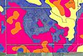
Soils of Oriniak WMA neighborhood

See also
 In Spanish: Condado de Pennington (Minnesota) para niños
