
Perkins, Oklahoma facts for kids
Quick facts for kids
Perkins, Oklahoma
|
|
|---|---|
 |
|

Location within Payne County and Oklahoma
|
|
| Country | United States |
| State | Oklahoma |
| County | Payne |
| Area | |
| • Total | 2.92 sq mi (7.57 km2) |
| • Land | 2.92 sq mi (7.56 km2) |
| • Water | 0.00 sq mi (0.01 km2) |
| Elevation | 902 ft (275 m) |
| Population
(2020)
|
|
| • Total | 3,205 |
| • Density | 1,097.98/sq mi (423.88/km2) |
| Time zone | UTC-6 (Central (CST)) |
| • Summer (DST) | UTC-5 (CDT) |
| ZIP code |
74059
|
| Area code(s) | 405/572 |
| FIPS code | 40-58150 |
| GNIS feature ID | 2411402 |
| Website | cityofperkins.net |
Perkins is a city located in the southern part of Payne County, Oklahoma, United States. In 2020, about 3,205 people lived there. The city's name comes from Bishop Walden Perkins, a congressman who helped set up the local post office. The main office for the Iowa Tribe of Oklahoma is also in Perkins.
Contents
History of Perkins
Perkins was started during the exciting Land Run in April 1889. A man named Joseph Wert claimed 160 acres of land. He then offered 40 acres of his land to create a new town.
In its first year, the town had three different names: Cimarron, Italy, and finally Perkins. The name Perkins was chosen to honor Bishop Walden Perkins. He was a congressman from Kansas who helped the town get its own post office. Perkins officially became a city on August 25, 1891.
Even though Perkins was settled in 1889, it celebrates "Old Settlers Day" around September 22. This date marks the anniversary of the Land Run of 1891. Perkins was an important starting point for this land run because it was on the north side of the Cimarron River.
In the summer of 1891, the first wagon bridge across the Cimarron River in Oklahoma Territory was built near Perkins. On September 22, 1891, the lands of the Sac and Fox and Iowa tribes were officially opened up. By January 1900, the Eastern Oklahoma Railway started service in Perkins. This helped the town become a busy center for trading farm goods.
Where is Perkins Located?
Perkins is found on the north bank of the Cimarron River. It is located along U.S. Route 177, just south of where it meets State Highway 33. The city covers a total area of about 2.2 square miles (5.7 square kilometers), and all of it is land.
Perkins Population Over Time
| Historical population | |||
|---|---|---|---|
| Census | Pop. | %± | |
| 1900 | 719 | — | |
| 1910 | 603 | −16.1% | |
| 1920 | 608 | 0.8% | |
| 1930 | 606 | −0.3% | |
| 1940 | 728 | 20.1% | |
| 1950 | 706 | −3.0% | |
| 1960 | 769 | 8.9% | |
| 1970 | 1,029 | 33.8% | |
| 1980 | 1,762 | 71.2% | |
| 1990 | 1,925 | 9.3% | |
| 2000 | 2,272 | 18.0% | |
| 2010 | 2,831 | 24.6% | |
| 2020 | 3,205 | 13.2% | |
| U.S. Decennial Census | |||
In 2000, there were 2,272 people living in Perkins. These people lived in 913 households, with 644 of them being families. The population density was about 1,018 people per square mile.
About 32.9% of households had children under 18 living with them. Many households (54.2%) were married couples living together. The average household had 2.49 people, and the average family had 3.02 people.
The population was spread out by age. About 27.2% were under 18 years old. About 9.2% were between 18 and 24. Around 28.8% were between 25 and 44. About 20.8% were between 45 and 64, and 14.0% were 65 years or older. The average age in Perkins was 35 years old.
Famous People from Perkins
Perkins has been home to several notable individuals:
- Jesse Barnes: A baseball pitcher who played for the World Series Champion New York Giants.
- Frank "Pistol Pete" Eaton: He is buried in Perkins. His old house is now located in a park north of the city.
- Jeremy Hefner: A former professional baseball pitcher and a pitching coach for the New York Mets.
- Linda Livingstone: The 15th president of Baylor University.
- Michael Atkins: A former professional golfer who played on the PGA Tour and won seven tournaments.
Perkins in the Media
Perkins, Oklahoma, was featured in a TV series called "Independent Lens." This series showed stories about bullying.
Images for kids
-
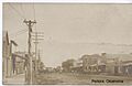
A historical image of Perkins.

See also
 In Spanish: Perkins (Oklahoma) para niños
