Picnic Bay, Queensland facts for kids
Quick facts for kids Picnic BayMagnetic Island, Queensland |
|||||||||||||||
|---|---|---|---|---|---|---|---|---|---|---|---|---|---|---|---|

Picnic Bay, Magnetic Island
|
|||||||||||||||
| Population | 367 (2021 census) | ||||||||||||||
| • Density | 89.5/km2 (232/sq mi) | ||||||||||||||
| Established | 1877 | ||||||||||||||
| Postcode(s) | 4819 | ||||||||||||||
| Area | 4.1 km2 (1.6 sq mi) | ||||||||||||||
| Time zone | AEST (UTC+10:00) | ||||||||||||||
| LGA(s) | City of Townsville | ||||||||||||||
| County | Elphinstone | ||||||||||||||
| Parish | Magnetic | ||||||||||||||
| State electorate(s) | Townsville | ||||||||||||||
| Federal Division(s) | Herbert | ||||||||||||||
|
|||||||||||||||
Picnic Bay, once called Camoomilli, is a small town on Magnetic Island in Queensland, Australia. It's named after the beautiful bay it sits on, right at the southern tip of the island. In 2021, about 367 people lived in Picnic Bay.
Contents
Exploring Picnic Bay's Location
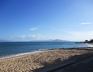
Picnic Bay is located at the very southern end of Magnetic Island. It has different bays around it:
- To the west, you'll find Cockle Bay.
- To the south, there's Picnic Bay itself.
- To the east, you'll see Rocky Bay.
Two points of land separate these bays:
- Nobby Head (also known as Point Burgamunda) is between Cockle Bay and Picnic Bay beach.
- Hawkins Point separates Picnic Bay from Rocky Bay.
For a long time, ferries from the mainland used to arrive at Picnic Bay. But now, they dock at a newer terminal in Nelly Bay, which is nearby.
A Look Back at Picnic Bay's History
Early Days and First Settlers
The area of Picnic Bay was first sold by the Queensland Government in 1877. It was called the "Town of Camoomillla" back then.
The first known family to settle here was Harry Butler's family in 1877. They started a small farm with a dairy and fruit trees. Magnetic Island was a quarantine station at that time, meaning people who were sick or had just arrived from other countries would stay there to prevent diseases from spreading. The Butler family even built a guest house and started a ferry service to Townsville. They also helped care for the sick people on the island.
In 1898, a businessman named Robert Hayles bought the Butler family's huts. He built a two-story hotel, a dance hall, and a temporary jetty (a pier for boats) to create a bigger tourist spot.
Growing as a Tourist Spot (1900-1949)
In 1900, Robert Hayles got permission to build a stronger wooden jetty. But in 1903, a big storm called Cyclone Leonta hit, damaging his new jetty. He fixed it, but it needed more work by 1910.
Hayles also started a regular ferry service from the mainland to Magnetic Island. This helped more people move to the island, and the population grew.
In 1911, Hayles' hotel burned down, but a new one was built. He also expanded his tourism businesses to other parts of Magnetic Island, like Nelly Bay, Horseshoe Bay, and Arcadia.
A school, Magnetic Island State School, opened in Picnic Bay in 1917. It was later renamed Picnic Bay State School in 1925 but closed in 1970. The local post office also opened in 1927 and was renamed Picnic Bay Post Office in 1935.
During World War II (1939-1945), the Australian army used Hayles' facilities in Picnic Bay as a place for soldiers to rest. After the war, Hayles made many improvements to the roads, buildings, and even deepened the channel for boats coming into Picnic Bay.
Modern Times (1950 Onwards)
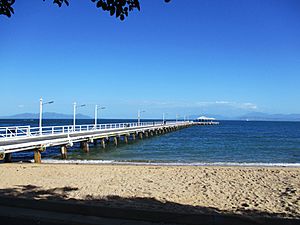
A new jetty was built in Picnic Bay in 1959. It was a big project that cost a lot of money. Robert Hayles' company leased this jetty and was responsible for keeping it in good shape.
In 1962, the town was officially named Picnic Bay, changing from its old name, Camoomilli.
In 1971, another strong storm, Cyclone Althea, hit Magnetic Island. The jetty was damaged but stayed strong, but many buildings in the bay were badly hit.
Over the years, shelters were added to the jetty for people waiting for ferries. However, in 2003, ferry services stopped using the Picnic Bay jetty and moved to a new harbor. In 2020, new underwater lights were added to the jetty, making it a beautiful sight at night.
In July 2022, a new place called Maggie Island Brewery opened in Picnic Bay.
People Living in Picnic Bay
The number of people living in Picnic Bay has changed over the years:
- In 2006, there were 360 people.
- In 2016, the population was 291 people.
- In 2021, the population grew to 367 people.
Important Historical Places
Picnic Bay has some places that are listed for their historical importance:
- The Picnic Bay Jetty on the Esplanade.
- The former Picnic Bay State School on Granite Street.
Getting Around Picnic Bay
Picnic Bay is connected to other parts of Magnetic Island by roads.
- Nelly Bay Road goes east from Picnic Bay, climbing over Hawkings Point and then down into Nelly Bay.
- West Point Road starts at Yule Street and connects Picnic Bay to the western towns like Cockle Bay and West Point. Part of this road is not sealed (it's a dirt road), so some rental cars might not be allowed on it.
The Magnetic Island Bus Service runs regularly, matching up with ferry arrivals and departures at the Nelly Bay Ferry Terminal. The bus stop at the base of the Picnic Bay Jetty is the last stop for buses coming from Horseshoe Bay, Arcadia, and Nelly Bay. You can also find taxis and car rental companies in Picnic Bay and Nelly Bay if you want to explore the island on your own.
What to Do in Picnic Bay
Picnic Bay has a few places to visit and things to do:
- The Picnic Bay Mall: An outdoor shopping area.
- Patrolled Beach: A safe beach along the waterfront where lifeguards are on duty.
- Magnetic Island Golf Course: A place to play golf.
- Magnetic Island Police Station: The local police station.
Fun Things to See
- The George Rennie Wreck: Off the coast of Picnic Bay, you can see the remains of a ship called the George Rennie at low tide. It's a cool sight!
 | Aaron Henry |
 | T. R. M. Howard |
 | Jesse Jackson |


